MyTopo
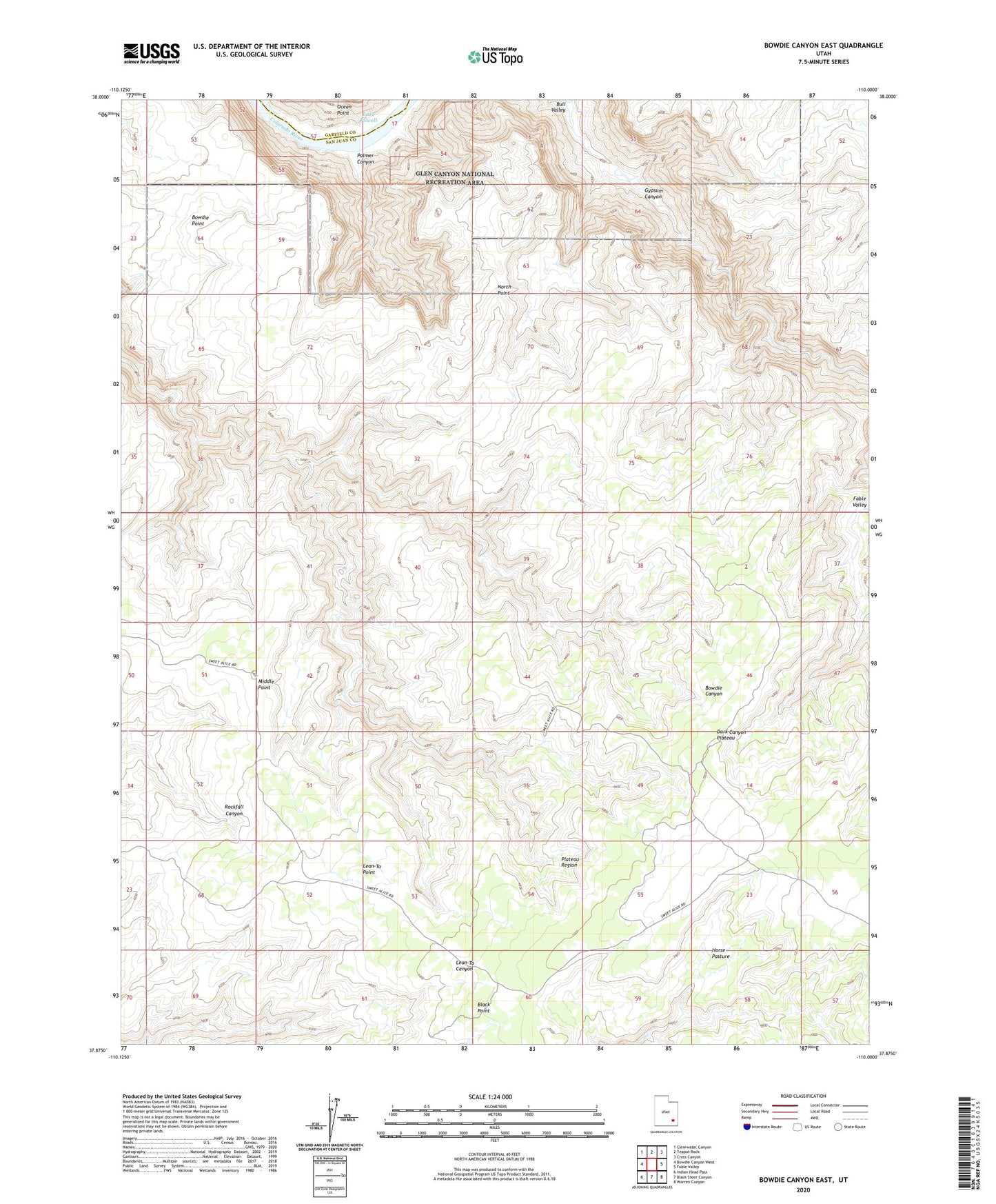
Bowdie Canyon East Utah US Topo Map
Couldn't load pickup availability
2023 topographic map quadrangle Bowdie Canyon East in the state of Utah. Scale: 1:24000. Based on the newly updated USGS 7.5' US Topo map series, this map is in the following counties: San Juan, Garfield. The map contains contour data, water features, and other items you are used to seeing on USGS maps, but also has updated roads and other features. This is the next generation of topographic maps. Printed on high-quality waterproof paper with UV fade-resistant inks.
Quads adjacent to this one:
West: Bowdie Canyon West
Northwest: Clearwater Canyon
North: Teapot Rock
Northeast: Cross Canyon
East: Fable Valley
Southeast: Warren Canyon
South: Black Steer Canyon
Southwest: Indian Head Pass
This map covers the same area as the classic USGS quad with code o37110h1.
Contains the following named places: Bowdie Point, Dark Canyon Plateau, Dark Canyon Primitive Area, Horse Pasture, Lean-To Point, Middle Point, North Point, Palmer Canyon, Plateau Region