MyTopo
Turks Head Utah US Topo Map
Couldn't load pickup availability
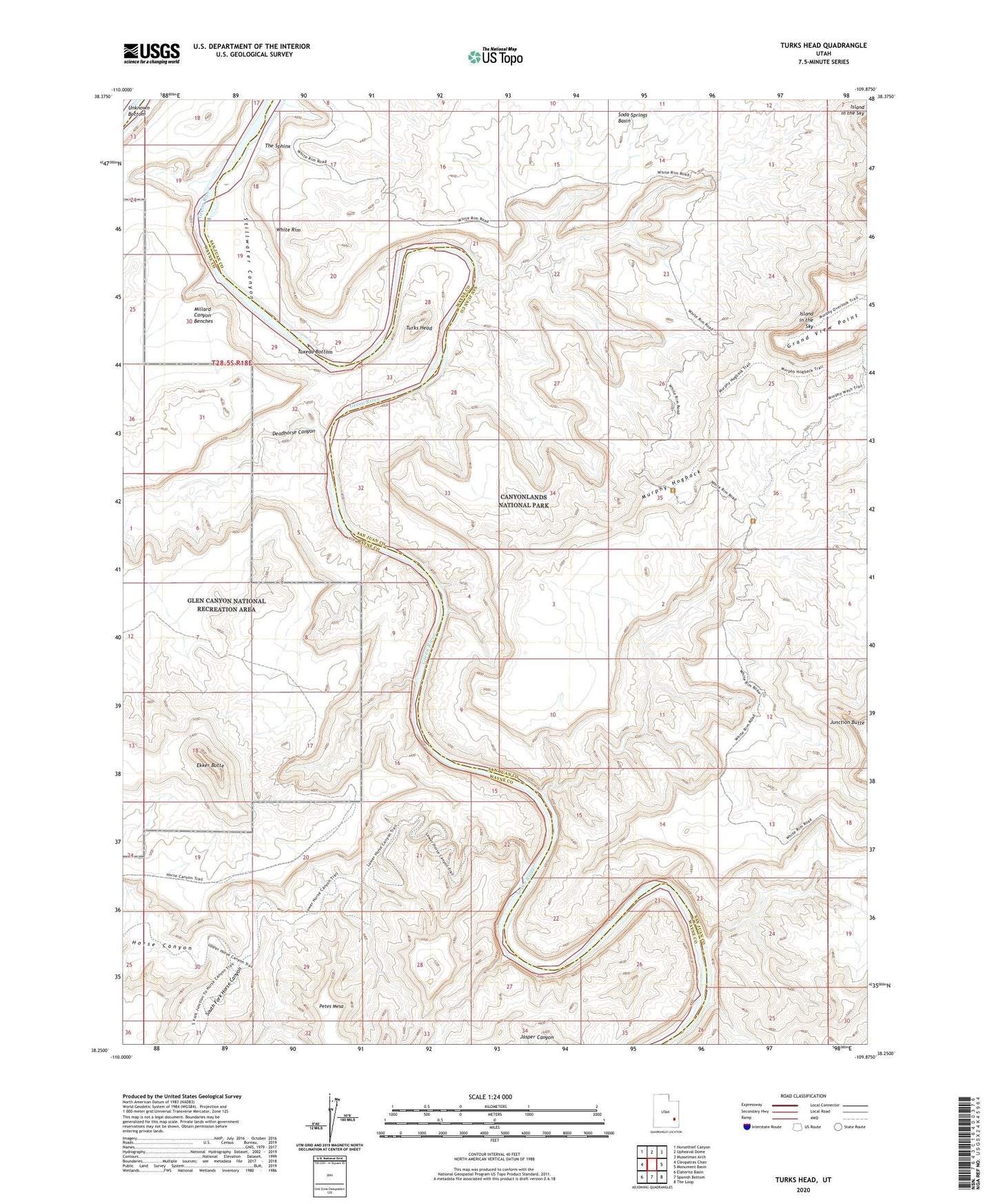
2023 topographic map quadrangle Turks Head in the state of Utah. Scale: 1:24000. Based on the newly updated USGS 7.5' US Topo map series, this map is in the following counties: San Juan, Wayne. The map contains contour data, water features, and other items you are used to seeing on USGS maps, but also has updated roads and other features. This is the next generation of topographic maps. Printed on high-quality waterproof paper with UV fade-resistant inks.
Quads adjacent to this one:
West: Cleopatras Chair
Northwest: Horsethief Canyon
North: Upheaval Dome
Northeast: Musselman Arch
East: Monument Basin
Southeast: The Loop
South: Spanish Bottom
Southwest: Elaterite Basin
This map covers the same area as the classic USGS quad with code o38109c8.
Contains the following named places: Deadhorse Canyon, Ekker Butte, Horse Canyon, Murphy Hogback, Murphy Point Overlook, Murphy Range, Soda Springs Basin, Soda Springs Canyon, South Fork Horse Canyon, The Sphinx, Turks Head, Tuxedo Bottom, White Rim