MyTopo
Monument Basin Utah US Topo Map
Couldn't load pickup availability
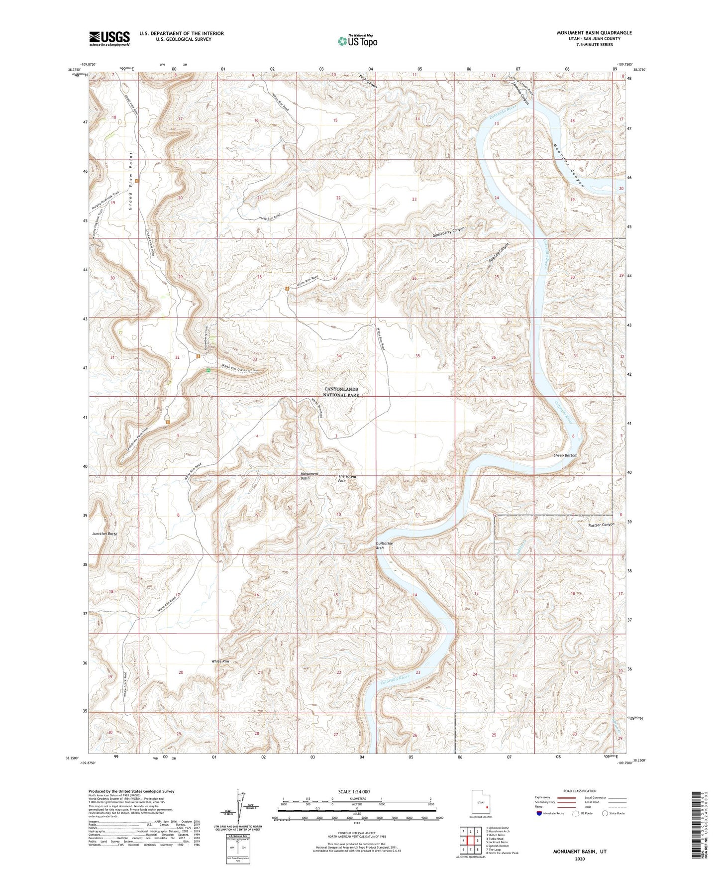
2023 topographic map quadrangle Monument Basin in the state of Utah. Scale: 1:24000. Based on the newly updated USGS 7.5' US Topo map series, this map is in the following counties: San Juan. The map contains contour data, water features, and other items you are used to seeing on USGS maps, but also has updated roads and other features. This is the next generation of topographic maps. Printed on high-quality waterproof paper with UV fade-resistant inks.
Quads adjacent to this one:
West: Turks Head
Northwest: Upheaval Dome
North: Musselman Arch
Northeast: Shafer Basin
East: Lockhart Basin
Southeast: North Six-shooter Peak
South: The Loop
Southwest: Spanish Bottom
This map covers the same area as the classic USGS quad with code o38109c7.
Contains the following named places: Buck Canyon, Buck Canyon Overlook, Dog Leg Canyon, Gooseberry Canyon, Grand View Point, Grand View Point Overlook, Guillotine Arch, Indian Creek, Junction Butte, Lathrop Canyon, Monument Basin, Rustler Canyon, Sheep Bottom, The Totem Pole, White Rim Trail