MyTopo
Musselman Arch Utah US Topo Map
Couldn't load pickup availability
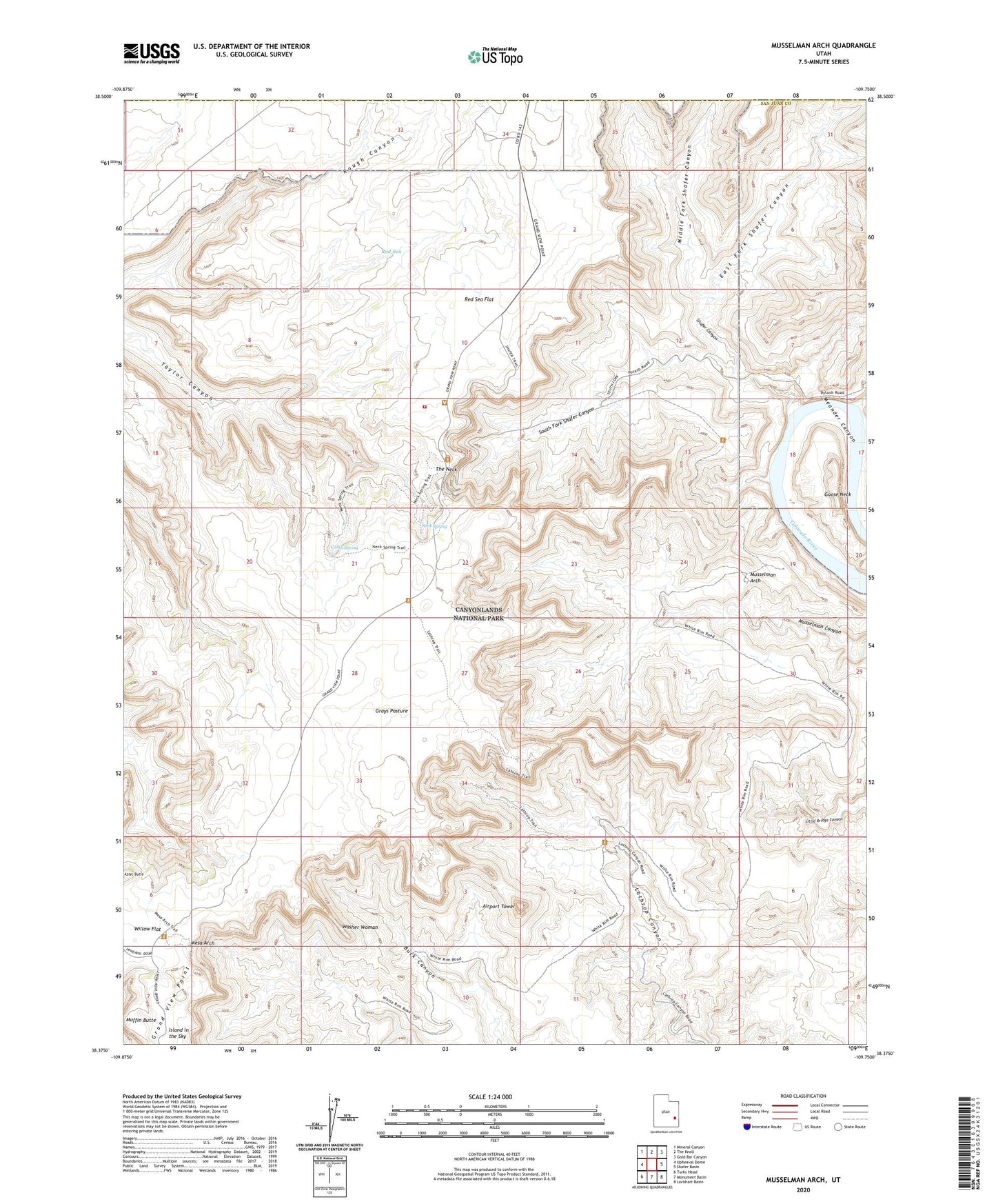
2023 topographic map quadrangle Musselman Arch in the state of Utah. Scale: 1:24000. Based on the newly updated USGS 7.5' US Topo map series, this map is in the following counties: San Juan, Grand. The map contains contour data, water features, and other items you are used to seeing on USGS maps, but also has updated roads and other features. This is the next generation of topographic maps. Printed on high-quality waterproof paper with UV fade-resistant inks.
Quads adjacent to this one:
West: Upheaval Dome
Northwest: Mineral Canyon
North: The Knoll
Northeast: Gold Bar Canyon
East: Shafer Basin
Southeast: Lockhart Basin
South: Monument Basin
Southwest: Turks Head
This map covers the same area as the classic USGS quad with code o38109d7.
Contains the following named places: Airport Tower, Aztec Butte, Cabin Spring, Canyonlands National Park Islands in the Park Fire District, East Fork Shafer Canyon, Goose Neck, Grays Pasture, Mesa Arch, Middle Fork Shafer Canyon, Muffin Butte, Musselman Arch, Neck Ranger Station, Neck Spring, Red Sea, Red Sea Flat, Shafer Canyon, Shafer Trail, South Fork Shafer Canyon, The Neck, Washer Woman