MyTopo
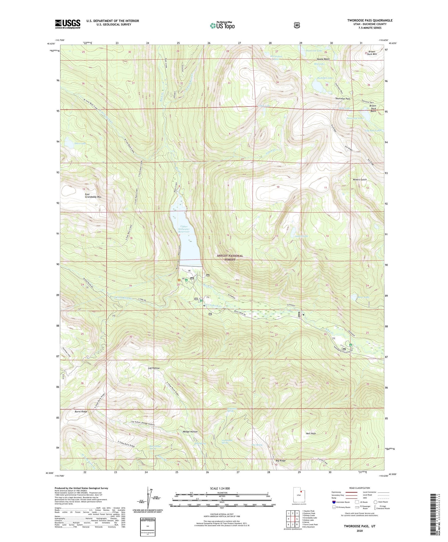
Tworoose Pass Utah US Topo Map
Couldn't load pickup availability
2020 topographic map quadrangle Tworoose Pass in the state of Utah. Scale: 1:24000. Based on the newly updated USGS 7.5' US Topo map series, this map is in the following counties: Duchesne. The map contains contour data, water features, and other items you are used to seeing on USGS maps, but also has updated roads and other features. This is the next generation of topographic maps. Printed on high-quality waterproof paper with UV fade-resistant inks.
Quads adjacent to this one:
West: Grandaddy Lake
Northwest: Hayden Peak
North: Explorer Peak
Northeast: Oweep Creek
East: Kidney Lake
Southeast: Dry Mountain
South: Farm Creek Peak
Southwest: Hanna
Contains the following named places: Audry Lake, Bear Lake, Big Ridge, Burnt Ridge, Burnt Ridge Spring, Cabin Creek, Cabin Lake, Diamond Lake, Docs Lake, East Fork Rock Creek, Fish Creek, Hell Hole, Horsehair Spring, Horseshoe Lake, Lily Pad Lake, Log Hollow Spring, Mid Lake, Milk Lake, Pine Spring, Rock Creek Ranch, Rock Creek Resort, Rock Spring, Rudolph Lake, South Fork Campground, South Fork Rock Creek, Stillwater Heliport, Tworoose Lake, Tworoose Pass, Upper Stillwater Campground, Upper Stillwater Dam, Upper Stillwater Reservoir, Wedge Hollow, West Fork Rock Creek, Yellow Pine Campground