MyTopo
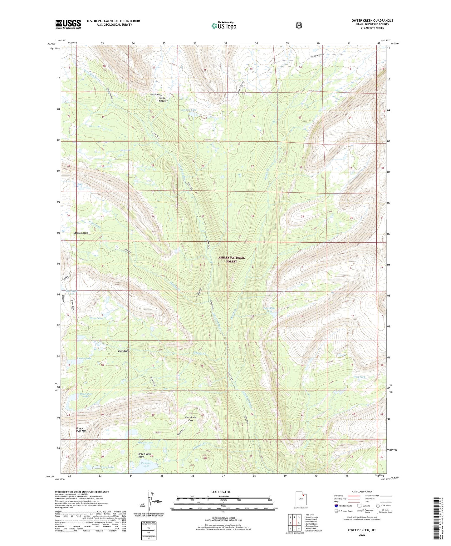
Oweep Creek Utah US Topo Map
Couldn't load pickup availability
Also explore the Oweep Creek Forest Service Topo of this same quad for updated USFS data
2023 topographic map quadrangle Oweep Creek in the state of Utah. Scale: 1:24000. Based on the newly updated USGS 7.5' US Topo map series, this map is in the following counties: Duchesne. The map contains contour data, water features, and other items you are used to seeing on USGS maps, but also has updated roads and other features. This is the next generation of topographic maps. Printed on high-quality waterproof paper with UV fade-resistant inks.
Quads adjacent to this one:
West: Explorer Peak
Northwest: Red Knob
North: Mount Lovenia
Northeast: Mount Powell
East: Garfield Basin
Southeast: Lake Fork Mountain
South: Kidney Lake
Southwest: Tworoose Pass
This map covers the same area as the classic USGS quad with code o40110f5.
Contains the following named places: Brown Duck Basin, Brown Duck Mountain, Clements Creek, Clements Lake, Clements Lake Dam, Cleveland Lake, Cleveland Pass, East Basin, East Basin Creek, East Basin Pass, East Slide Lake, High Uintas Primitive Area, Horseshoe Lake, Lake Fork Forest Service Station, Lambert Lake, Lambert Meadow, Ottoson Basin, Ottoson Creek, Oweep Creek, Picture Lake, Stewart Lake, Three Lakes, Twin Lakes, West Park