MyTopo
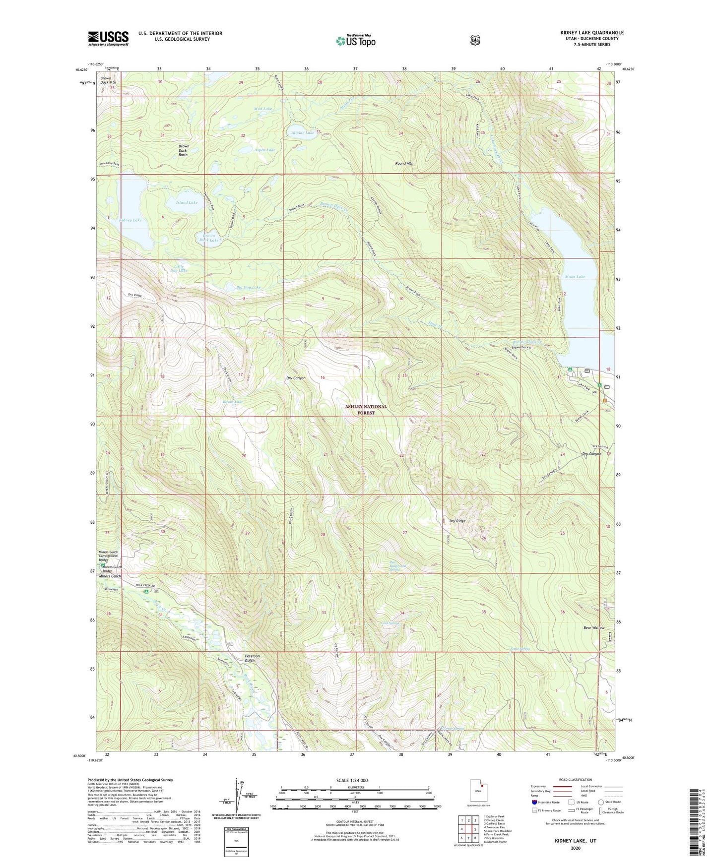
Kidney Lake Utah US Topo Map
Couldn't load pickup availability
Also explore the Kidney Lake Forest Service Topo of this same quad for updated USFS data
2023 topographic map quadrangle Kidney Lake in the state of Utah. Scale: 1:24000. Based on the newly updated USGS 7.5' US Topo map series, this map is in the following counties: Duchesne. The map contains contour data, water features, and other items you are used to seeing on USGS maps, but also has updated roads and other features. This is the next generation of topographic maps. Printed on high-quality waterproof paper with UV fade-resistant inks.
Quads adjacent to this one:
West: Tworoose Pass
Northwest: Explorer Peak
North: Oweep Creek
Northeast: Garfield Basin
East: Lake Fork Mountain
Southeast: Mountain Home
South: Dry Mountain
Southwest: Farm Creek Peak
This map covers the same area as the classic USGS quad with code o40110e5.
Contains the following named places: Aspen Lake, Atwine Creek, Atwine Lake, Baum Lake, Big Dog Lake, Brown Duck Basin, Brown Duck Creek, Brown Duck Dam, Brown Duck Lake, Cold Spring, Corner Spring, Dry Canyon, Dry Ridge, Fence Spring, Island Lake, Island Lake Dam, Kidney Lake, Kidney Lake Dam, Lake Fork Guard Station, Little Dog Lake, Miners Gulch, Miners Gulch Bridge, Miners Gulch Campground, Miners Gulch Campground Bridge, Moon Lake, Moon Lake Campground, Moon Lake Lodge, Mud Lake, Paint Mine, Peterson Gulch, Red Bedground Spring, Robbins Ranch, Rock Creek Corral, Round Mountain, Slate Creek