MyTopo
Upheaval Dome Utah US Topo Map
Couldn't load pickup availability
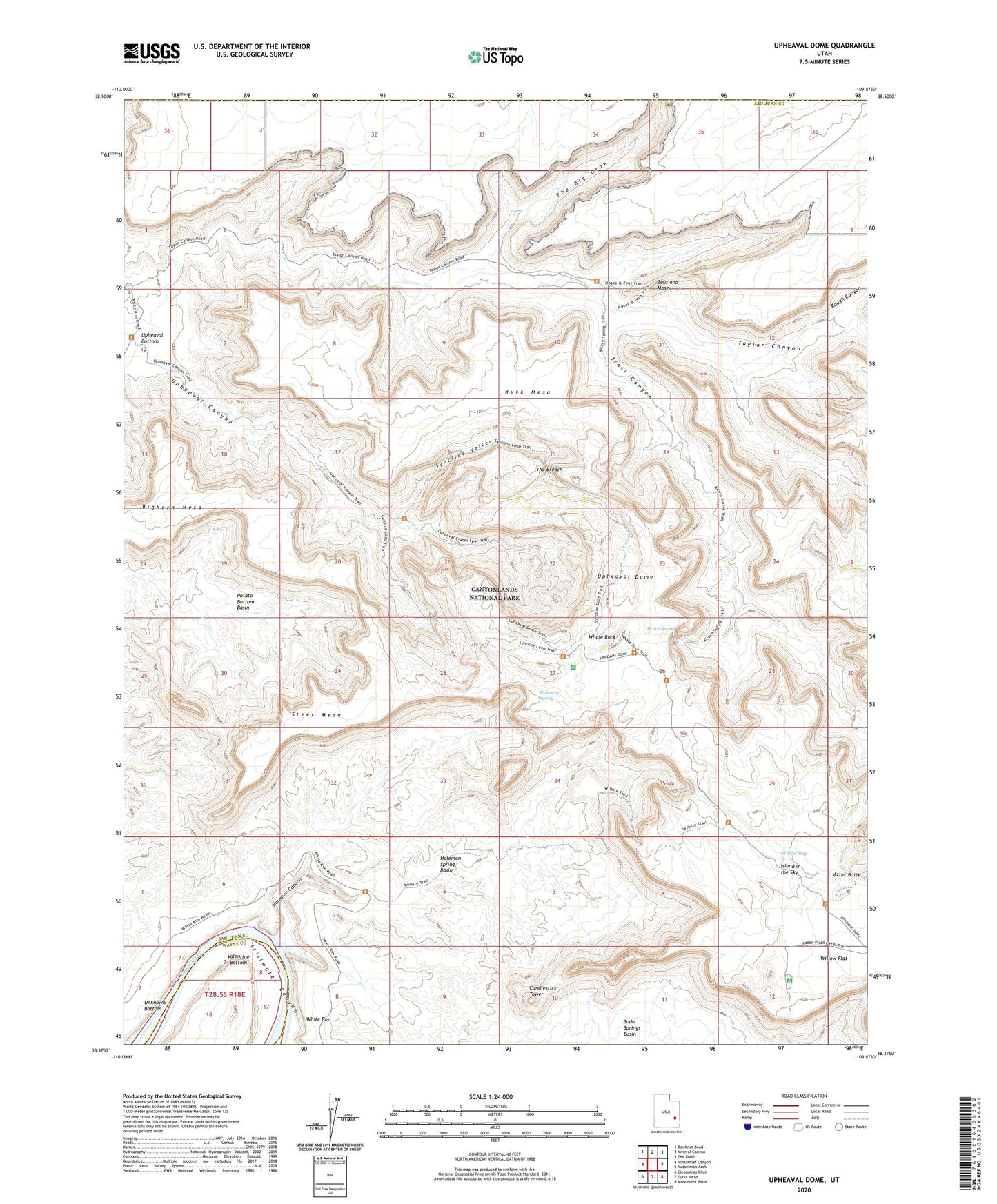
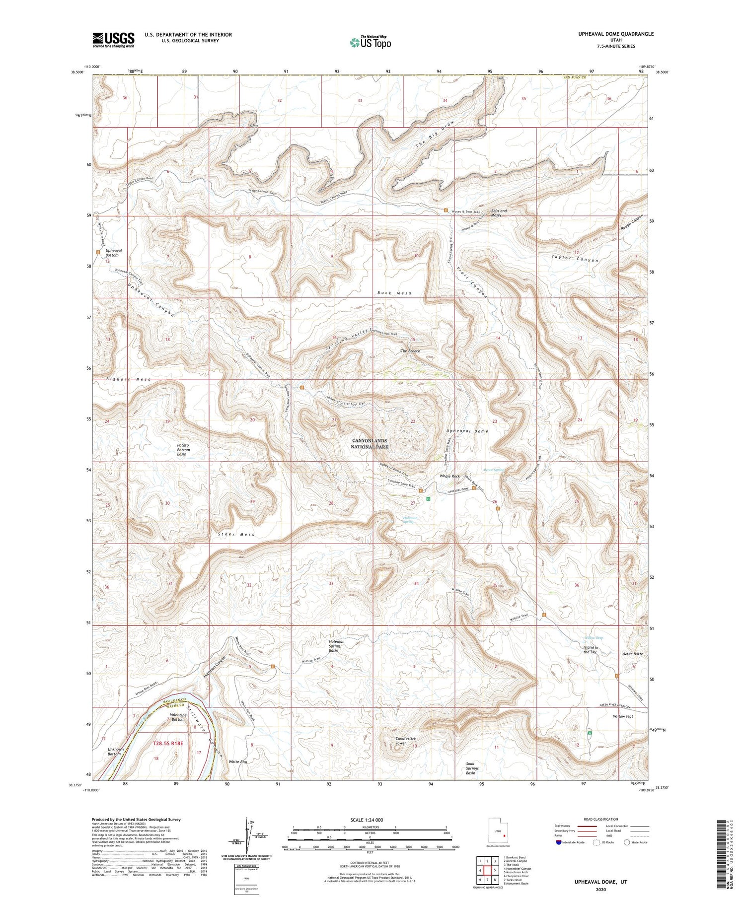
2020 topographic map quadrangle Upheaval Dome in the state of Utah. Scale: 1:24000. Based on the newly updated USGS 7.5' US Topo map series, this map is in the following counties: San Juan, Wayne, Grand. The map contains contour data, water features, and other items you are used to seeing on USGS maps, but also has updated roads and other features. This is the next generation of topographic maps. Printed on high-quality waterproof paper with UV fade-resistant inks.
Quads adjacent to this one:
West: Horsethief Canyon
Northwest: Bowknot Bend
North: Mineral Canyon
Northeast: The Knoll
East: Musselman Arch
Southeast: Monument Basin
South: Turks Head
Southwest: Cleopatras Chair
Contains the following named places: Alcove Spring, Bighorn Mesa, Buck Mesa, Candlestick Tower, Green River Overlook, Holeman Canyon, Holeman Spring, Holeman Spring Basin, Island in the Sky, Potato Bottom Basin, Rough Canyon, Steer Mesa, Syncline Valley, Taylor Canyon, The Big Draw, The Breach, Trail Canyon, Upheaval Bottom, Upheaval Canyon, Upheaval Dome, Upheaval Dome Trail, Valentine Bottom, Whale Rock, Willow Flat, Willow Flat Campground, Willow Seep, Zeus and Moses