MyTopo
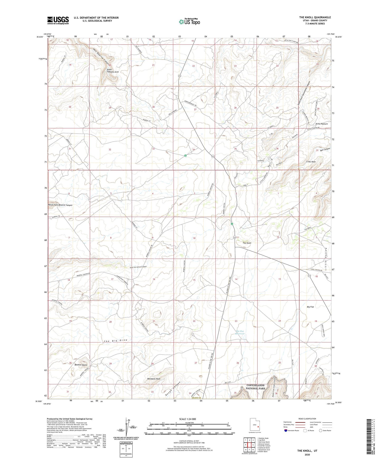
The Knoll Utah US Topo Map
Couldn't load pickup availability
2023 topographic map quadrangle The Knoll in the state of Utah. Scale: 1:24000. Based on the newly updated USGS 7.5' US Topo map series, this map is in the following counties: Grand. The map contains contour data, water features, and other items you are used to seeing on USGS maps, but also has updated roads and other features. This is the next generation of topographic maps. Printed on high-quality waterproof paper with UV fade-resistant inks.
Quads adjacent to this one:
West: Mineral Canyon
Northwest: Dubinky Wash
North: Jug Rock
Northeast: Merrimac Butte
East: Gold Bar Canyon
Southeast: Shafer Basin
South: Musselman Arch
Southwest: Upheaval Dome
This map covers the same area as the classic USGS quad with code o38109e7.
Contains the following named places: Beehive Butte, Big Flat, Big Flat Reservoir, Crips Hole, Horsethief Point, Jewel Tibbetts Arch, The Knoll, Whitbeck Rock