MyTopo
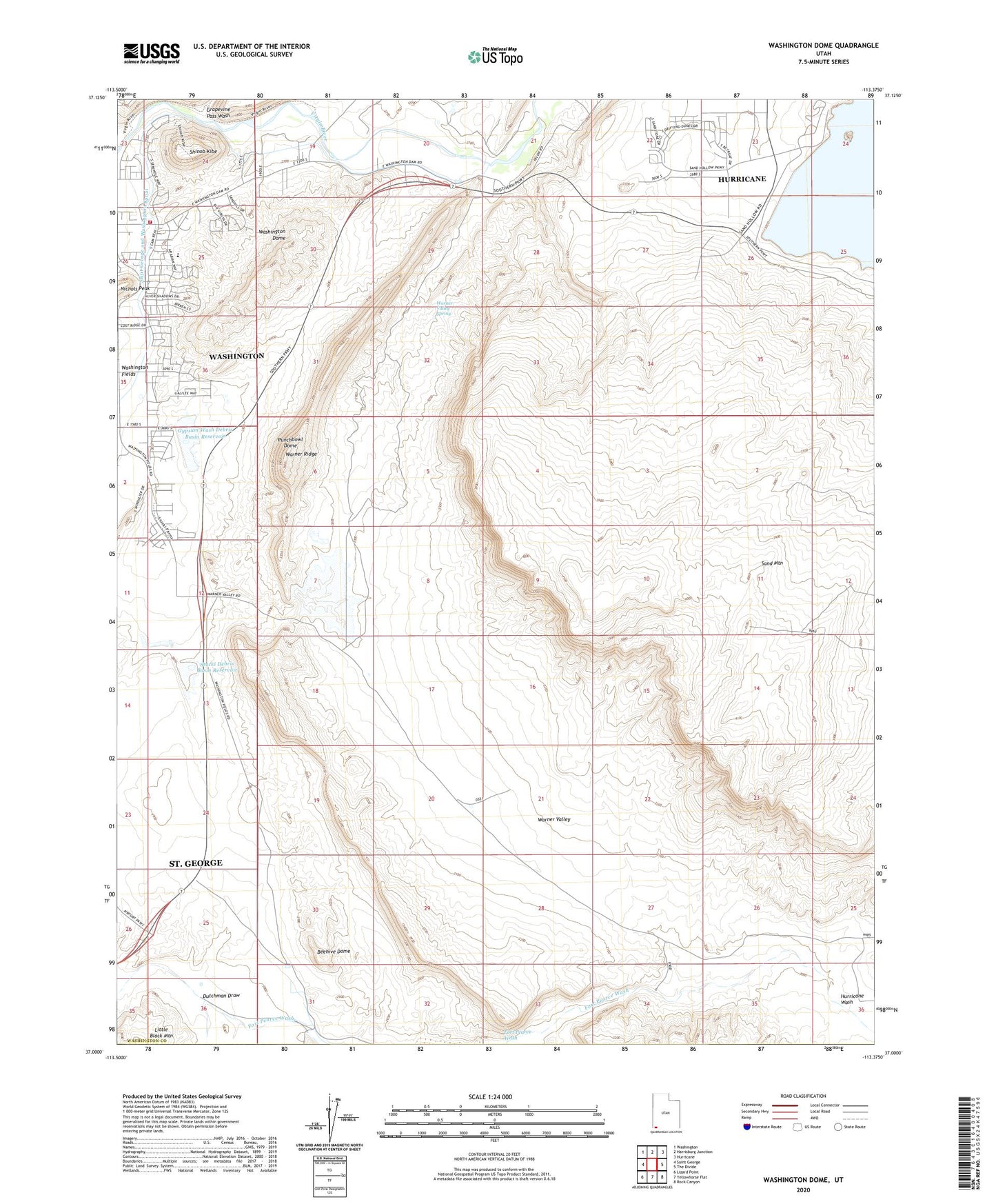
Washington Dome Utah US Topo Map
Couldn't load pickup availability
2023 topographic map quadrangle Washington Dome in the state of Utah. Scale: 1:24000. Based on the newly updated USGS 7.5' US Topo map series, this map is in the following counties: Washington. The map contains contour data, water features, and other items you are used to seeing on USGS maps, but also has updated roads and other features. This is the next generation of topographic maps. Printed on high-quality waterproof paper with UV fade-resistant inks.
Quads adjacent to this one:
West: Saint George
Northwest: Washington
North: Harrisburg Junction
Northeast: Hurricane
East: The Divide
Southeast: Rock Canyon
South: Yellowhorse Flat
Southwest: Lizard Point
This map covers the same area as the classic USGS quad with code o37113a4.
Contains the following named places: Beehive Dome, Dutchman Draw, Grapevine Pass Wash, Gypsum Wash Debris Basin Dam, Gypsum Wash Debris Basin Reservoir, Herd House, Hurricane Wash, Little Black Mountain, Punchbowl Dome, Saint George and Washington Canal, Sand Mountain, Shinob Kibe, Stucki Debris Basin Dam, Stucki Debris Basin Reservoir, Warner Draw Debris Basin Dam, Warner Draw Debris Basin Reservoir, Warner Ridge, Warner Valley, Warner Valley Spring, Washington City Fire Department - Station 62, Washington Dome