MyTopo
Lizard Point Arizona US Topo Map
Couldn't load pickup availability
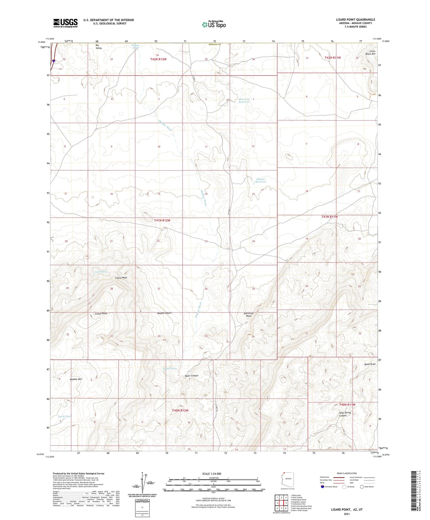
2021 topographic map quadrangle Lizard Point in the state of Arizona. Scale: 1:24000. Based on the newly updated USGS 7.5' US Topo map series, this map is in the following counties: Mohave, Washington. The map contains contour data, water features, and other items you are used to seeing on USGS maps, but also has updated roads and other features. This is the next generation of topographic maps. Printed on high-quality waterproof paper with UV fade-resistant inks.
Quads adjacent to this one:
West: Purgatory Canyon
Northwest: White Hills
North: Saint George
Northeast: Washington Dome
East: Yellowhorse Flat
Southeast: Hole-n-Wall Canyon
South: Wolf Hole Mountain East
Southwest: Wolf Hole Mountain West
Contains the following named places: Gardener Well, Lizard Point, Lizard Spring, Mokaac Reservoir, Mokaac Spring, Mokaac Wash, North Tank, Quail Canyon, Seep Spring Canyon, State Line Reservoir