MyTopo
Willow Creek Butte Utah US Topo Map
Couldn't load pickup availability
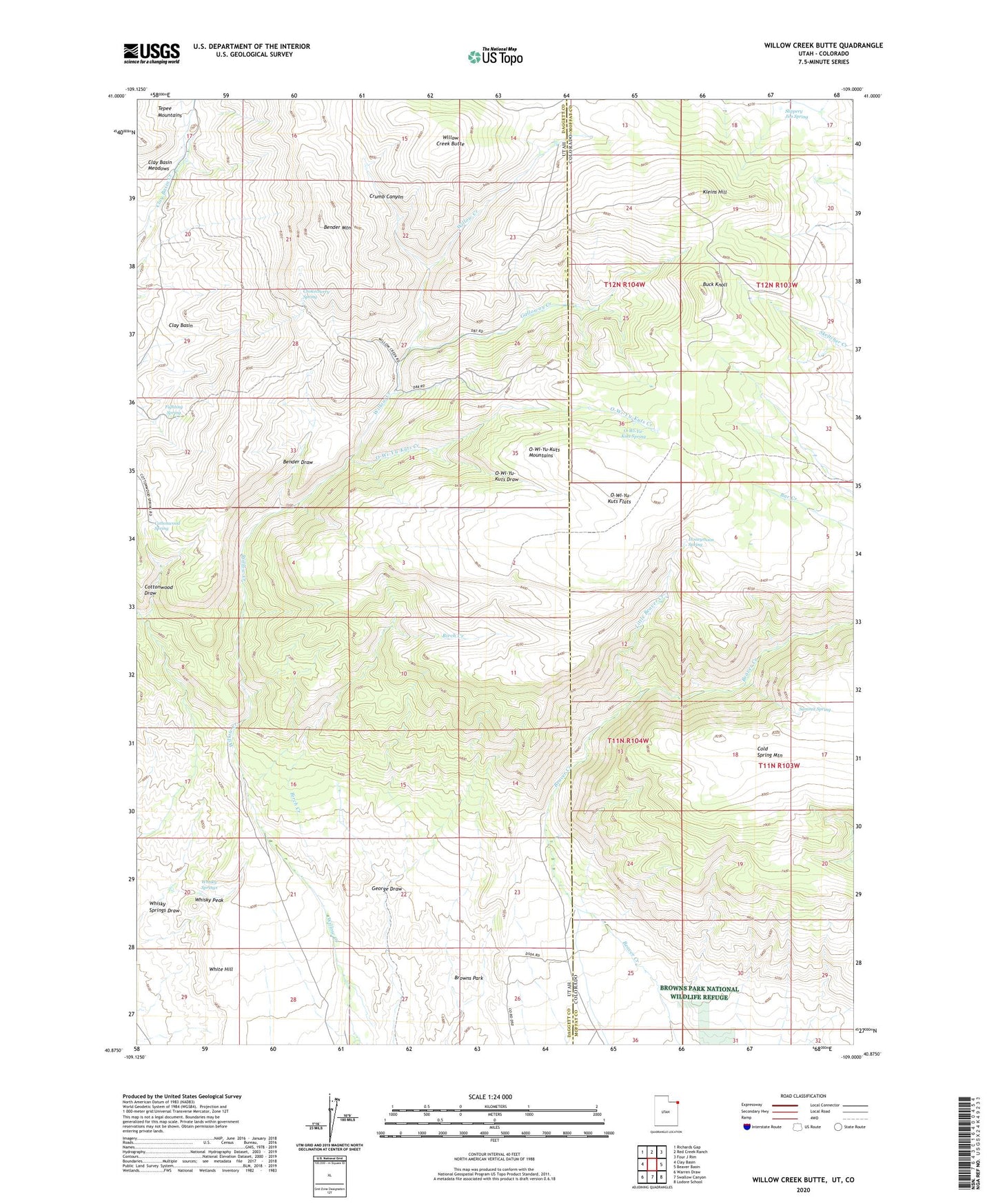
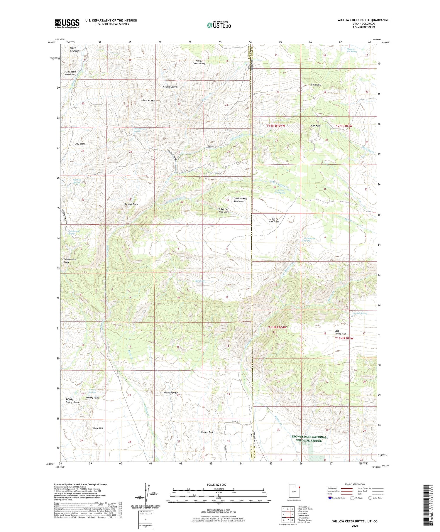
2020 topographic map quadrangle Willow Creek Butte in the states of Utah, Colorado. Scale: 1:24000. Based on the newly updated USGS 7.5' US Topo map series, this map is in the following counties: Daggett, Moffat. The map contains contour data, water features, and other items you are used to seeing on USGS maps, but also has updated roads and other features. This is the next generation of topographic maps. Printed on high-quality waterproof paper with UV fade-resistant inks.
Quads adjacent to this one:
West: Clay Basin
Northwest: Richards Gap
North: Red Creek Ranch
Northeast: Four J Rim
East: Beaver Basin
Southeast: Lodore School
South: Swallow Canyon
Southwest: Warren Draw
Contains the following named places: Bender Draw, Bender Mountain, Birch Creek, Buck Knoll, Chokecherry Spring, Clay Basin Meadows, Cottonwood Draw, Cottonwood Spring, Crumb Canyon, Fighting Spring, Galloway Creek, Honeymoon Spring, Kleins Hill, Little Beaver Creek, O-Wi-Yu-Kuts Creek, O-Wi-Yu-Kuts Draw, O-Wi-Yu-Kuts Flats, O-Wi-Yu-Kuts Mountains, O-Wi-Yu-Kuts Spring, Slippery Jim Spring, Summit Spring, Whisky Peak, Whisky Springs, White Hill, Willow Creek Butte, Willow Creek Ranch