MyTopo
Richards Gap Wyoming US Topo Map
Couldn't load pickup availability
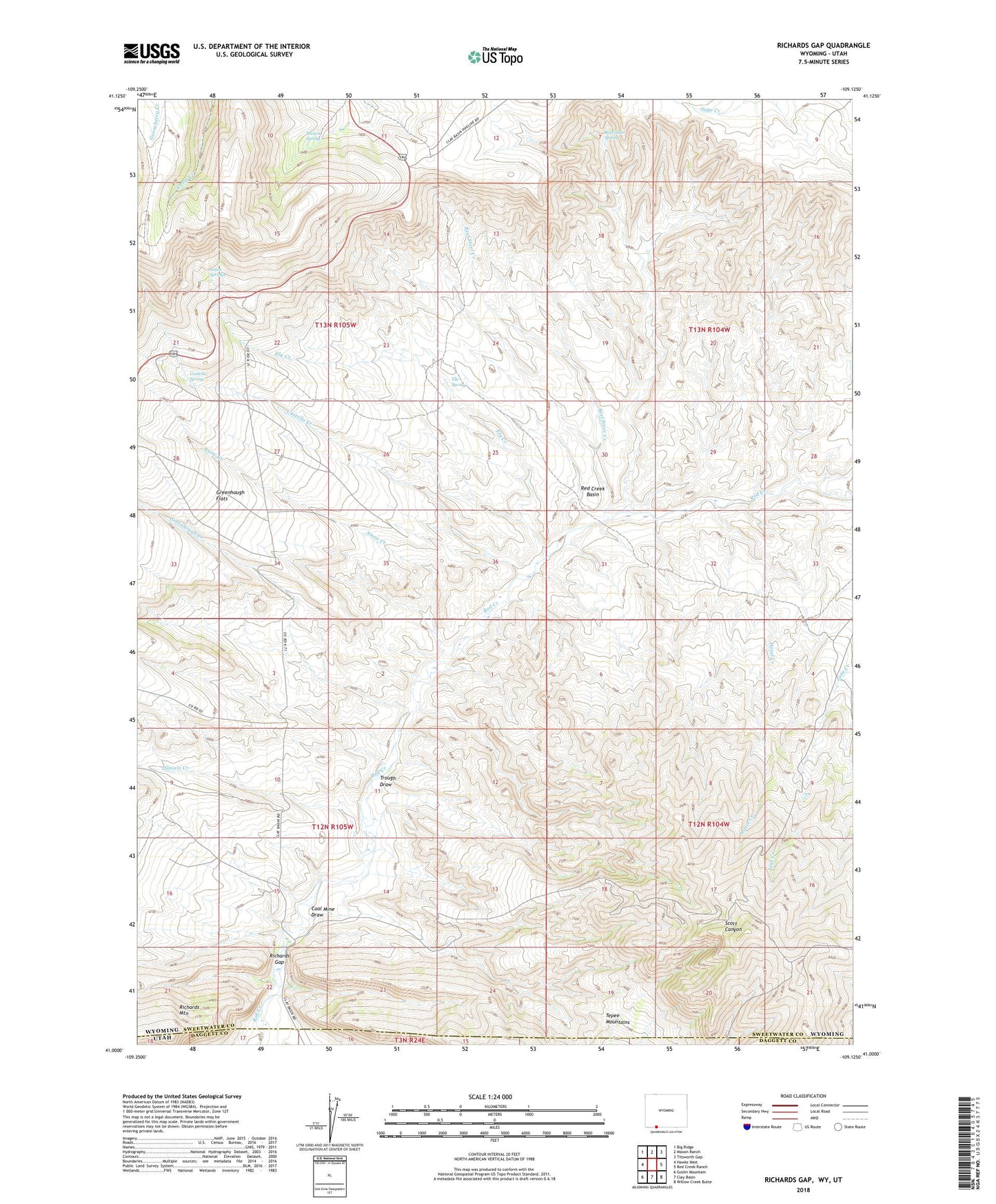
2021 topographic map quadrangle Richards Gap in the states of Wyoming, Utah. Scale: 1:24000. Based on the newly updated USGS 7.5' US Topo map series, this map is in the following counties: Sweetwater, Daggett. The map contains contour data, water features, and other items you are used to seeing on USGS maps, but also has updated roads and other features. This is the next generation of topographic maps. Printed on high-quality waterproof paper with UV fade-resistant inks.
Quads adjacent to this one:
West: Hawks Nest
Northwest: Big Ridge
North: Maxon Ranch
Northeast: Titsworth Gap
East: Red Creek Ranch
Southeast: Willow Creek Butte
South: Clay Basin
Southwest: Goslin Mountain
This map covers the same area as the classic USGS quad with code o41109a2.
Contains the following named places: Beef Steer Creek, Beef Steer Spring, Brown Spring, Castello Creek, Castello Spring, Coal Mine Draw, Daniels Creek, Ely Creek, Ely Spring, Greenhough Creek, Greenhough Flats, Greenhough Place, Hazel Creek, Jones Springs, Red Creek Badlands, Red Creek Basin, Richards Gap, Scott Canyon, Snow Creek, Tepee Mountains, Trough Draw