MyTopo
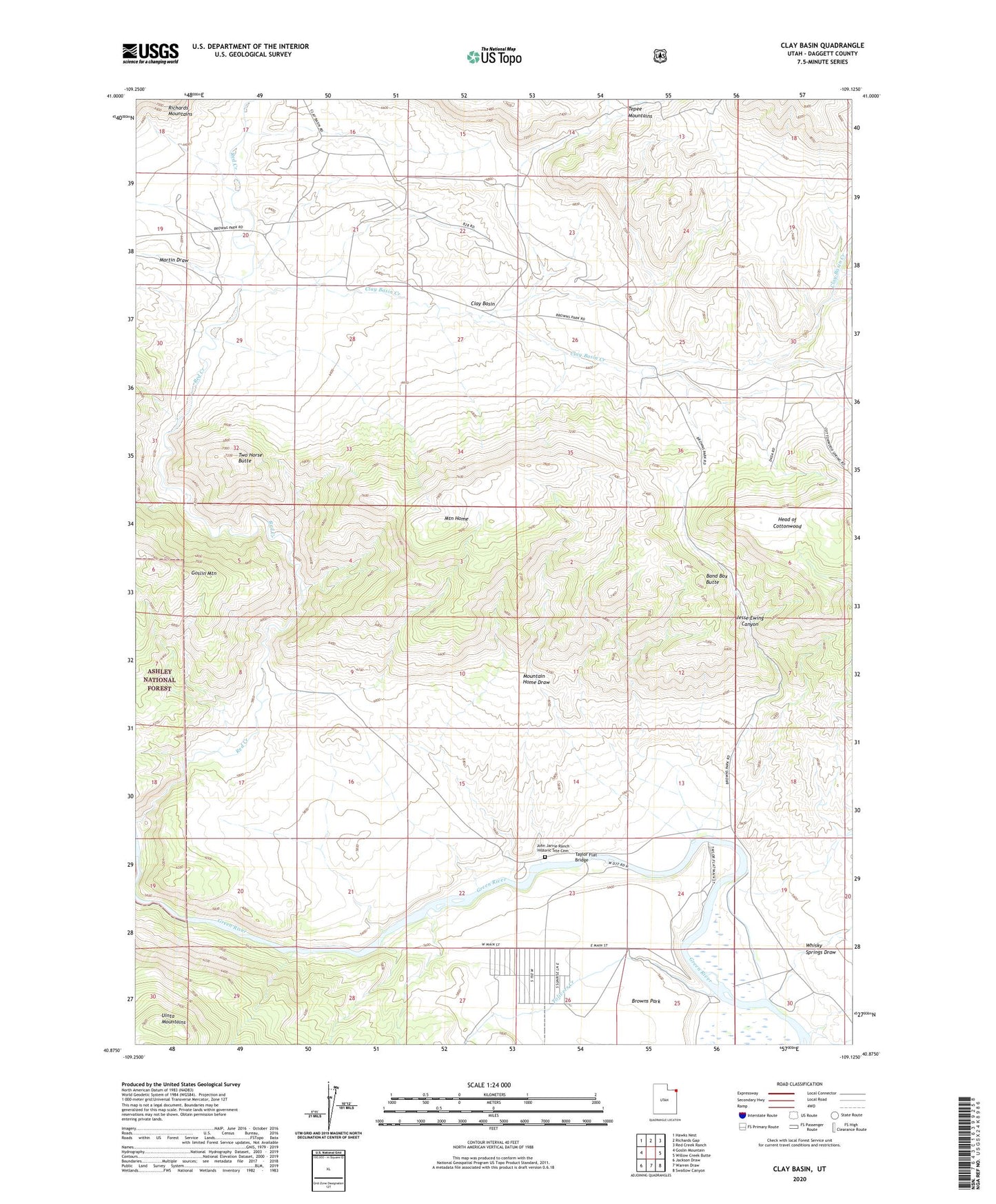
Clay Basin Utah US Topo Map
Couldn't load pickup availability
Also explore the Clay Basin Forest Service Topo of this same quad for updated USFS data
2023 topographic map quadrangle Clay Basin in the state of Utah. Scale: 1:24000. Based on the newly updated USGS 7.5' US Topo map series, this map is in the following counties: Daggett. The map contains contour data, water features, and other items you are used to seeing on USGS maps, but also has updated roads and other features. This is the next generation of topographic maps. Printed on high-quality waterproof paper with UV fade-resistant inks.
Quads adjacent to this one:
West: Goslin Mountain
Northwest: Hawks Nest
North: Richards Gap
Northeast: Red Creek Ranch
East: Willow Creek Butte
Southeast: Swallow Canyon
South: Warren Draw
Southwest: Jackson Draw
This map covers the same area as the classic USGS quad with code o40109h2.
Contains the following named places: Airstrip Camp, Band Box Butte, Beaver Dam Camp, Bridge Hollow Picnic Area, Browns Park, Browns Park National Wildlife Refuge Dam, Browns Park National Wildlife Refuge Reservoir, Browns Park Waterfowl Area, Clay Basin, Clay Basin Camp, Clay Basin Creek, Clay Basin Wildlife Management Area, Cottonwood Grove Camp, East Daggett Division, Elm Grove Camp, Fire Flat Camp, Head of Cottonwood, Indian Crossing Campground, Indian Crossing Raft Ramp, Jesse Ewing Canyon, John Jarvie Ranch, John Jarvie Ranch Historic Site Cemetery, Kastler Compressor Station Airport, Long Bend Camp, Martin Draw, Mountain Home, Mountain Home Draw, Red Creek Boat Camp, Riverside Camp, Taylor Flat Bridge, Taylors Flat Wildlife Management Area, Tolivers Creek, Two Horse Butte, Whisky Springs Draw, ZIP Code: 84023