MyTopo
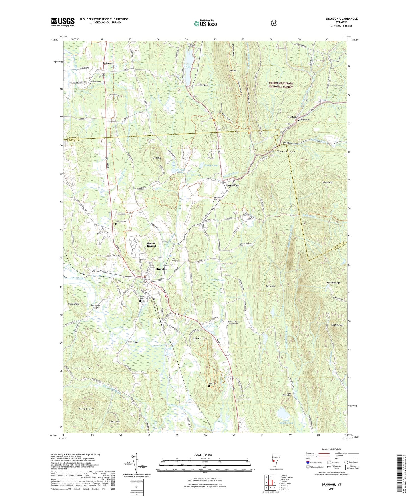
Brandon Vermont US Topo Map
Couldn't load pickup availability
Also explore the Brandon Forest Service Topo of this same quad for updated USFS data
2024 topographic map quadrangle Brandon in the state of Vermont. Scale: 1:24000. Based on the newly updated USGS 7.5' US Topo map series, this map is in the following counties: Rutland, Addison. The map contains contour data, water features, and other items you are used to seeing on USGS maps, but also has updated roads and other features. This is the next generation of topographic maps. Printed on high-quality waterproof paper with UV fade-resistant inks.
Quads adjacent to this one:
West: Sudbury
Northwest: Cornwall
North: East Middlebury
Northeast: Bread Loaf
East: Mount Carmel
Southeast: Chittenden
South: Proctor
Southwest: Bomoseen
This map covers the same area as the classic USGS quad with code o43073g1.
Contains the following named places: Arnold School, Basin Brook, Birch Hill, Bradbury State Park, Brandon, Brandon Area Rescue Squad, Brandon Baptist Church, Brandon Census Designated Place, Brandon Fire District 1, Brandon Free Public Library, Brandon Municipal Forest, Brandon Police Department, Brandon Post Office, Brandon State School, Brandon Town Cemetery, Brandon Town Hall, Brandon Village Historic District, Bresee Mill Brook, Brookside Cemetery, Burnell Pond, Castle Hill, Chaffee Mountain, Chandler Ridge Trail, Churchhill House Ski Area, Dean Bridge, Duval Trail, Fern Lake, Fernville, Forest Dale, Forest Dale Post Office, Forestdale Cemetery, Forestdale Iron Furnace, Gilbert - Cook - Goodrow Cemetery, Goshen, Goshen Cemetery, Goshen Municipal Forest, Gould Brook, Halls Island, Hawk Hill, Jones Brook, Jones Mill Pond, June Cemetery, Lead Mine Mountain, Leicester, Leicester Central School, Leicester Hollow Brook, Leicester Hollow Trail, Leicester Meeting House, Leicester Town Hall, Lion Hill, Maple Street Cemetery, Mount Pleasant, Neshobe Golf Course, Neshobe River, Neshobe School, North Branch Neshobe River, Oak Hill, Otter Valley Union High School, Pine Hill Cemetery, Proctor Lookout, Rutland Northeast Supervisory Union, Saint Marys Cemetery, Sanderson Bridge, School Number 1, School Number 2, Seager Hill, Smalley Swamp, Smoke Rise Family Campground, Spring Pond, Stephen A Douglas Birthplace, Stiles Hill, Sugar Hollow, Sugar Hollow Cemetery, Sugar Hollow Pond, Town of Brandon, Town of Goshen, Town of Leicester, Towtaid, Vermont Thorpe Camp, Waste Hill, ZIP Code: 05733