MyTopo
Gilson Mountain Vermont US Topo Map
Couldn't load pickup availability
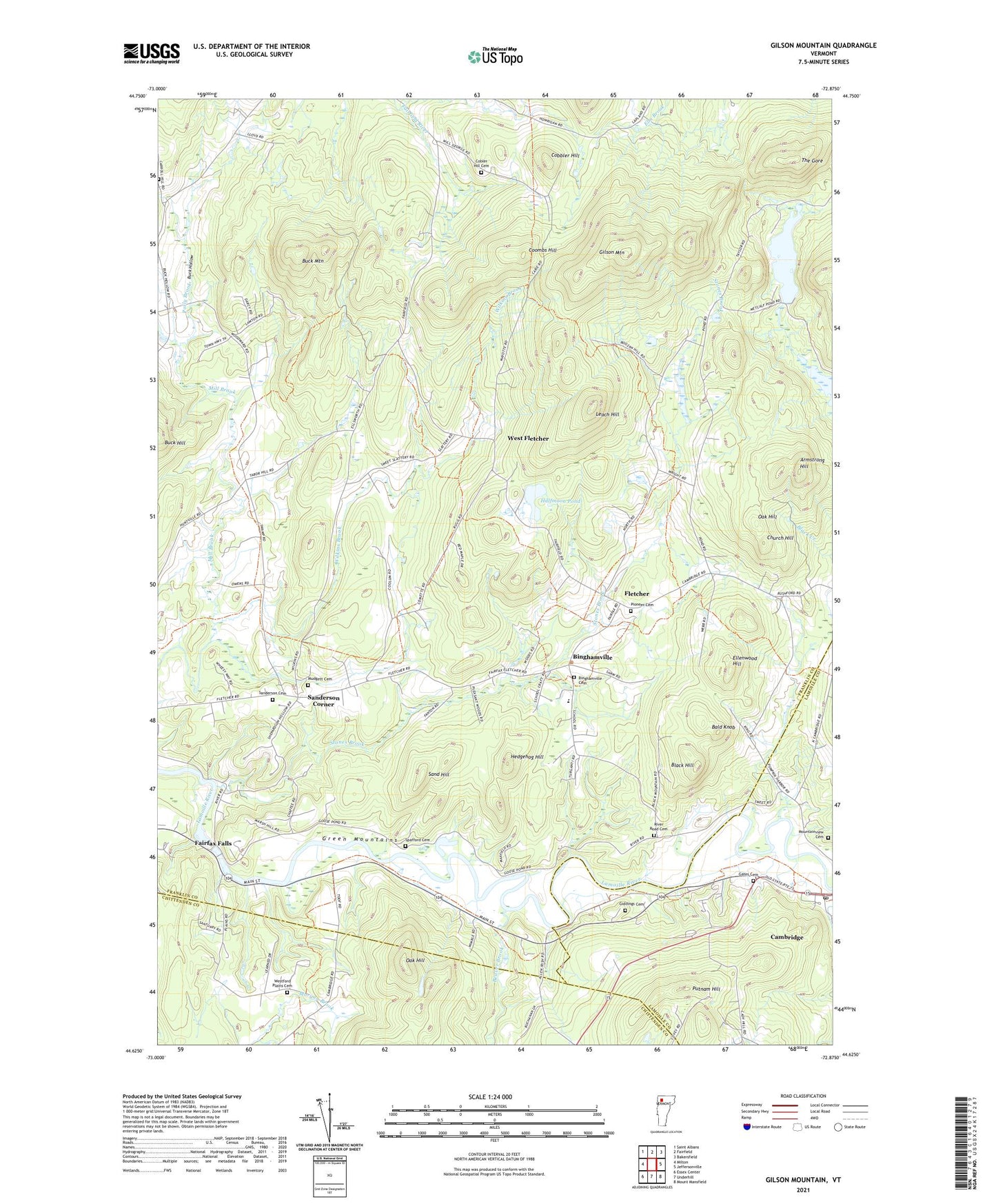
2024 topographic map quadrangle Gilson Mountain in the state of Vermont. Scale: 1:24000. Based on the newly updated USGS 7.5' US Topo map series, this map is in the following counties: Franklin, Lamoille, Chittenden. The map contains contour data, water features, and other items you are used to seeing on USGS maps, but also has updated roads and other features. This is the next generation of topographic maps. Printed on high-quality waterproof paper with UV fade-resistant inks.
Quads adjacent to this one:
West: Milton
Northwest: Saint Albans
North: Fairfield
Northeast: Bakersfield
East: Jeffersonville
Southeast: Mount Mansfield
South: Underhill
Southwest: Essex Center
This map covers the same area as the classic USGS quad with code o44072f8.
Contains the following named places: Armstrong Hill, Bald Knob, Beaver Brook, Binghamville, Binghamville Cemetery, Black Hill, Buck Hill, Buck Hollow, Buck Hollow School, Buck Mountain, Cambridge, Cambridge Congregational Church, Cambridge Post Office, Cambridge State Forest, Carroll Hill Cemetery, Church Hill, Cobbler Hill, Cobler Hill Cemetery, Coombs Hill, Ellenwood Hill, Fairfax Falls, Fairfax Falls Dam, Fairfax Falls Pond, Fletcher, Fletcher Elementary School, Fletcher Union Church, Gates Cemetery, Giddings Cemetery, Gilson Mountain, Halfmoon Pond, Hedgehog Hill, Huntsville, Leach Hill, Metcalf Pond, Mountainview Cemetery, Mudgett Cemetery, Oak Hill, Parsons School, Pioneer Cemetery, Polly Brook, Pond School, Putnam Hill, River Road Cemetery, River View School, Saint Marys Catholic Church, Sand Hill, Sanderson Cemetery, Sanderson Corner, Shepardson School, Spafford Cemetery, Stones Brook, The Gore, Town of Fletcher, Village of Cambridge, West Fletcher, Westford Plains Cemetery, Wilkins Brook, ZIP Code: 05444