MyTopo
Stone Mountain Vermont US Topo Map
Couldn't load pickup availability
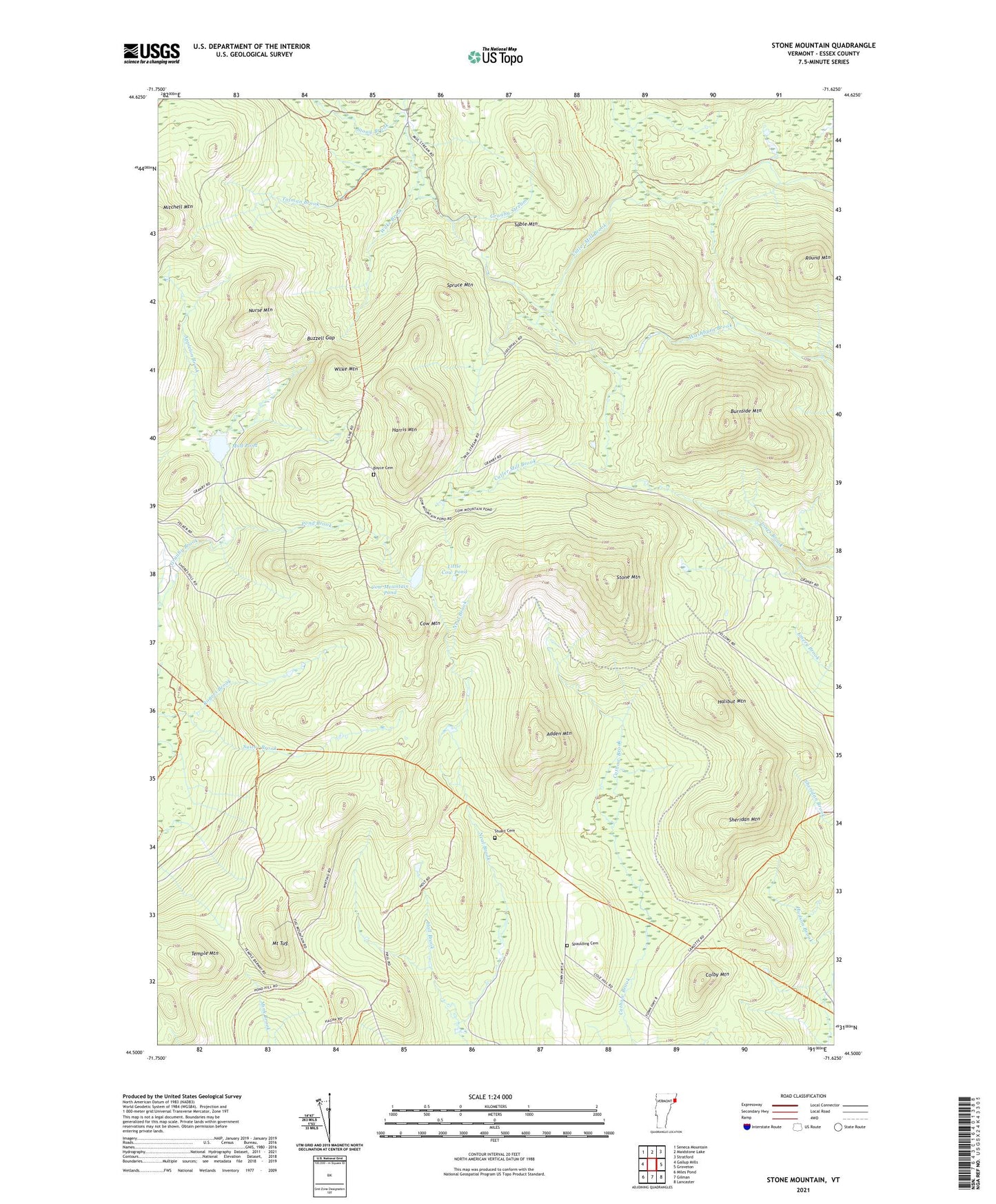
2024 topographic map quadrangle Stone Mountain in the state of Vermont. Scale: 1:24000. Based on the newly updated USGS 7.5' US Topo map series, this map is in the following counties: Essex. The map contains contour data, water features, and other items you are used to seeing on USGS maps, but also has updated roads and other features. This is the next generation of topographic maps. Printed on high-quality waterproof paper with UV fade-resistant inks.
Quads adjacent to this one:
West: Gallup Mills
Northwest: Seneca Mountain
Northeast: Stratford
East: Groveton
Southeast: Lancaster
South: Gilman
Southwest: Miles Pond
This map covers the same area as the classic USGS quad with code o44071e6.
Contains the following named places: Adden Mountain, Applelon Brook, Boyce Cemetery, Burnside Mountain, Buzzell Gap, Colby Mountain, Cow Mountain, Cow Mountain Pond, Halibut Mountain, Hall Brook, Harris Mountain, Little Cow Pond, Mount Tug, Mud Pond, Nurse Mountain, Pond Brook, Round Mountain, Sable Mountain, Sable Mountain Brook, Sheridan Mountain, Spaulding Cemetery, Spruce Mountain, Stone Mountain, Stony Brook, Stuart Cemetery, Suitor Brook, Temple Mountain, Tolman Brook, Town of Granby, Town of Guildhall, Wilke Brook, Wilke Mountain