MyTopo
Gilman Vermont US Topo Map
Couldn't load pickup availability
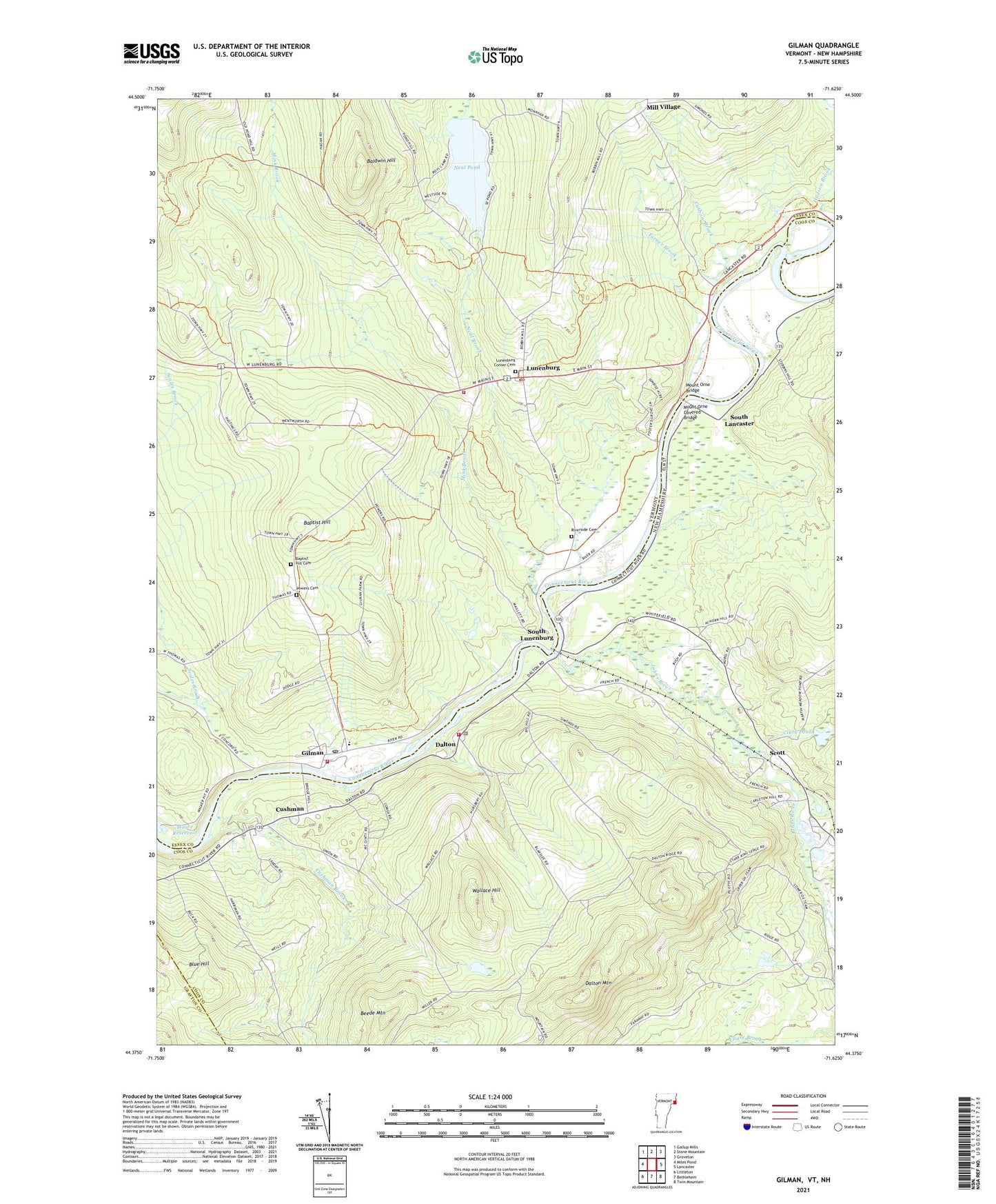
2021 topographic map quadrangle Gilman in the states of New Hampshire, Vermont. Scale: 1:24000. Based on the newly updated USGS 7.5' US Topo map series, this map is in the following counties: Essex, Coos, Grafton. The map contains contour data, water features, and other items you are used to seeing on USGS maps, but also has updated roads and other features. This is the next generation of topographic maps. Printed on high-quality waterproof paper with UV fade-resistant inks.
Quads adjacent to this one:
West: Miles Pond
Northwest: Gallup Mills
North: Stone Mountain
Northeast: Groveton
East: Lancaster
Southeast: Twin Mountain
South: Bethlehem
Southwest: Littleton
Contains the following named places: Alden Balch Memorial Library, Baldwin Hill, Baptist Hill, Baptist Hill Cemetery, Baptist Hill School, Beede Mountain, Blue Hill, Catbow Brook, Clark Pond, Cushman, Cushman Brook, Dalton, Dalton Elementary School, Dalton Mountain, Dalton Police Department, Dalton Volunteer Fire Department, Gilman, Gilman - Lunenburg Rescue Squad, Gilman Census Designated Place, Gilman Post Office, Gilman Project Dam, Gilman Project Reservoir, Gilman Public Library, Gold Mine Pond, Gold Mine Pond Dam, Hudson Brook, Johns River, Lunenburg, Lunenburg and Gillman Schools, Lunenburg Census Designated Place, Lunenburg Corner Cemetery, Lunenburg Elementary School, Lunenburg Fire Department, Lunenburg Fire Department - Gilman, Lunenburg Post Office, Mill Village, Mink Brook, Mount Orne Bridge, Mount Orne Covered Bridge, Neal Brook, Neal Pond, Powers Cemetery, Riverside Cemetery, Scales Brook, School Number 9, Scott, South Lancaster, South Lunenburg, South Lunenburg School, Town of Dalton, Town of Lunenburg, Turner Brook, Union School, Wallace Hill, West Lunenburg School, ZIP Codes: 03598, 05904, 05906