MyTopo
Highgate Center Vermont US Topo Map
Couldn't load pickup availability
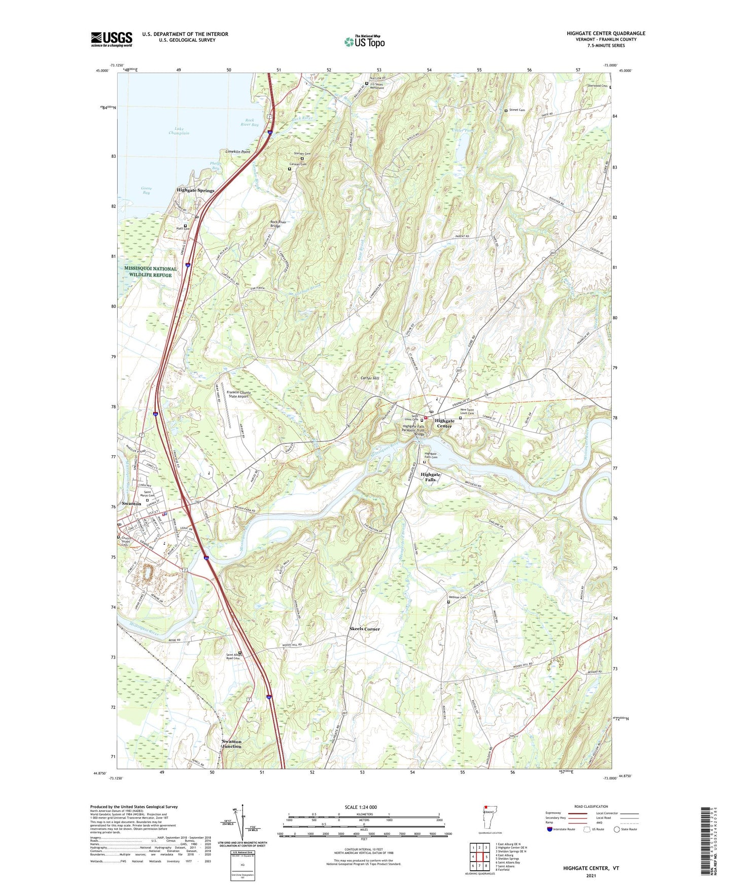
2021 topographic map quadrangle Highgate Center in the state of Vermont. Scale: 1:24000. Based on the newly updated USGS 7.5' US Topo map series, this map is in the following counties: Franklin. The map contains contour data, water features, and other items you are used to seeing on USGS maps, but also has updated roads and other features. This is the next generation of topographic maps. Printed on high-quality waterproof paper with UV fade-resistant inks.
Quads adjacent to this one:
West: East Alburg
Northwest: East Alburg OE N
North: Highgate Center OE N
Northeast: Sheldon Springs OE N
East: Sheldon Springs
Southeast: Fairfield
South: Saint Albans
Southwest: Saint Albans Bay
Contains the following named places: Beaulieus Corner, Carman Brook, Carman Cemetery, Carter Hill, Church of the Nativity, Church Street Cemetery, Cutler Pond, De La Bruere Dairy, First Congregational Church, Franklin County State Airport, Franklin Northwest Supervisory Union, Green Mountain Dairy Farm, Highate Falls Dam, Highgate Center, Highgate Center Cemetery, Highgate Center Census Designated Place, Highgate Center Post Office, Highgate Elementary School, Highgate Falls, Highgate Falls Cemetery, Highgate Falls Parabolic Truss Bridge, Highgate Springs, Highgate Springs Census Designated Place, Highgate Springs Post Office, Highgate Volunteer Fire Department, Holy Trinity Episcopal Church, Hungerford Brook, Hyde Cemetery, J G Saxes Monument, Kelly Brook, Limekiln Point, Mary S Babcock Elementary School, Missisquoi Valley Rescue Squad, Missisquoi Valley Union High School, Munchkinland Montessori School, New Saint Louis Cemetery, Phelps Bay, Platt Cemetery, Rock River, Rock River Bay, Rock River Bridge, Round Barn, Saint Albans Road Cemetery, Saint Johns Episcopal Church, Saint Louis Cemetery, Saint Louis Church, Saint Marys Cemetery, Saxe Brook, Sherwood Cemetery, Skeels Corner, Steele Brook, Sternes Cemetery, Stimet Cemetery, Swanton, Swanton Elementary School, Swanton Junction, Swanton Police Department, Swanton Post Office, Swanton Public Library, Swanton Town Hall, Swanton Village Fire Department, Town of Highgate, Village of Swanton, Webster Cemetery, Youngman Brook, ZIP Code: 05459