MyTopo
Richmond Vermont US Topo Map
Couldn't load pickup availability
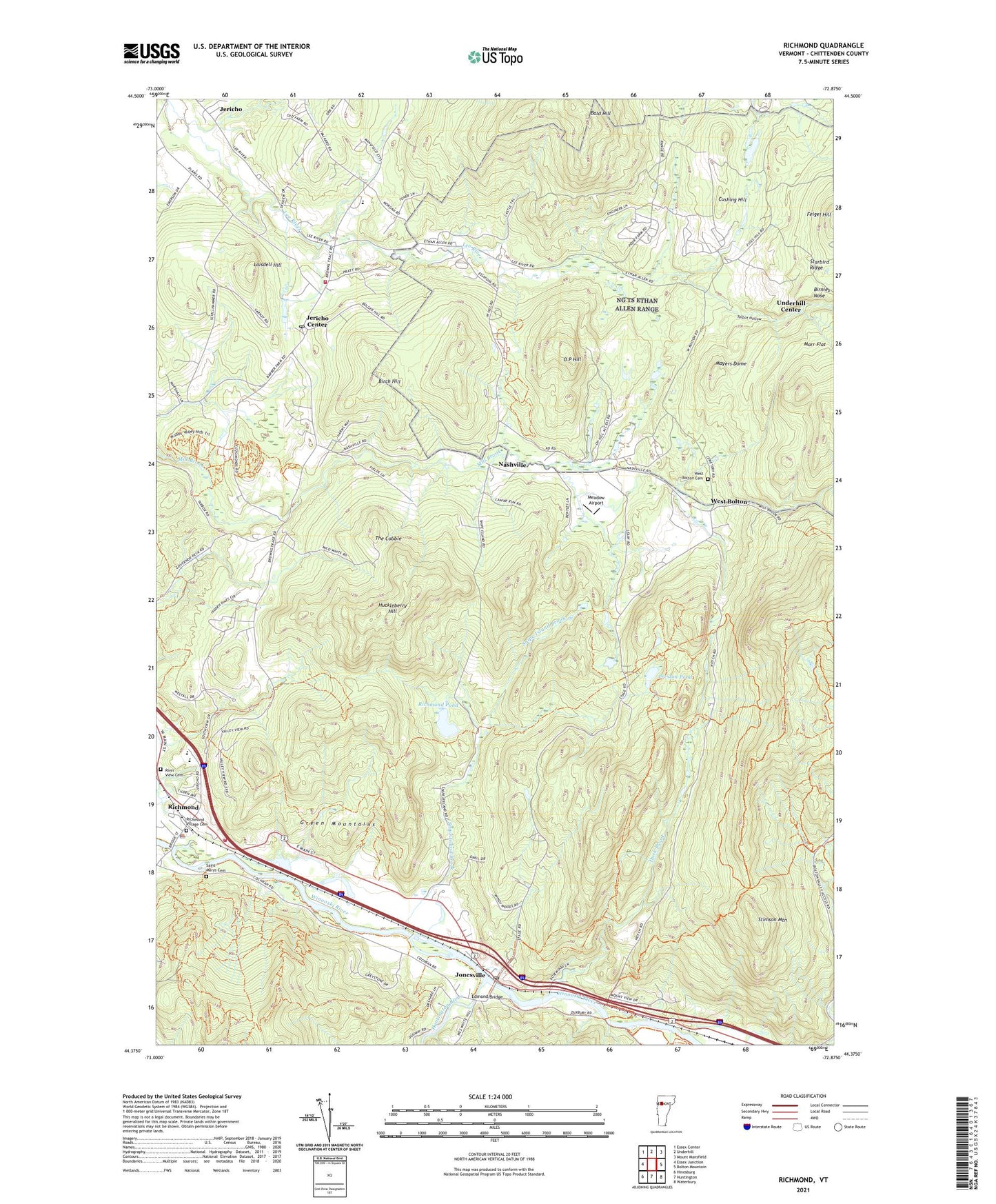
2024 topographic map quadrangle Richmond in the state of Vermont. Scale: 1:24000. Based on the newly updated USGS 7.5' US Topo map series, this map is in the following counties: Chittenden. The map contains contour data, water features, and other items you are used to seeing on USGS maps, but also has updated roads and other features. This is the next generation of topographic maps. Printed on high-quality waterproof paper with UV fade-resistant inks.
Quads adjacent to this one:
West: Essex Junction
Northwest: Essex Center
North: Underhill
Northeast: Mount Mansfield
East: Bolton Mountain
Southeast: Waterbury
South: Huntington
Southwest: Hinesburg
This map covers the same area as the classic USGS quad with code o44072d8.
Contains the following named places: Bald Hill, Birch Hill, Birnies Nose, Bolton Notch, Camels Hump Middle School, Camp Underhill, Champlain Council Campfire Girls Camp, Cochran Ski Center, Cushing Hill, Duck Brook, Edmond Bridge, Huckleberry Hill, Huntington River, Jericho Center, Jericho Center Post Office, Jonesville, Jonesville Academy, Jonesville Post Office, Laisdell Hill, Machine Gun School, Marr Flat, Mayers Dome, Meadow Airport, Mount Mansfield Union High School, Nashville, O P Hill, Old Round Church, Preston Brook, Preston Pond, Richmond, Richmond Census Designated Place, Richmond Congregational Church, Richmond Elementary School, Richmond Fire Department, Richmond Police Department, Richmond Pond, Richmond Post Office, Richmond Rescue Squad, Richmond Village Cemetery, River View Cemetery, Saint Marys Cemetery, Snipe Island Brook, Starbird Ridge, Stimson Mountain, Talbot Hollow, The Cobble, Town of Bolton, Town of Jericho, Town of Richmond, Training Site Ethan Allen Range, Underhill - Jericho Fire Department, Vermont Research Forest Agriculture Experiment StatiON, West Bolton, West Bolton Cemetery, West Bolton Golf Course, ZIP Codes: 05465, 05477