MyTopo
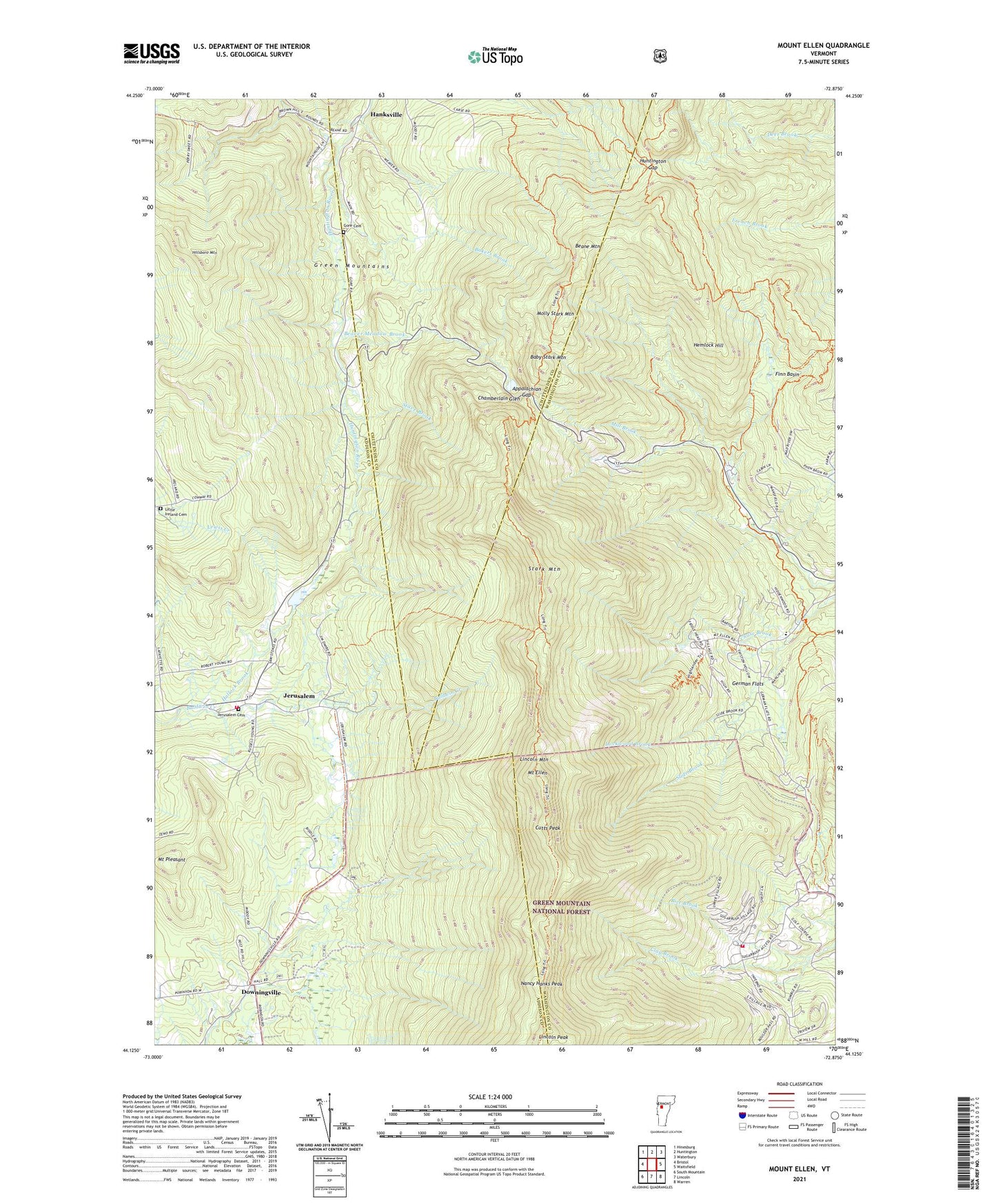
Mount Ellen Vermont US Topo Map
Couldn't load pickup availability
Also explore the Mount Ellen Forest Service Topo of this same quad for updated USFS data
2024 topographic map quadrangle Mount Ellen in the state of Vermont. Scale: 1:24000. Based on the newly updated USGS 7.5' US Topo map series, this map is in the following counties: Washington, Addison, Chittenden. The map contains contour data, water features, and other items you are used to seeing on USGS maps, but also has updated roads and other features. This is the next generation of topographic maps. Printed on high-quality waterproof paper with UV fade-resistant inks.
Quads adjacent to this one:
West: Bristol
Northwest: Hinesburg
North: Huntington
Northeast: Waterbury
East: Waitsfield
Southeast: Warren
South: Lincoln
Southwest: South Mountain
This map covers the same area as the classic USGS quad with code o44072b8.
Contains the following named places: Appalachian Gap, Baby Stark Mountain, Bakers Brook, Beane Mountain, Beane Trail, Beaver Meadow Brook, Birch Glen Camp, Bristol Municipal Forest, Buels Gore, Camels Hump State Park, Catamount Cross Country Trail, Chamberlain Glen, Cutts Peak, Downingville, Fayston Elementary School, Finn Basin, German Flats, Glen Ellen Ski Area, Gore Cemetery, Hallock Brook, Hanksville, Hemlock Hill, Hillsboro Mountain, Huntington Gap, Huntington Gap Wildlife Manangement Area, Jerusalem, Jerusalem Cemetery, Jerusalem Trail, Lincoln Mountain, Lincoln Peak, Little Ireland Cemetery, Lockwood Brook, Mad River Glen Nordic Ski Center, Mad River Glen Ski Area, Molly Stark Mountain, Mount Ellen, Mount Pleasant, Nancy Hanks Peak, Rice Brook, Slide Brook, Stark Mountain, Starksboro Volunteer Fire Department Station 2, Stave Brook, Strattonwald Dam, Sugarbush Ski Center, Sugarbush Valley Ski Area, Sugarbush Village, Theron Dean Shelter, Warren Volunteer Fire Department Sugarbush Substation, WDOT-FM (Warren), ZIP Code: 05487