MyTopo
Miles Pond Vermont US Topo Map
Couldn't load pickup availability
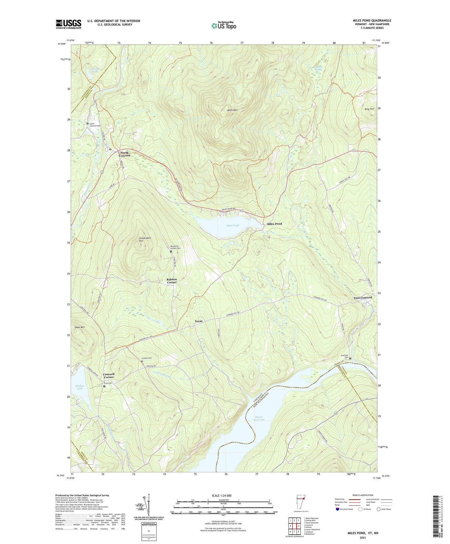
2021 topographic map quadrangle Miles Pond in the states of Vermont, New Hampshire. Scale: 1:24000. Based on the newly updated USGS 7.5' US Topo map series, this map is in the following counties: Essex, Grafton, Caledonia, Coos. The map contains contour data, water features, and other items you are used to seeing on USGS maps, but also has updated roads and other features. This is the next generation of topographic maps. Printed on high-quality waterproof paper with UV fade-resistant inks.
Quads adjacent to this one:
West: Concord
Northwest: Burke Mountain
North: Gallup Mills
Northeast: Stone Mountain
East: Gilman
Southeast: Bethlehem
South: Littleton
Contains the following named places: Brook School, Carpenter Brook, Carr Brook, Concord Corner, Cutting Brook, Dudley Brook, East Concord, Frye Cemetery, Goudreault Hill, Graves Cemetery, Hastings Swamp, Johnson Pond, King Hill, Miles Mountain, Miles Pond, Miles Pond Dam, Miles Stream, Mink Brook, Nichols Hall, North Concord, North Concord Cemetery, North Concord Post Office, North Concord School, Old Overlook Cemetery, Overlook Cemetery, Ralston Corner, Ralston Corner School, Roaring Brook, Royalston Corner Cemetery, Samuel Reed Hall Monument, Shadow Lake, Shaw Mountain, Texas, Texas School, Town of Concord, ZIP Code: 05824