MyTopo
Orwell Vermont US Topo Map
Couldn't load pickup availability
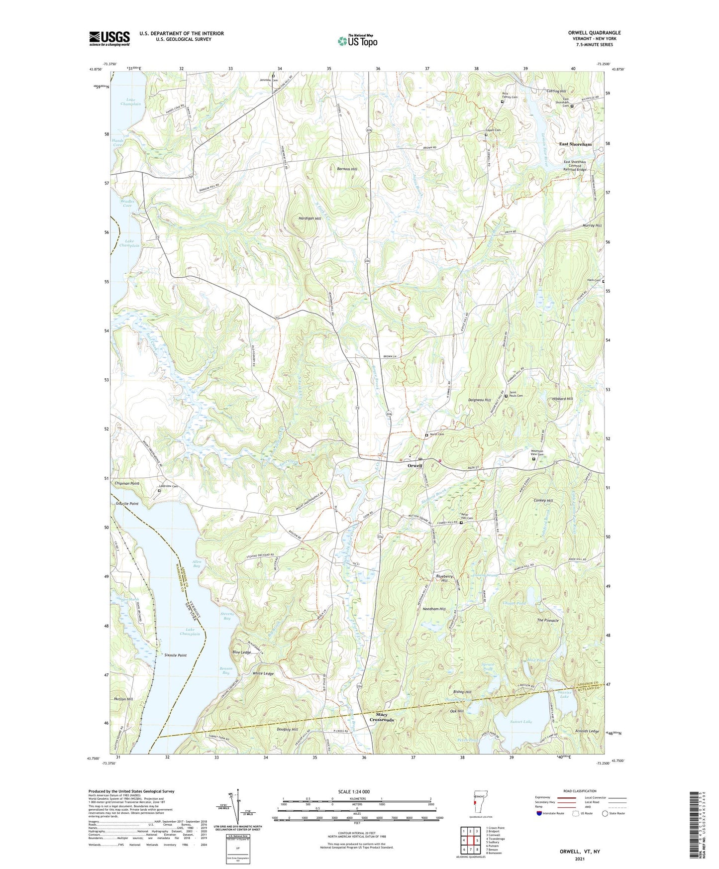
2021 topographic map quadrangle Orwell in the states of Vermont, New York. Scale: 1:24000. Based on the newly updated USGS 7.5' US Topo map series, this map is in the following counties: Addison, Rutland, Washington, Essex. The map contains contour data, water features, and other items you are used to seeing on USGS maps, but also has updated roads and other features. This is the next generation of topographic maps. Printed on high-quality waterproof paper with UV fade-resistant inks.
Quads adjacent to this one:
West: Ticonderoga
Northwest: Crown Point
North: Bridport
Northeast: Cornwall
East: Sudbury
Southeast: Bomoseen
South: Benson
Southwest: Putnam
Contains the following named places: Allen Bay, Arnolds Ledge, Barnum Hill, Barnum Hill School, Beadles Cove, Beemans Corners, Benson Bay, Big Brook, Bishop Hill, Blue Ledge, Blueberry Hill, Camp Sunrise, Chipman Point Marina, Choate Pond, Conkey Hill, Conway Swamp, Cutting Hill, Daigneau Hill, Doughty Hill, Doughty Pond, East Creek Site 1 Dam, East Creek Site 2 Dam, East Creek Waterfowl Area, East Shoreham, East Shoreham Cemetery, East Shoreham Covered Railroad Bridge, Gourlie Point, Hack Cemetery, Hands Cove, Hardigan Hill, Hibbard Hill, Hough Crossing, Hough Crossing School, Hutton Hill, Jennison Cemetery, Jones Brook, Lakeview Cemetery, Lapell Cemetery, Larrabees Point Station, Mountain View Cemetery, Mud Dock, Mud Pond, Murray Hill, Needham Hill, Negro Marsh, North Cemetery, North Fork East Creek, North Orwell, Oak Hill, Orwell, Orwell Bluff Light, Orwell Landing, Orwell Post Office, Orwell Village School, Orwell Volunteer Fire Department, Pepper Brook, Perch Pond, Peter Hall Cemetery, Pond Woods Wildlife Management Area, Rich Family Cemetery, Richville, Royce Brook, Saint Pauls Cemetery, Sanford Brook, Shoreham Center School, Sixmile Point, Smith School, South Fork East Creek, Spruce Pond, Stacy Brook, Stacy Crossroads, Stevens Bay, Sunrise Lake, Sunrise Lake Dam, Sunset Lake, The Pinnacle, Town of Orwell, White Ledge, ZIP Code: 05760