MyTopo
Mount Mansfield Vermont US Topo Map
Couldn't load pickup availability
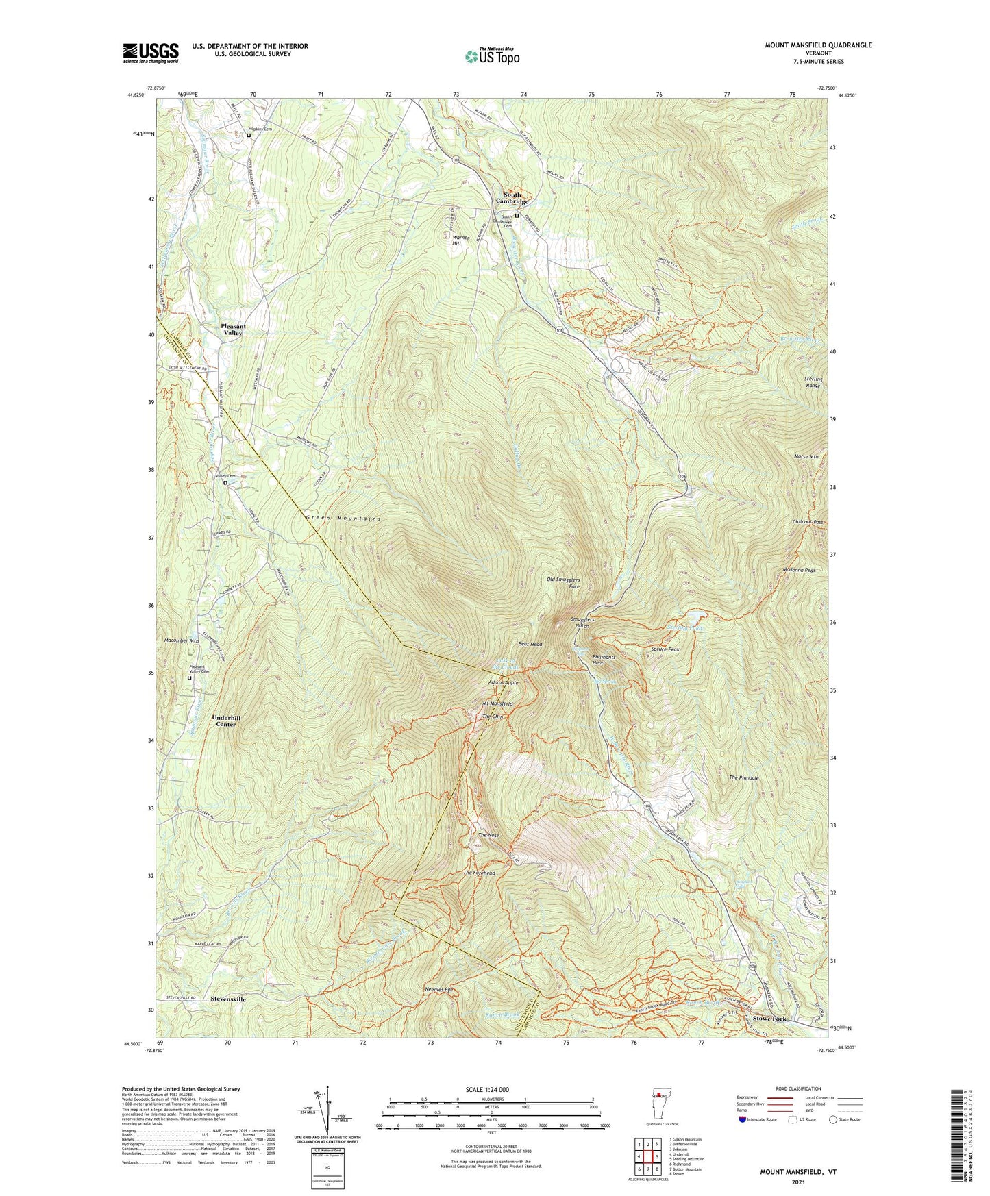
2024 topographic map quadrangle Mount Mansfield in the state of Vermont. Scale: 1:24000. Based on the newly updated USGS 7.5' US Topo map series, this map is in the following counties: Lamoille, Chittenden. The map contains contour data, water features, and other items you are used to seeing on USGS maps, but also has updated roads and other features. This is the next generation of topographic maps. Printed on high-quality waterproof paper with UV fade-resistant inks.
Quads adjacent to this one:
West: Underhill
Northwest: Gilson Mountain
North: Jeffersonville
Northeast: Johnson
East: Sterling Mountain
Southeast: Stowe
South: Bolton Mountain
Southwest: Richmond
This map covers the same area as the classic USGS quad with code o44072e7.
Contains the following named places: Adams Apple, Barnes Camp, Bear Head, Bear Pond, Big Spring, Bingham Falls, Bulter Lodge, Camp Mansfield, Chilcoot Pass, Elephants Head, Gallup Branch, Halfway House, Harvey School, Haselton Trail, Hopkins Cemetery, Lake of the Clouds, Macomber Mountain, Madonna Peak, Morristown Municipal Forest, Morse Mountain, Morses Mill, Mount Mansfield, Mount Mansfield Hotel, Mount Mansfield Ski Area, Mount Mansfield Ski Touring Center, Mount Mansfield State Forest, Mount Mansfield Winter Academy, Needles Eye, North American Hockey Academy, Nose Dive Trail, Old Smugglers Face, Pleasant Valley, Pleasant Valley Cemetery, Ranch Brook, Ranch Camp, Settlement Brook, Smugglers Notch, Smugglers Notch Natural Area, South Cambridge, South Cambridge Cemetery, Spruce Peak, Spruce Peak Ski Area, Sterling Pond, Stevensville, Stowe Fork, Sugar House Nordic Center, Taft Lodge, The Chin, The Forehead, The Long Trail, The Nose, The Pinnacle, Valley Cemetery, Warner Hill, WCAX-TV (Burlington), WETK-TV (Burlington), WEZF-FM (Burlington), WVMX-FM (Stowe), WVNY-TV (Burlington), WVPS-FM (Burlington)