MyTopo
Sharon Vermont US Topo Map
Couldn't load pickup availability
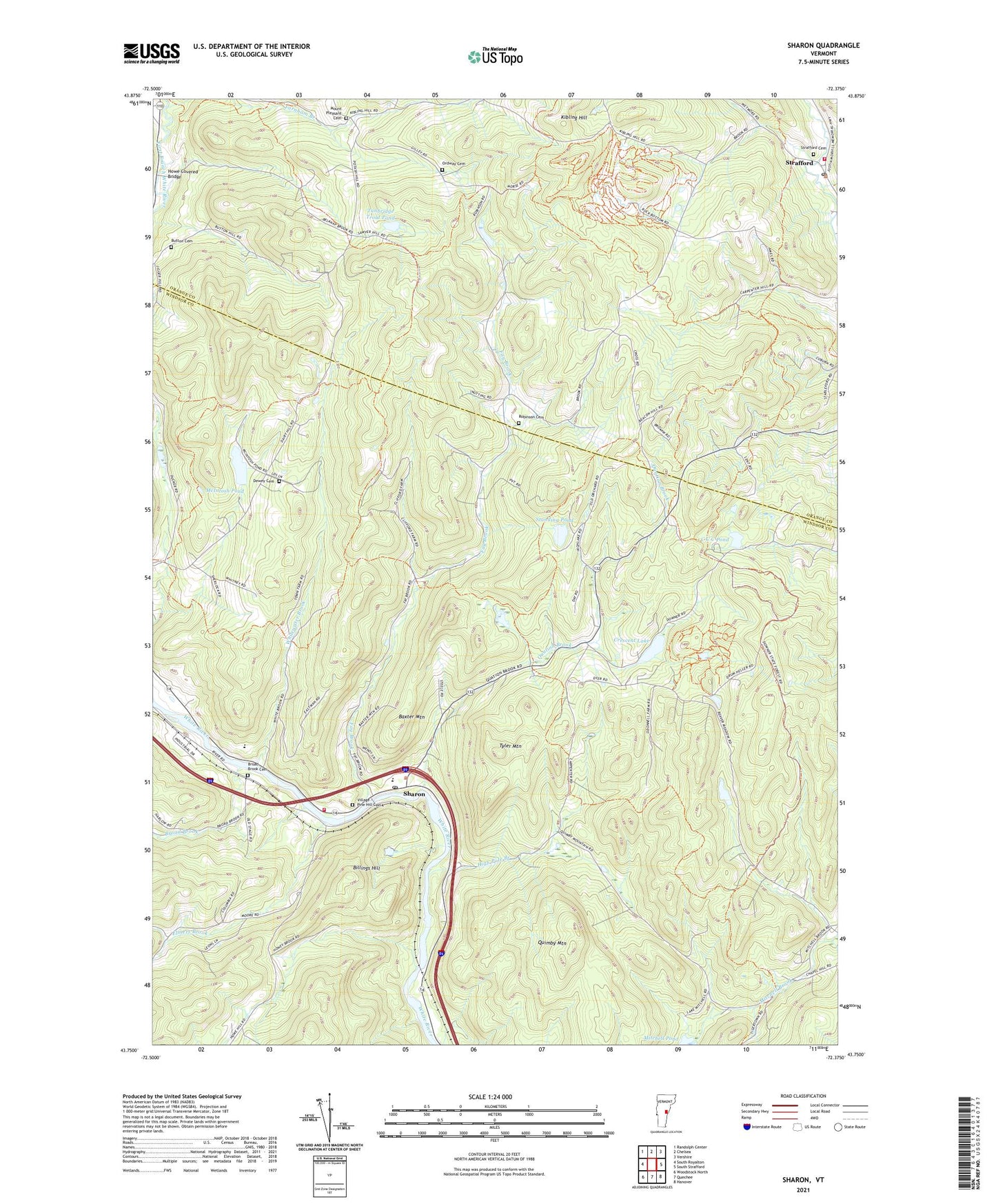
2024 topographic map quadrangle Sharon in the state of Vermont. Scale: 1:24000. Based on the newly updated USGS 7.5' US Topo map series, this map is in the following counties: Windsor, Orange. The map contains contour data, water features, and other items you are used to seeing on USGS maps, but also has updated roads and other features. This is the next generation of topographic maps. Printed on high-quality waterproof paper with UV fade-resistant inks.
Quads adjacent to this one:
West: South Royalton
Northwest: Randolph Center
North: Chelsea
Northeast: Vershire
East: South Strafford
Southeast: Hanover
South: Quechee
Southwest: Woodstock North
This map covers the same area as the classic USGS quad with code o43072g4.
Contains the following named places: Baxter Mountain, Belnap Pond Dam, Billings Hill, Broad Brook, Broad Brook Cemetery, Button Cemetery, C C C Pond, C C C Pond Dam, Charles Downer State Forest, Clover Hill Wildlife Management Area, Crescent Lake, Crescent Lake Dam, Dairy Hill School, Day School, Dewey Cemetery, Downer 4-H Camp, Elmers Brook, Farnham Branch, Fay Brook, High Pole Branch, Howe Covered Bridge, Howe Hill School, Joseph Smith Monument, Kibling Hill, McIntosh Pond, McIntosh Pond Dam, Morrill Memorial and Harris Library, Mount Pleasant Cemetery, Ordway Cemetery, Quation Brook, Quimby Mountain, Robinson Cemetery, Robinson School, School Number 3, Sharon, Sharon Academy High School, Sharon Academy Middle School, Sharon Broad Brook School, Sharon Congregational Church, Sharon Elementary School, Sharon Post Office, Sharon Volunteer Fire Department, Standing Pond, Strafford, Strafford Cemetery, Strafford Fire Station, Strafford Meeting House, Strafford Post Office, Strafford Village Historic District, Town of Sharon, Tunbridge Trout Pond, Tyler Mountain, Village - Pine Hill Cemetery, White River Wildlife Management Area, Whitewater Brook, ZIP Code: 05065