MyTopo
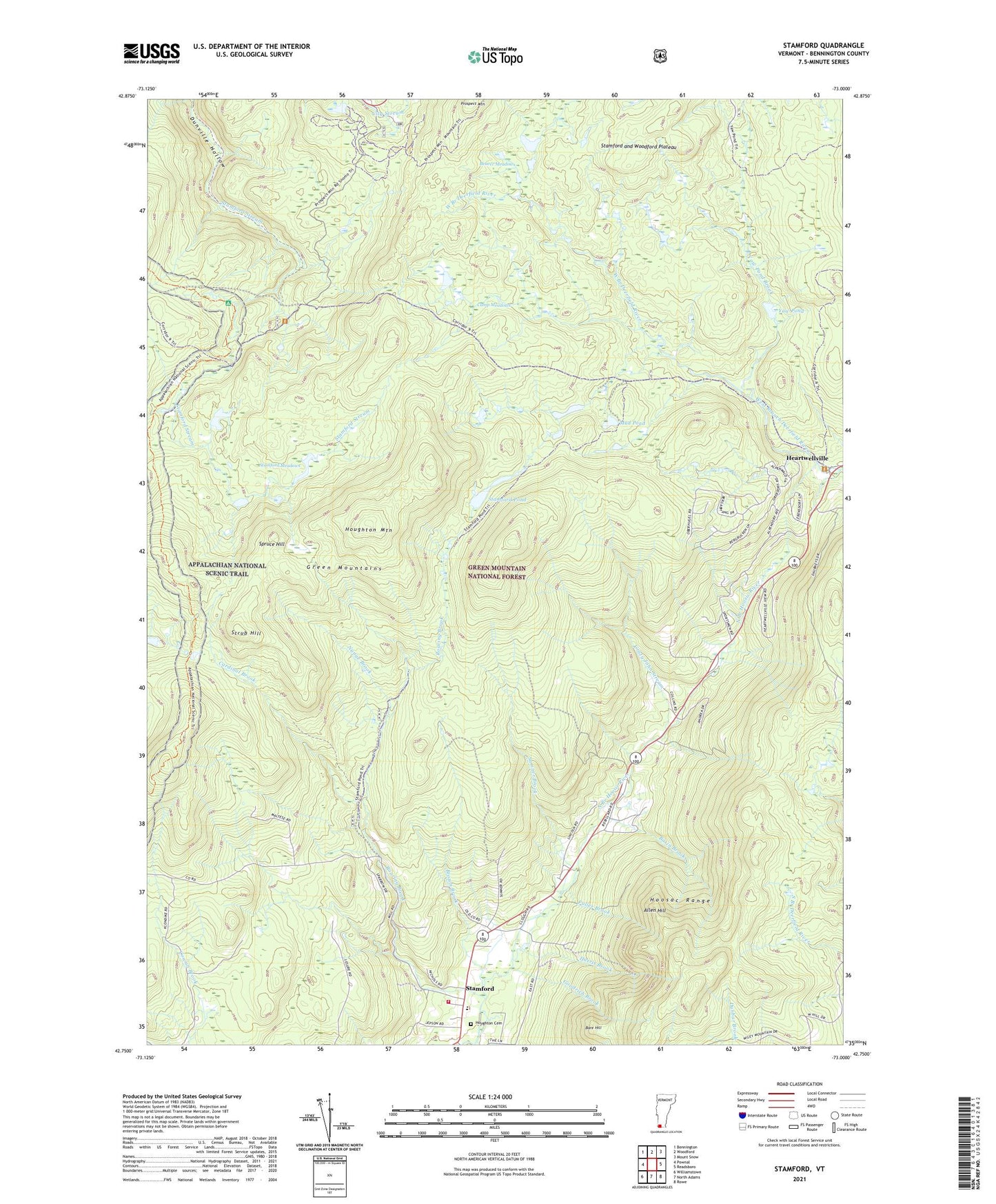
Stamford Vermont US Topo Map
Couldn't load pickup availability
2021 topographic map quadrangle Stamford in the state of Vermont. Scale: 1:24000. Based on the newly updated USGS 7.5' US Topo map series, this map is in the following counties: Bennington. The map contains contour data, water features, and other items you are used to seeing on USGS maps, but also has updated roads and other features. This is the next generation of topographic maps. Printed on high-quality waterproof paper with UV fade-resistant inks.
Quads adjacent to this one:
West: Pownal
Northwest: Bennington
North: Woodford
Northeast: Mount Snow
East: Readsboro
Southeast: Rowe
South: North Adams
Southwest: Williamstown
Contains the following named places: Allen Hill, Bare Hill, Basin Brook, Beaver Meadows, Brown Brook, Camp Casino, Camp Meadows, Cardinal Brook, Congdon Camp, Crazy John Stream, Dutch Hill Winter Sports Area, Fuller Brook, George D Aiken Wilderness, Goodrich Brook, Harris Brook, Houghton Cemetery, Houghton Mountain, Kelly Camp Trail, Mud Pond, Nunge Brook, Old Stage Trail, Prospect Mountain, Prospect Mountain Winter Sports Area, Reservoir Brook, Roaring Brook, Scrub Hill, Spruce Hill, Stamford, Stamford and Woodford Plateau, Stamford Census Designated Place, Stamford Community Library, Stamford Elementary School, Stamford Meadows, Stamford Meadows Wildlife Management Area, Stamford Pond, Stamford Town Hall, Stamford Volunteer Fire Department, Sumner Brook, Town of Stamford, Village of Alpenwald, Yaw Brook Cabin, Yaw Pond, Yaw Pond Brook, ZIP Code: 05352