MyTopo
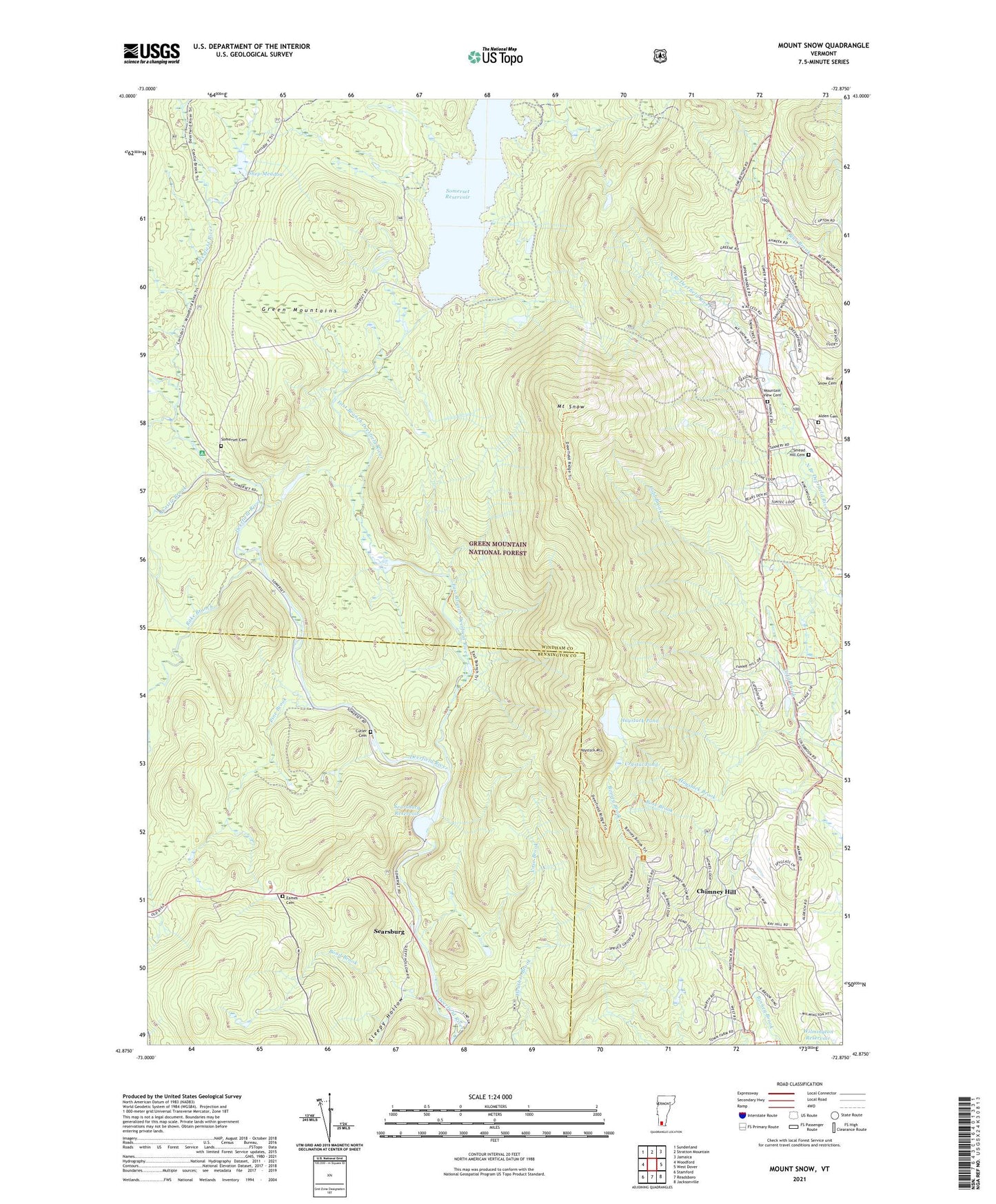
Mount Snow Vermont US Topo Map
Couldn't load pickup availability
Also explore the Mount Snow Forest Service Topo of this same quad for updated USFS data
2024 topographic map quadrangle Mount Snow in the state of Vermont. Scale: 1:24000. Based on the newly updated USGS 7.5' US Topo map series, this map is in the following counties: Windham, Bennington. The map contains contour data, water features, and other items you are used to seeing on USGS maps, but also has updated roads and other features. This is the next generation of topographic maps. Printed on high-quality waterproof paper with UV fade-resistant inks.
Quads adjacent to this one:
West: Woodford
Northwest: Sunderland
North: Stratton Mountain
Northeast: Jamaica
East: West Dover
Southeast: Jacksonville
South: Readsboro
Southwest: Stamford
This map covers the same area as the classic USGS quad with code o42072h8.
Contains the following named places: Alden Cemetery, Bond Brook, Carinthia Ski Area, Carinthia Ski Center, Castle Brook, Chimney Hill, Chimney Hill Census Designated Place, Crystal Pond, Cutler Cemetery, Deerfield Ridge Trail, Eames Cemetery, East Branch Deerfield River, Glastenbury River, Haystack Brook, Haystack Golf and Country Club, Haystack Mountain, Haystack Mountain Ski Area, Haystack Pond, Haystack Ski Center, Hermitage Touring Center, Mount Snow, Mount Snow Academy, Mount Snow Conference Center, Mount Snow Ski Area, Mount Snow Ski Resort, Mountain View Cemetery, Pine Brook, Rake Branch, Rose Brook, Searsburg, Searsburg Dam, Searsburg Reservoir, Searsburg Town Hall, Shep Meadow, Sleepy Hollow, Smead Hill Cemetery, Snow Cemetery, Somerset, Somerset Cemetery, Somerset Dam, Timber Creek Ski Resort, Town of Searsburg, Town of Somerset, Vose Brook, Wilmington Reservoir, WVAY-FM (Wilmington), ZIP Code: 05363