MyTopo
West Dover Vermont US Topo Map
Couldn't load pickup availability
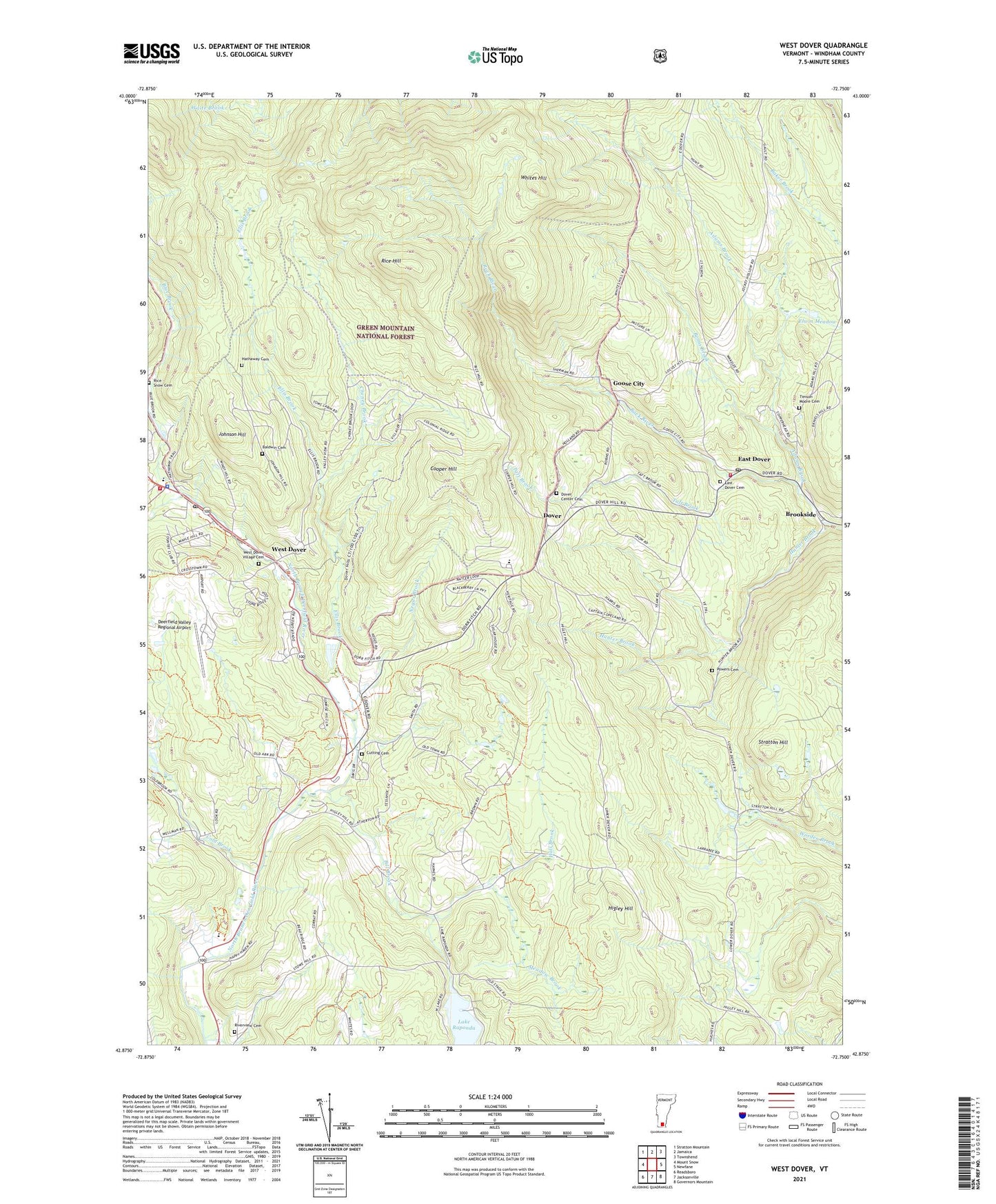
2021 topographic map quadrangle West Dover in the state of Vermont. Scale: 1:24000. Based on the newly updated USGS 7.5' US Topo map series, this map is in the following counties: Windham. The map contains contour data, water features, and other items you are used to seeing on USGS maps, but also has updated roads and other features. This is the next generation of topographic maps. Printed on high-quality waterproof paper with UV fade-resistant inks.
Quads adjacent to this one:
West: Mount Snow
Northwest: Stratton Mountain
North: Jamaica
Northeast: Townshend
East: Newfane
Southeast: Governors Mountain
South: Jacksonville
Southwest: Readsboro
Contains the following named places: Adams Brook, Baldwin Cemetery, Bemis Brook, Bill Brook, Blue Brook, Brookside, Cheney Brook, Cold Brook, Cooper Hill, Cutting Cemetery, Deerfield Valley Elementary School, Deerfield Valley Regional Airport, Dover, Dover Center Cemetery, Dover Common, Dover Elementary School, Dover Fire Department, Dover Free Library, Dover Post Office, Dover Town Hall, Dover Town Offices, East Dover, East Dover Baptist Church, East Dover Cemetery, East Dover Post Office, East Dover Volunteer Fire Department, Ellis Brook, Elwin Meadow, Goose City, Hall Brook, Hathaway Cemetery, Higley Hill, Hunter Brook, Johnson Hill, Lake Raponda, Meadow Brook, Mount Snow Golf Course, Negus Brook, New Riverview Cemetery, Powers Cemetery, Rice - Snow Cemetery, Rice Hill, Riverview Cemetery, Sitzmark Cross Country Ski Center, Sitzmark Golf Course, Stratton Hill, Taft Brook, Timson Moore Cemetery, Town of Dover, Town of Wilmington, West Dover, West Dover Congregational Church, West Dover Historic District, West Dover Police Department, West Dover Post Office, West Dover Village Cemetery, Whites Hill, ZIP Codes: 05341, 05356