MyTopo
Stratton Mountain Vermont US Topo Map
Couldn't load pickup availability
Also explore the Stratton Mountain Forest Service Topo of this same quad for updated USFS data
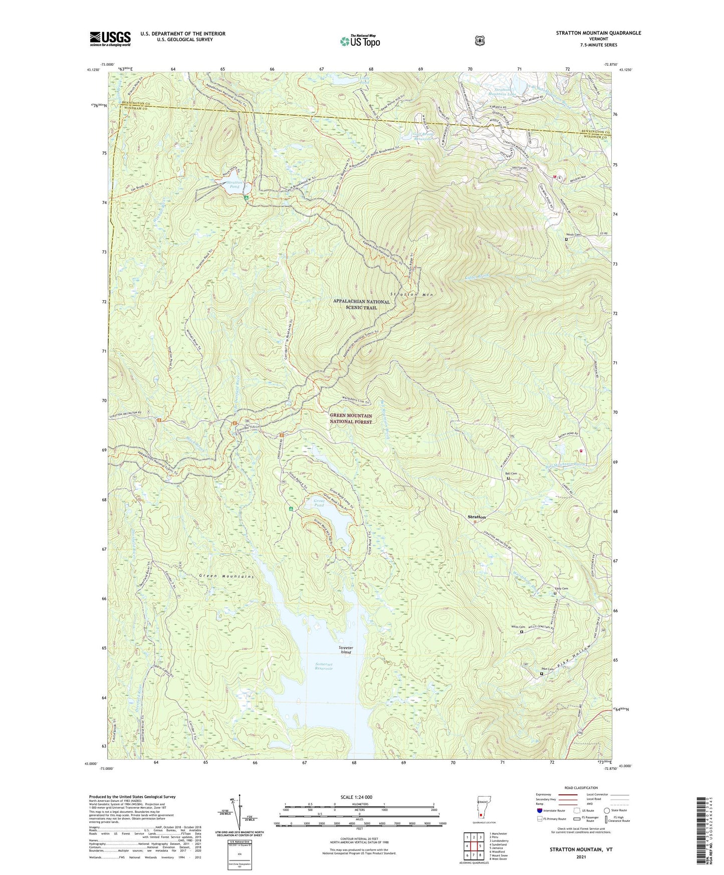
2024 topographic map quadrangle Stratton Mountain in the state of Vermont. Scale: 1:24000. Based on the newly updated USGS 7.5' US Topo map series, this map is in the following counties: Windham, Bennington. The map contains contour data, water features, and other items you are used to seeing on USGS maps, but also has updated roads and other features. This is the next generation of topographic maps. Printed on high-quality waterproof paper with UV fade-resistant inks.
Quads adjacent to this one:
West: Sunderland
Northwest: Manchester
North: Peru
Northeast: Londonderry
East: Jamaica
Southeast: West Dover
South: Mount Snow
Southwest: Woodford
This map covers the same area as the classic USGS quad with code o43072a8.
Contains the following named places: Ball Cemetery, Bigelow Shelter, Black Brook, Chapel of the Snows, Cooridor 7, Daniel Webster Historical Monument, Deerfield Trail, Eddy Cemetery, Grout Pond, Grout Pond Recreation Site, Gulf Brook Reservoir, Gulf Brook Reservoir Dam, Little Pond, North Cemetery, Pike Cemetery, School Number 5, Somerset Reservoir, Stratton, Stratton Lookout Tower, Stratton Mountain, Stratton Mountain Camp, Stratton Mountain Census Designated Place, Stratton Mountain Country Club, Stratton Mountain Lake, Stratton Mountain Lake Dam, Stratton Mountain School, Stratton Mountain Volunteer Fire Company, Stratton Mountain Volunteer Fire Company - Town Garage, Stratton Mountain Winter Sports Area, Stratton Pond, Stratton View Shelter, Streeter Island, Town of Stratton, Vondell Shelter, Webster Shelter, Willis Cemetery, Willis Ross Camp, ZIP Codes: 05155, 05360