MyTopo
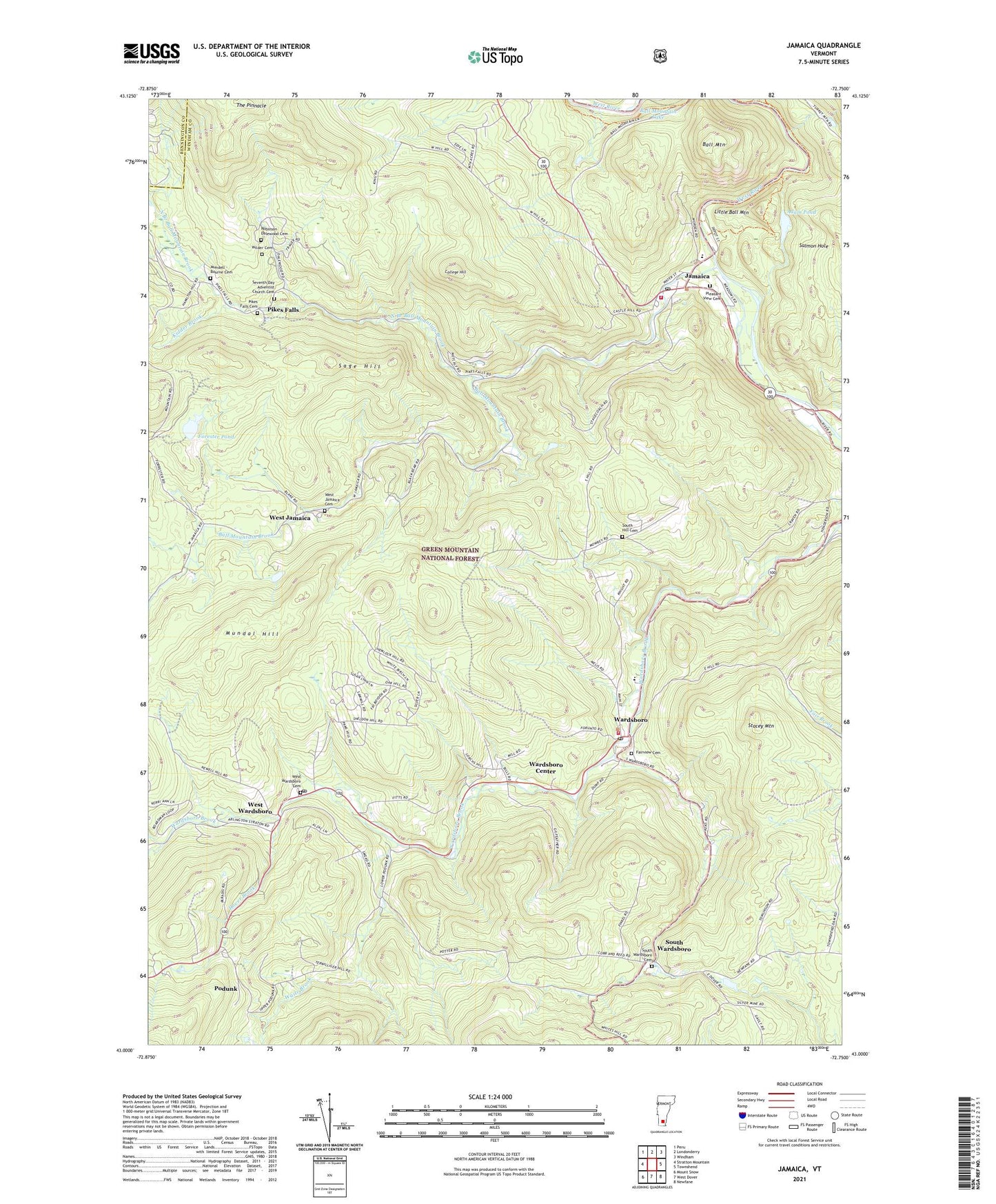
Jamaica Vermont US Topo Map
Couldn't load pickup availability
Also explore the Jamaica Forest Service Topo of this same quad for updated USFS data
2024 topographic map quadrangle Jamaica in the state of Vermont. Scale: 1:24000. Based on the newly updated USGS 7.5' US Topo map series, this map is in the following counties: Windham, Bennington. The map contains contour data, water features, and other items you are used to seeing on USGS maps, but also has updated roads and other features. This is the next generation of topographic maps. Printed on high-quality waterproof paper with UV fade-resistant inks.
Quads adjacent to this one:
West: Stratton Mountain
Northwest: Peru
North: Londonderry
Northeast: Windham
East: Townshend
Southeast: Newfane
South: West Dover
Southwest: Mount Snow
This map covers the same area as the classic USGS quad with code o43072a7.
Contains the following named places: Adam Pond, Ball Mountain, Ball Mountain Brook, Cobb Brook, College Hill, Dover Brook, Fairview Cemetery, Forester Pond, Jamaica, Jamaica Census Designated Place, Jamaica Fire Department, Jamaica Memorial Free Public Library, Jamaica Post Office, Jamaica State Park, Jamaica Village School, Kidder Brook, Little Ball Mountain, Mundal Hill, Mundell - Bourne Cemetery, North Branch Ball Mountain Brook, Overlook Trail, Pike Hollow, Pikes Falls, Pikes Falls Cemetery, Pleasant View Cemetery, Podunk, Railroad Bed Trail, Robinson Dalewood Cemetery, Sage Hill, Salmon Hole, Seventh Day Adventist Church Cemetery, South Hill Cemetery, South Wardsboro, South Wardsboro Cemetery, Stacey Mountain, The Pinnacle, Town of Jamaica, Town of Wardsboro, Waite Brook, Wardsboro, Wardsboro Census Designated Place, Wardsboro Center, Wardsboro Elementary School, Wardsboro Fire Department, Wardsboro Post Office, West Jamaica, West Jamaica Cemetery, West Wardsboro, West Wardsboro Cemetery, West Wardsboro Fire Station, West Wardsboro Post Office, Wilder Cemetery, Winhall Town Forest, ZIP Codes: 05343, 05355