MyTopo
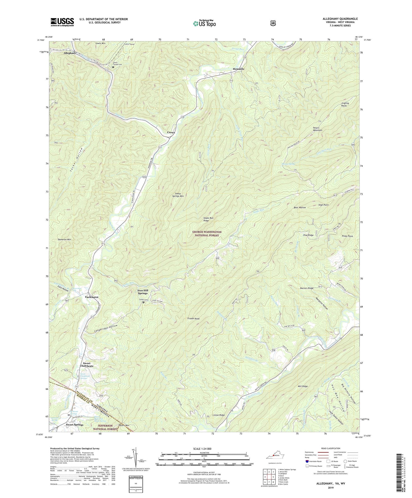
Alleghany Virginia US Topo Map
Couldn't load pickup availability
Also explore the Alleghany Forest Service Topo of this same quad for updated USFS data
2022 topographic map quadrangle Alleghany in the states of Virginia, West Virginia. Scale: 1:24000. Based on the newly updated USGS 7.5' US Topo map series, this map is in the following counties: Alleghany, Monroe, Craig. The map contains contour data, water features, and other items you are used to seeing on USGS maps, but also has updated roads and other features. This is the next generation of topographic maps. Printed on high-quality waterproof paper with UV fade-resistant inks.
Quads adjacent to this one:
West: Glace
Northwest: White Sulphur Springs
North: Jerrys Run
Northeast: Callaghan
East: Jordan Mines
Southeast: New Castle
South: Potts Creek
Contains the following named places: Alleghany, Andrew S Rowan Memorial Home, Bear Wallow, Beaverdam Falls, Bennett Branch, Big Hickory Hollow, Boiling Springs District, Carter Cemetery, Cove Creek, Crow Run, Crows, Dameron Church, Dameron Mountain, Doctors Ridge, Earlehurst, Fall Hollow Branch, Falls Hollow, Forrest Memorial Church, Fridleys Branch, Frozen Knob, Government Floyd Monument, Green Swamp Branch, Hamilton Branch, Hematite, High Point, Iron Hill Church, Iron Hill Springs, Jack Tucker Hollow, Jerrys Run, Jingling Rocks, Kyles Branch, Lewis Tunnel, Lewis Tunnel Cemetery, Linton Ridge, Little Crow Run, Longbridge Hollow, Lynnside Historic District, Lynnside Spring, Margaret Hollow, Mill Ridge, Miller Branch, Nelse Branch, Old Sweet Springs, Palestine Church, Paxton Branch, Pee Wee Hollow, Pine Ridge, Piney Point, Robinson Branch, Rowan Memorial Home Spring, Sampson Branch, Shawvers Run, Shiloh Church, Snake Run, Snake Run Ridge, Sugar Valley Church, Sweet Chalybeate, Sweet Chalybeate Springs, Sweet Spring Creek, Sweet Springs, Sweet Springs Creek, Sweet Springs Mountain, Sweet Springs Post Office, Sweet Springs Valley, Sweet Springs Valley Volunteer Rescue Squad, Thomas Spring, Toms Branch, Tucker Hollow, Tygers Creek, Wylies Run