MyTopo
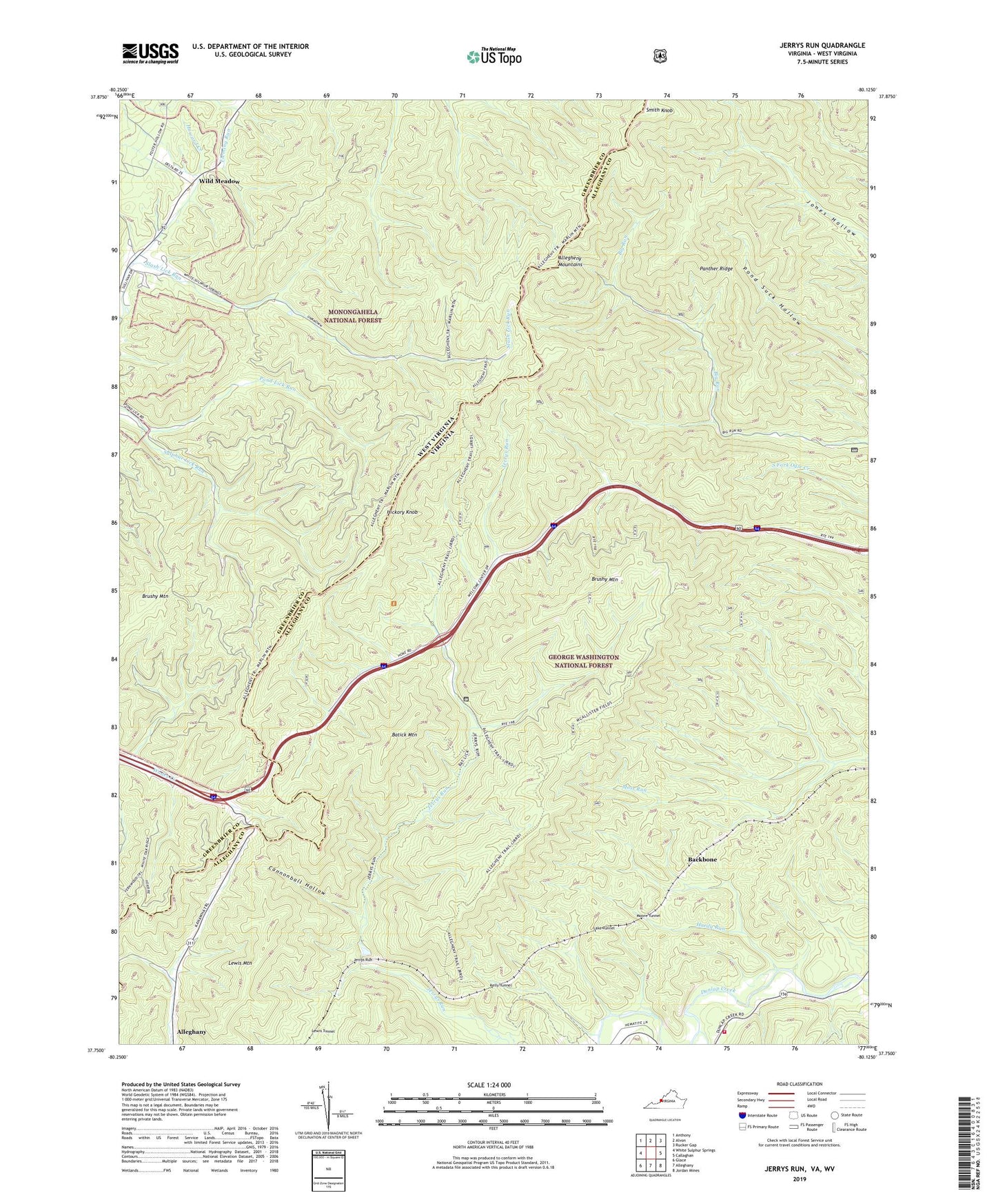
Jerrys Run Virginia US Topo Map
Couldn't load pickup availability
Also explore the Jerrys Run Forest Service Topo of this same quad for updated USFS data
2022 topographic map quadrangle Jerrys Run in the states of Virginia, West Virginia. Scale: 1:24000. Based on the newly updated USGS 7.5' US Topo map series, this map is in the following counties: Alleghany, Greenbrier. The map contains contour data, water features, and other items you are used to seeing on USGS maps, but also has updated roads and other features. This is the next generation of topographic maps. Printed on high-quality waterproof paper with UV fade-resistant inks.
Quads adjacent to this one:
West: White Sulphur Springs
Northwest: Anthony
North: Alvon
Northeast: Rucker Gap
East: Callaghan
Southeast: Jordan Mines
South: Alleghany
Southwest: Glace
Contains the following named places: Backbone, Batick Mountain, Brushy Mountain, Brushy Mountain Lookout, Brushy Mountain Trail, Cannonball Hollow, Dunlap School, Dunlap Volunteer Fire and Rescue Main Station, Hardy Run, Hickory Knob, Jerrys Run, Kelly Tunnel, Lake Tunnel, Lewis Mountain, Moore Tunnel, Panther Ridge, Pond Lick Run, Slash Lick Run, Smith Knob, Stack Mine, Thacker Draft, Wild Meadow, Wild Meadow Baptist Church, Wild Meadow Trail, WXMD-FM (White Sulphur Springs)