MyTopo
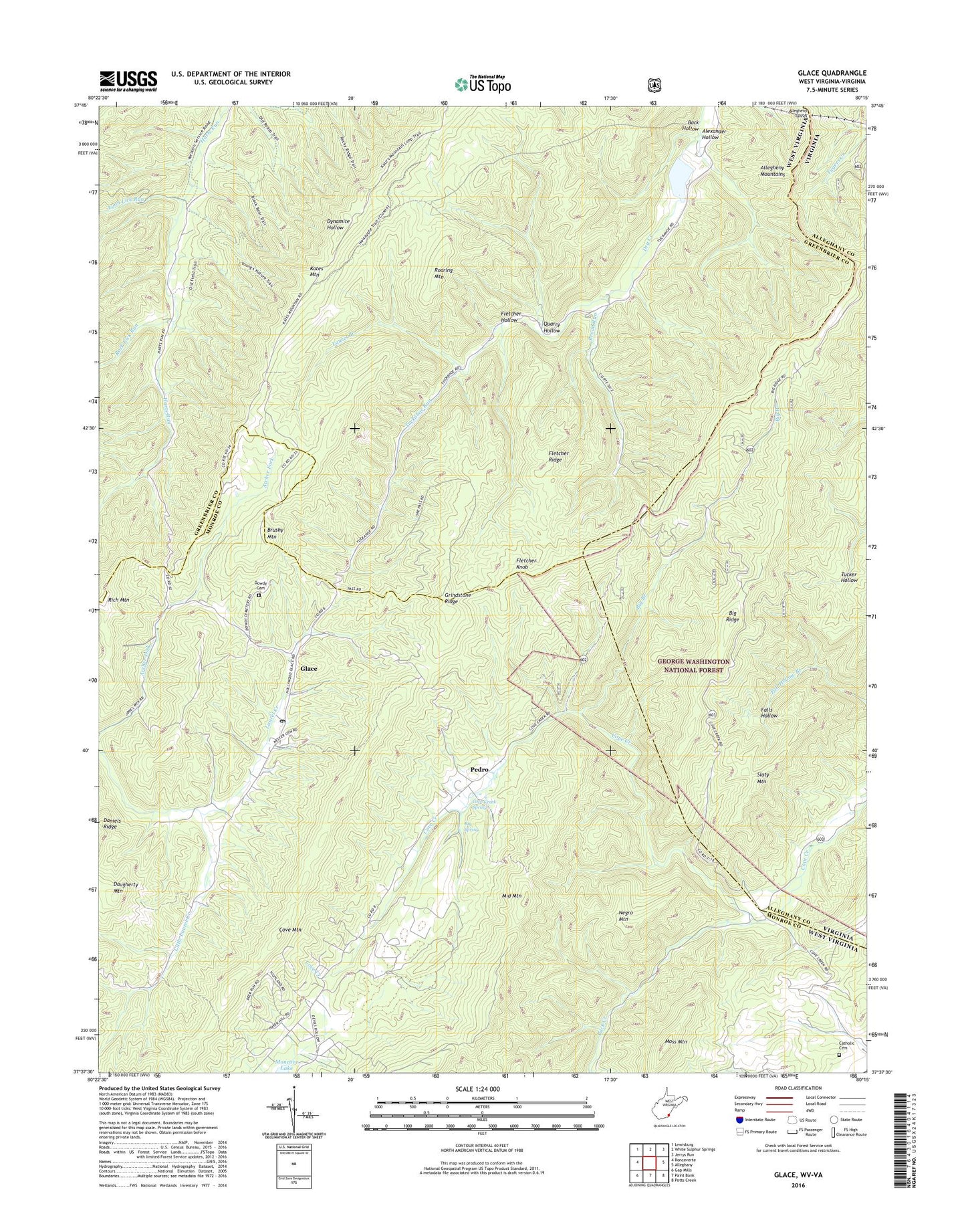
Glace West Virginia US Topo Map
Couldn't load pickup availability
Also explore the Glace Forest Service Topo of this same quad for updated USFS data
2023 topographic map quadrangle Glace in the states of West Virginia, Virginia. Scale: 1:24000. Based on the newly updated USGS 7.5' US Topo map series, this map is in the following counties: Greenbrier, Monroe, Alleghany. The map contains contour data, water features, and other items you are used to seeing on USGS maps, but also has updated roads and other features. This is the next generation of topographic maps. Printed on high-quality waterproof paper with UV fade-resistant inks.
Quads adjacent to this one:
West: Ronceverte
Northwest: Lewisburg
North: White Sulphur Springs
Northeast: Jerrys Run
East: Alleghany
Southeast: Potts Creek
Southwest: Gap Mills
This map covers the same area as the classic USGS quad with code o37080f3.
Contains the following named places: Alexander Hollow, Allegheny Tunnel, Antioch Church, Back Creek, Back Hollow, Big Branch, Big Branch School, Big Ridge, Big Ridge Lookout, Big Spring, Broad Run, Brushy Mountain, Brushy Mountain Lookout Tower, Catholic Cemetery, Cove Creek School, Cove Creek Spring, Cove Creek Wildlife Management Area, Daugherty Mountain, Dowdy Cemetery, Fletcher Hollow, Fletcher Knob, Fletcher Ridge, Glace, Glace Post Office, Glace School, Greenbrier State Forest, Grindstone Ridge, Harts Run Camping Area, Harts Run School, Hilton School, Hylton Church, Kates Mountain Overlook, Laurel Branch, Little Laurel Creek, Lynn Lick Run, Middle Mountain, Moss Mountain, Negro Mountain, Pedro, Pentecostal Church, Quarry Hollow, Rich Mountain, Roaring Mountain, Rock Lick Run, Slaty Mountain, Tuckahoe Run, Upper Tuckahoe School, Wylie Chapel, Youngs Nature Trail, Zion Church