MyTopo
Amonate Virginia US Topo Map
Couldn't load pickup availability
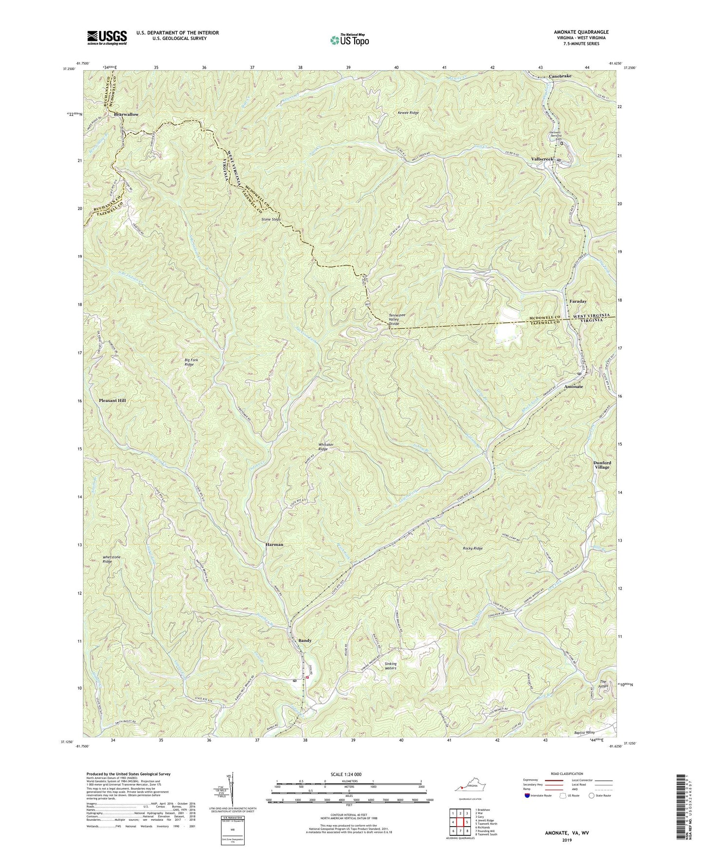
2019 topographic map quadrangle Amonate in the states of Virginia, West Virginia. Scale: 1:24000. Based on the newly updated USGS 7.5' US Topo map series, this map is in the following counties: Tazewell, McDowell, Buchanan. The map contains contour data, water features, and other items you are used to seeing on USGS maps, but also has updated roads and other features. This is the next generation of topographic maps. Printed on high-quality waterproof paper with UV fade-resistant inks.
Quads adjacent to this one:
West: Jewell Ridge
Northwest: Bradshaw
North: War
Northeast: Gary
East: Tazewell North
Southeast: Tazewell South
South: Pounding Mill
Southwest: Richlands
Contains the following named places: Amonate, Amonate Census Designated Place, Amonate Post Office, Bandy, Bandy Assembly of God Church, Bandy Post Office, Bandy Volunteer Fire Department, Bearwallow, Bearwallow School, Beech Fork, Beech Fork School, Bevers Store, Big Fork Ridge, Bills Branch, Camp Tazewell, Canebrake, Coal Branch, Dry Fork Slurry Impoundment Dam, Dunford Village, Faraday, Gap Store, Greasy Creek, Harman, Hartwell - Berwind Cemetery, Hix, Indian Creek School, Jackson Fork, Johny Branch, Kewee Ridge, Lamberts Store, Lewis Fork, Lick Branch, Lick Branch School, Long Branch, North Branch Indian Creek, Panther Branch, Pleasant Hill, Ray Fork, Reedy School, Rivermont School, Rocky Ridge, Salem Church, Sinking Waters, Sinking Waters School, South Branch Indian Creek, Stone Steps, The Jumps, Thirtyone Camp, Thirtyone Hollow, Vall Creek, Vallscreek, Vallscreek Post Office, Vallscreek Slurry Pond, Whetstone Ridge, Whitaker Ridge, William Branch, ZIP Codes: 24601, 24602, 24815