MyTopo
Pounding Mill Virginia US Topo Map
Couldn't load pickup availability
Also explore the Pounding Mill Forest Service Topo of this same quad for updated USFS data
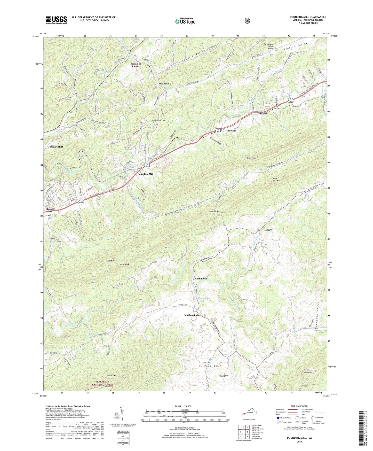
2022 topographic map quadrangle Pounding Mill in the state of Virginia. Scale: 1:24000. Based on the newly updated USGS 7.5' US Topo map series, this map is in the following counties: Tazewell. The map contains contour data, water features, and other items you are used to seeing on USGS maps, but also has updated roads and other features. This is the next generation of topographic maps. Printed on high-quality waterproof paper with UV fade-resistant inks.
Quads adjacent to this one:
West: Richlands
Northwest: Jewell Ridge
North: Amonate
Northeast: Tazewell North
East: Tazewell South
Southeast: Chatham Hill
South: Broadford
Southwest: Saltville
This map covers the same area as the classic USGS quad with code o37081a6.
Contains the following named places: Bald Rock, Bandys Chapel, Baptist Valley, Baptist Valley School, Busthead, Cave Section Branch, Cedar Hills Raceway, Cliffield, Cliffield School, Cove School, Cove Volunteer Fire Department, Deskin Creek, Earl Branch, Gillespie, Green Place, Greens Chapel, Joe Whites, Laurel Fork, Laurel Gap, Liberty, Liberty Creek, Liberty School, Little River School, Lost Mill, Lowe Branch, Maiden Spring, Maiden Spring Creek, Maiden Spring Fort, McGuire Valley, Mouth of Laurel, Paint Lick Mountain, Paint Rock, Pounding Mill, Pounding Mill Branch, Pounding Mill Census Designated Place, Pounding Mill Post Office, Pounding Mill School, Raven Nest Branch, Raven Nest School, Rockhouse, Short Mountain, Smith Ridge, Thompson Valley, Van Dyke, Ward Cove, West End Church, Western District, Whites Store, ZIP Code: 24637