MyTopo
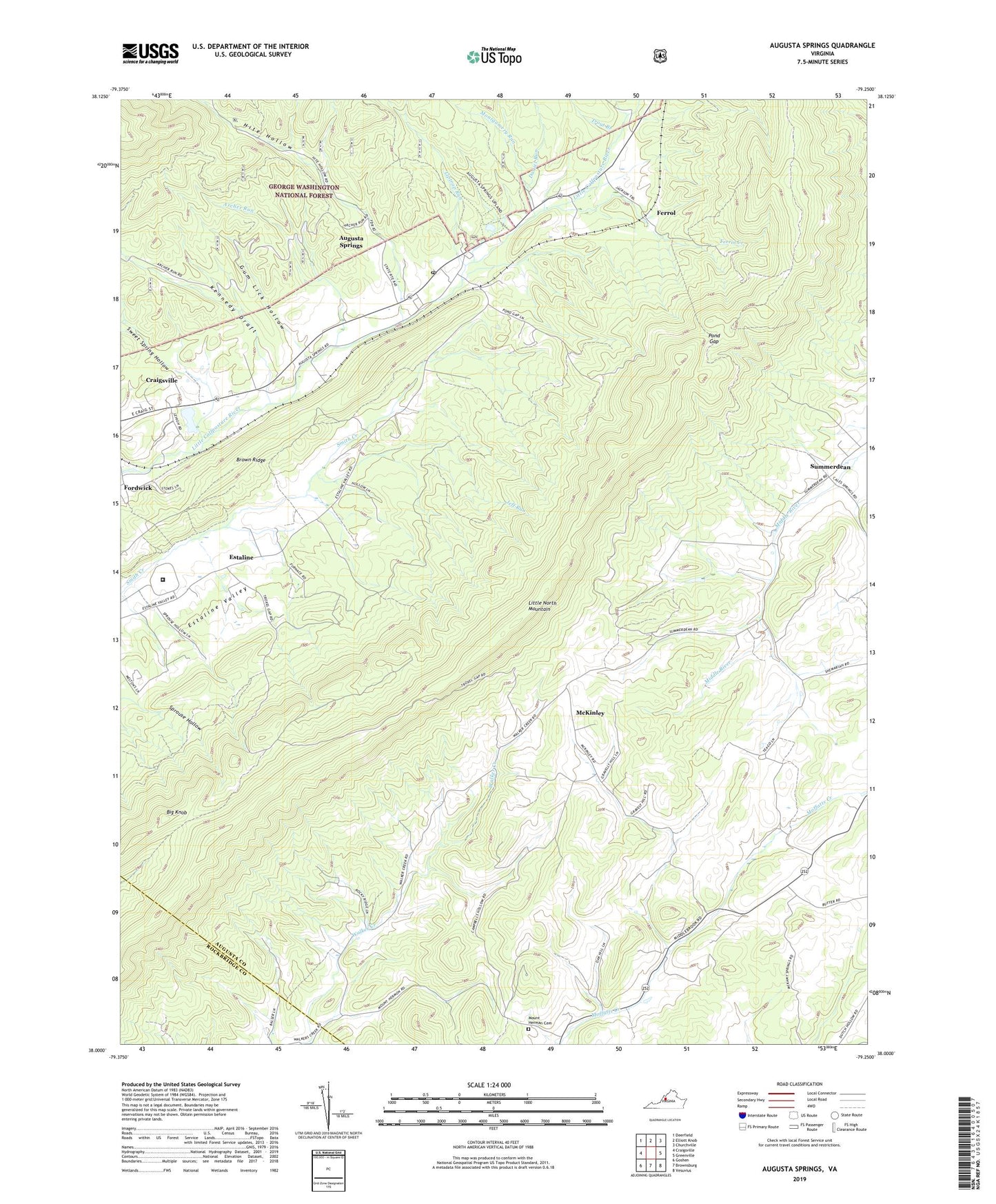
Augusta Springs Virginia US Topo Map
Couldn't load pickup availability
Also explore the Augusta Springs Forest Service Topo of this same quad for updated USFS data
2022 topographic map quadrangle Augusta Springs in the state of Virginia. Scale: 1:24000. Based on the newly updated USGS 7.5' US Topo map series, this map is in the following counties: Augusta, Rockbridge. The map contains contour data, water features, and other items you are used to seeing on USGS maps, but also has updated roads and other features. This is the next generation of topographic maps. Printed on high-quality waterproof paper with UV fade-resistant inks.
Quads adjacent to this one:
West: Craigsville
Northwest: Deerfield
North: Elliott Knob
Northeast: Churchville
East: Greenville
Southeast: Vesuvius
South: Brownsburg
Southwest: Goshen
This map covers the same area as the classic USGS quad with code o38079a3.
Contains the following named places: Archer Run, Augusta Correctional Center, Augusta Springs, Augusta Springs Census Designated Place, Augusta Springs Post Office, Augusta Springs YCC Camp, Big Knob, Brown Ridge, Craigsville Reservoir, Daniel Run, Estaline, Estaline Furnace, Ferrol, Ferrol Creek, Fordwick, Gum Lick Hollow, Hite Hollow, Jeff Run, Kennedy Draft, Liptrap Run, Little North Mountain, Little North Mountain Wildlife Management Ar, McKinley, Miller Memorial Church, Moffett Creek Post Office, Montgomery Run, Mount Hermon Lutheran Church Cemetery, Newport, Pond Gap, Shemariah Church, Sprouse Hollow, Summerdean, Sweet Spring Hollow, Trout Branch, ZIP Codes: 24411, 24430, 24459