MyTopo
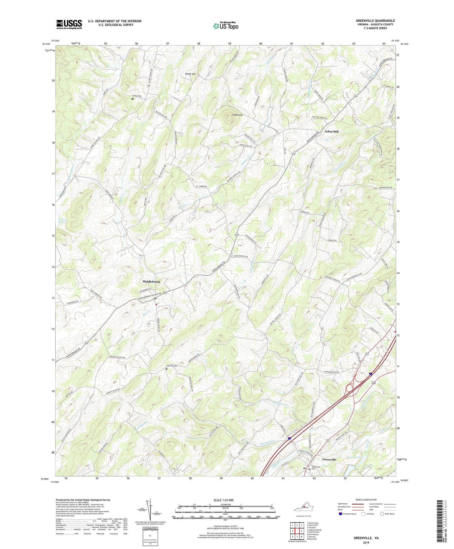
Greenville Virginia US Topo Map
Couldn't load pickup availability
Also explore the Greenville Forest Service Topo of this same quad for updated USFS data
2022 topographic map quadrangle Greenville in the state of Virginia. Scale: 1:24000. Based on the newly updated USGS 7.5' US Topo map series, this map is in the following counties: Augusta. The map contains contour data, water features, and other items you are used to seeing on USGS maps, but also has updated roads and other features. This is the next generation of topographic maps. Printed on high-quality waterproof paper with UV fade-resistant inks.
Quads adjacent to this one:
West: Augusta Springs
Northwest: Elliott Knob
North: Churchville
Northeast: Staunton
East: Stuarts Draft
Southeast: Big Levels
South: Vesuvius
Southwest: Brownsburg
This map covers the same area as the classic USGS quad with code o38079a2.
Contains the following named places: Allen Mine, Arbor Hill, Arbor Hill Church, Bethel Church, Bridgewater College, Broadhead Creek, Cockran Spring, Glebe Cemetery, Greenville, Greenville Baptist Church, Greenville Census Designated Place, Greenville Post Office, Greenville United Methodist Church, Greenville United Methodist Church Cemetery, Harris Mine, Holy Trinity Church, Lower Wallace Dam, Middlebrook, Middlebrook Census Designated Place, Middlebrook High School, Middlebrook Historic District, Middlebrook Post Office, Middlebrook Volunteer Fire Department Company 3, Mount Airey Church, Mount Tabor Church, Oak Hill Cemetery, Poor Creek, Riverheads District, Riverheads Elementary School, Riverheads High School, Riverheads Volunteer Fire Department Company 25, Roaring Run, Saint Johns Church, Sinking Springs Farm, Stony Hill, Sugarloaf, Upper Wallace Dam, Walace Lake, Wrenn's Turkey Farm