MyTopo
Chase City Virginia US Topo Map
Couldn't load pickup availability
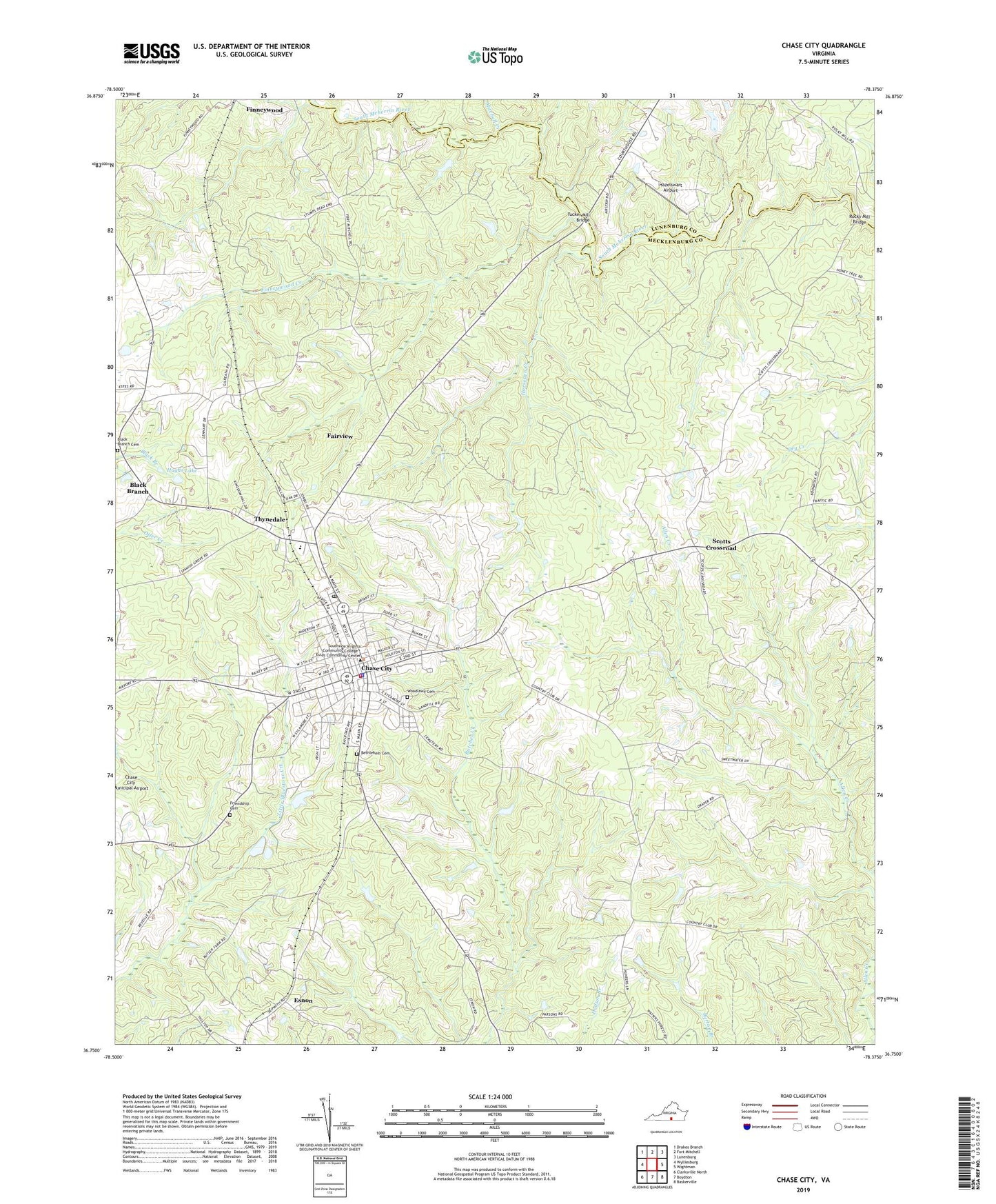
2022 topographic map quadrangle Chase City in the state of Virginia. Scale: 1:24000. Based on the newly updated USGS 7.5' US Topo map series, this map is in the following counties: Mecklenburg, Lunenburg. The map contains contour data, water features, and other items you are used to seeing on USGS maps, but also has updated roads and other features. This is the next generation of topographic maps. Printed on high-quality waterproof paper with UV fade-resistant inks.
Quads adjacent to this one:
West: Wylliesburg
Northwest: Drakes Branch
North: Fort Mitchell
Northeast: Lunenburg
East: Wightman
Southeast: Baskerville
South: Boydton
Southwest: Clarksville North
This map covers the same area as the classic USGS quad with code o36078g4.
Contains the following named places: Berean Church, Bethlehem Baptist Church, Bethlehem Cemetery, Black Branch, Black Branch Cemetery, Black Branch Church, Butler Memorial Library, Butlers Dam, Bynum Store, Centenary United Methodist Church, Chase City, Chase City Elementary School, Chase City Graded School, Chase City High School, Chase City Post Office, Chase City Presbyterian Church, Chase City Rescue Squad, Chase City Volunteer Fire Department Company 3, Chase Police Department, Concord Church, Concord School, Esnon, Fairview, Fairview Census Designated Place, Finneywood Church, Finneywood Creek, Fire Station Number 1, First Baptist Church of Chase City, First Christian Church, Friendship Cemetery, Friendship Church, Hazelswart Airport, Horsepen Creek, Hughs Lake, Lee School, Mecklenburg Country Club, Mitchell Creek, Piney Grove School, Rocky Mill Bridge, Saint Johns Episcopal Church, Scotts Crossroad, Silone Baptist Church, South Central Fairgrounds, Thyne School, Thynedale Census Designated Place, Town of Chase City, Tucker Mill Bridge, Walkers Store, WMEK-AM (Chase City), Woodlawn Cemetery, ZIP Code: 23924