MyTopo
Tungsten North Carolina US Topo Map
Couldn't load pickup availability
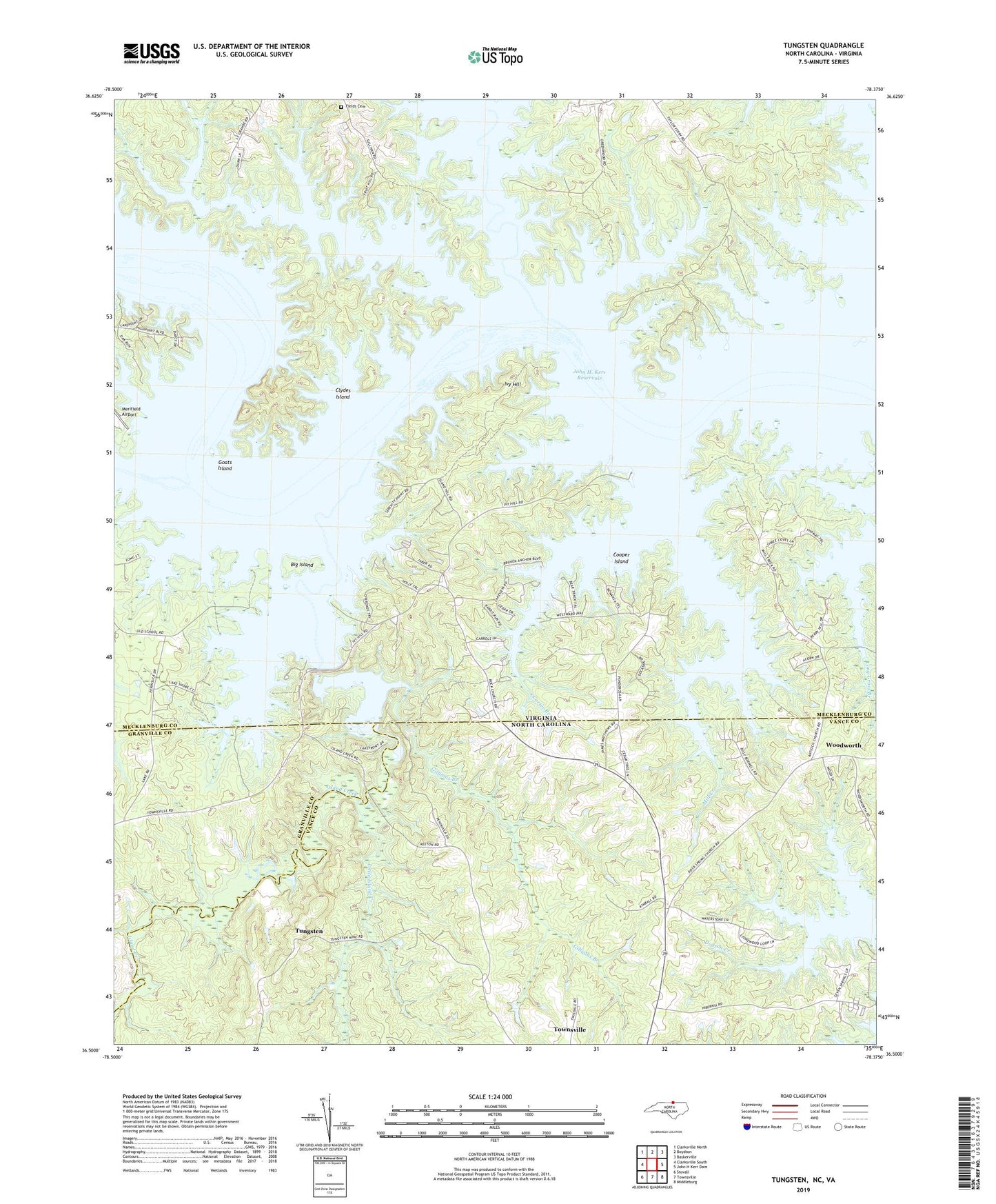
2022 topographic map quadrangle Tungsten in the states of Virginia, North Carolina. Scale: 1:24000. Based on the newly updated USGS 7.5' US Topo map series, this map is in the following counties: Vance, Mecklenburg, Granville. The map contains contour data, water features, and other items you are used to seeing on USGS maps, but also has updated roads and other features. This is the next generation of topographic maps. Printed on high-quality waterproof paper with UV fade-resistant inks.
Quads adjacent to this one:
West: Clarksville South
Northwest: Clarksville North
North: Boydton
Northeast: Baskerville
East: John H Kerr Dam
Southeast: Middleburg
South: Townsville
Southwest: Stovall
Contains the following named places: Antioch Church, Berryhill Plantation, Big Island, Butcher Creek, Camp Jean Short, Carter Branch, Cedar Grove Church, Cedar Grove School, Cedar Grove Wildlife Management Area, Clydes Island, Cooper Island, District 1, Eagle Point Boat Ramp, Eagle Point Falls, Eagle Point Wildlife Management Area, Fields Cemetery, Fields Church, Fields Ferry, Fields Island, Fields School, Gilliams Branch, Goats Island, Grassy Creek, Hundred Islands, Island Creek, Island Creek Dam, Island Creek Public Use Area, Island Creek Reservoir, Island Hill Church, Island Hill School, Ivy Hill, Ivy Hill Public Use Area, Little Island Creek, Mill Creek, Oakleaf Wildlife Management Area, Panhandle Creek, Peckerwood Branch, Ponderosa, Richardson, Rock Spring Church, Rocky Branch, South Bend, Tabernacle Church, Terrys Island, Township of Townsville, Tungsten, Whetstone Branch, Woodworth, Woodworth Church