MyTopo
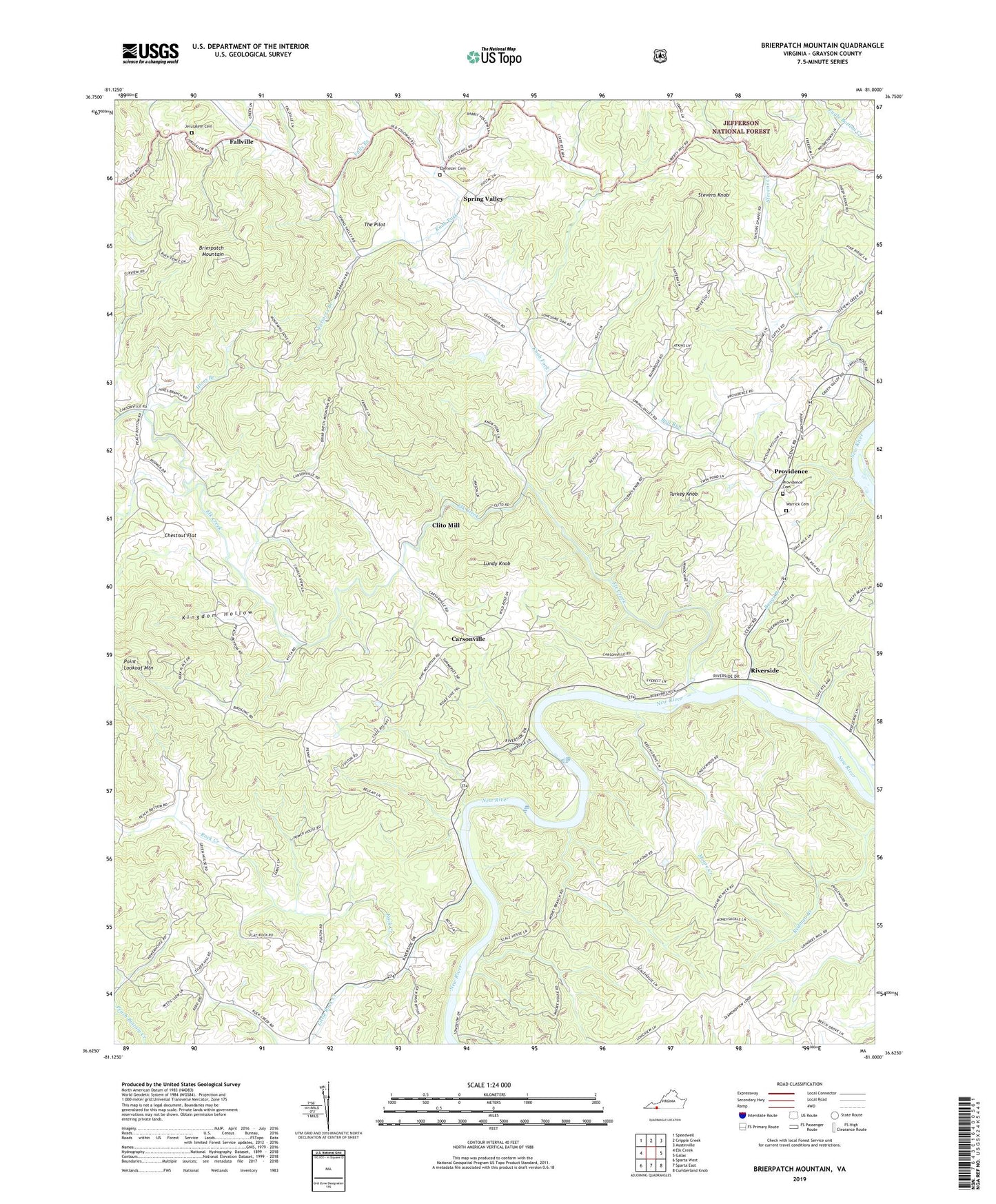
Brierpatch Mountain Virginia US Topo Map
Couldn't load pickup availability
Also explore the Brierpatch Mountain Forest Service Topo of this same quad for updated USFS data
2022 topographic map quadrangle Brierpatch Mountain in the state of Virginia. Scale: 1:24000. Based on the newly updated USGS 7.5' US Topo map series, this map is in the following counties: Grayson. The map contains contour data, water features, and other items you are used to seeing on USGS maps, but also has updated roads and other features. This is the next generation of topographic maps. Printed on high-quality waterproof paper with UV fade-resistant inks.
Quads adjacent to this one:
West: Elk Creek
Northwest: Speedwell
North: Cripple Creek
Northeast: Austinville
East: Galax
Southeast: Cumberland Knob
South: Sparta East
Southwest: Sparta West
This map covers the same area as the classic USGS quad with code o36081f1.
Contains the following named places: Atkins Church, Baxter Ferry, Boags Branch, Brierpatch Mountain, Bull Run, Carsonville, Catrons Mill, Cattrons Mill, Center View Church, Chestnut Flat, Clito Mill, Dell School, Ebenezer Cemetery, Ebenezer Church, Elk Creek, Eureka School, Falls Branch, Fallville, Farmers Branch, Flat Rock Church, Flat Rock School, Hacklers Store, Hines Branch, Hines Branch Church, Hole School, Jerusalem Cemetery, Jerusalem Church, Johns Creek School, Kingdom Hollow, Knob Fork, Laurel Spring School, Liberty Church, Little Rock Creek, Longview Church, Lundy Knob, Moore Creek, Moore Ferry, Moore School, Mount Carmel Church, Mount Carmel School, Mount Olive Church, Mountain View School, Pilgrims Rest Church, Pine Mountain Church, Pleasant Hill Church, Providence, Providence Cemetery, Providence Church, Providence District, Providence Elementary School, Quaker Church, Rectors Store, Redman Church, River Hill Church, Riverside, Rock Creek, Rock Creek Church, Spring Valley, Springfield Church, Stevens Knob, Summerfield Church, Summerfield School, Taylor Chapel, The Pilot, Turkey Knob, Warrick Cemetery, ZIP Code: 24330