MyTopo
Broadford Virginia US Topo Map
Couldn't load pickup availability
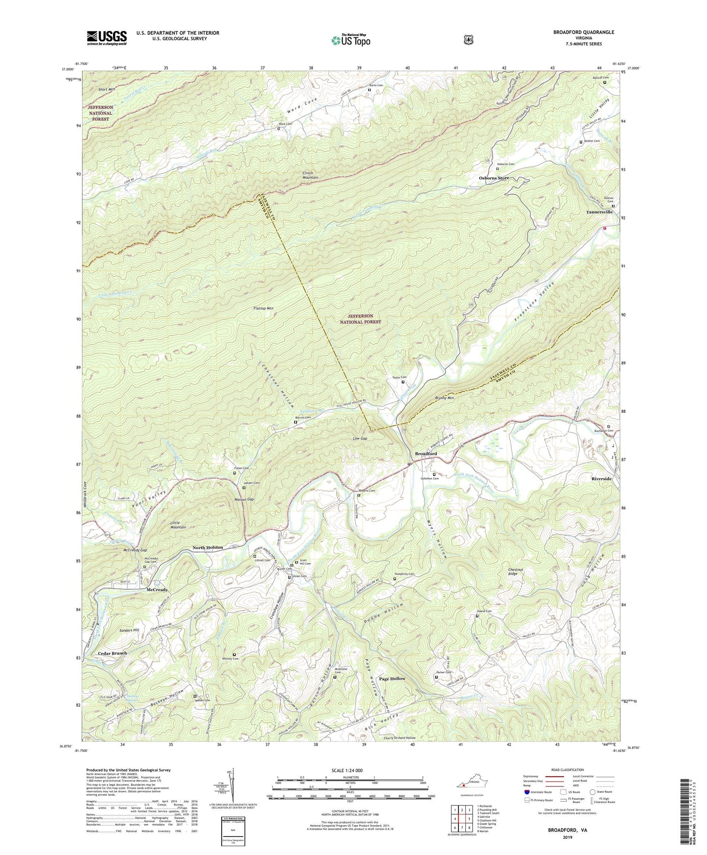
2019 topographic map quadrangle Broadford in the state of Virginia. Scale: 1:24000. Based on the newly updated USGS 7.5' US Topo map series, this map is in the following counties: Smyth, Tazewell. The map contains contour data, water features, and other items you are used to seeing on USGS maps, but also has updated roads and other features. This is the next generation of topographic maps. Printed on high-quality waterproof paper with UV fade-resistant inks.
Quads adjacent to this one:
West: Saltville
Northwest: Richlands
North: Pounding Mill
Northeast: Tazewell South
East: Chatham Hill
Southeast: Marion
South: Chilhowie
Southwest: Glade Spring
Contains the following named places: Airaudi Run, Barns Cemetery, Beaver Creek, Blevins Cemetery, Blue Grass Trail, Broadford, Broadford Post Office, Brown Cemetery, Buchanan Cemetery, Buckeye Hollow, Buckeye Hollow School, Buckeye Spring, Carter School, Cedar Branch, Cherry Orchard Hollow, Chestnut Hollow, Chestnut Ridge, Comers Branch, Cranshaw Hollow, Doane Cemetery, Doane Hollow, Elkhorn Branch, Freestone Valley, Fullen Cemetery, Gollehon Cemetery, Harper Cemetery, Holmes Cemetery, Humphrey Cemetery, Keister Cemetery, Laurel Creek, Little Tumbling Creek, Little Valley, Little Valley Church, Littrell Cemetery, Locust Cove Creek, Low Gap, Macedonia Church, McAllister Cemetery, McCready, McCready Gap, McCready United Methodist Church, McCreadys Gap Cemetery, Mount Pleasant Church, Mountain View Church, Myers Hollow, North Holston, Northwood Middle School, Oak Grove Church, Old Broad Ford, Osborne Cemetery, Osborne Farms, Osborns Store, Page Hollow, Parker Cemetery, Possum Hollow, Ratcliff Cemetery, Rich Valley Elementary School, Riverside, Roberts Cemetery, Saltville District, Sanders Hill, Scott Hill Cemetery, Stillhouse Branch, Tannersville, Tannersville Rescue Squad, Tannersville School, Tannersville Volunteer Fire Department, Taylor Cemetery, Turkey Run Creek, Union Cemetery, Union Church, Walker Cemetery, Ward Cemetery, Watson Gap, Watson Gap Branch, Watson Gap Church, Whitely Cemetery, Whiterock Cove, Worthy Mine, ZIP Codes: 24316, 24370