MyTopo
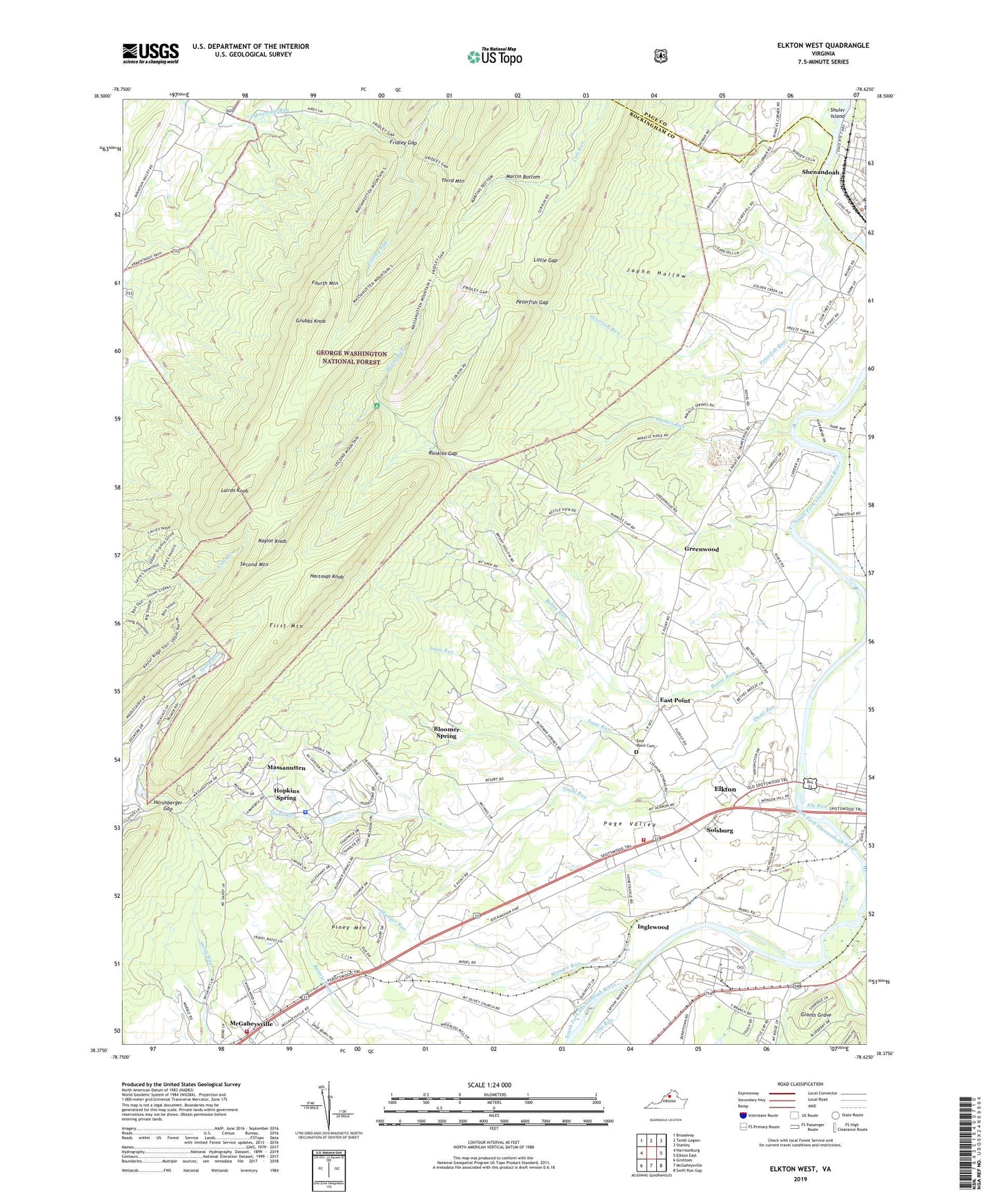
Elkton West Virginia US Topo Map
Couldn't load pickup availability
Also explore the Elkton West Forest Service Topo of this same quad for updated USFS data
2022 topographic map quadrangle Elkton West in the state of Virginia. Scale: 1:24000. Based on the newly updated USGS 7.5' US Topo map series, this map is in the following counties: Rockingham, Page. The map contains contour data, water features, and other items you are used to seeing on USGS maps, but also has updated roads and other features. This is the next generation of topographic maps. Printed on high-quality waterproof paper with UV fade-resistant inks.
Quads adjacent to this one:
West: Harrisonburg
Northwest: Broadway
North: Tenth Legion
Northeast: Stanley
East: Elkton East
Southeast: Swift Run Gap
South: McGaheysville
Southwest: Grottoes
This map covers the same area as the classic USGS quad with code o38078d6.
Contains the following named places: Bethel Church, Bloomer Spring, Boone Run, Boone Run Shelter, Brethren of the Woods Camp, East Point, East Point Cemetery, Elk Run, Elkton Airport, Elkton Volunteer Fire Company, First Mountain, Fourth Mountain, Fridley Gap, Fridley Run, Gap Run, Giants Grave, Golden Valley Dairy, Greenwood, Grubbs Knob, Harshberger Gap, Hartman Knob, Hawksbill Creek, Hopkins Spring, Humes Run, Inglewood, Jayho Hollow, Kaylor Knob, Lairds Knob, Little Gap, Martin Bottom, Massanutten, Massanutten Census Designated Place, Massanutten Police Department, McGaheysville Volunteer Fire Department, Monger Run, Mount Olivet Church, Mount Sinai Church, Mount Zion Church, New Hope Baptist Church, Peterfish Gap, Peterfish Run, Piney Mountain, Quail Run, Runkles Gap, Saint Peters Church, Second Mountain, Shenandoah, Shenandoah Dam, Shenandoah Reservoir, Shuler Island, Snag Run, Solsburg, ZIP Code: 22840