MyTopo
Brumley Virginia US Topo Map
Couldn't load pickup availability
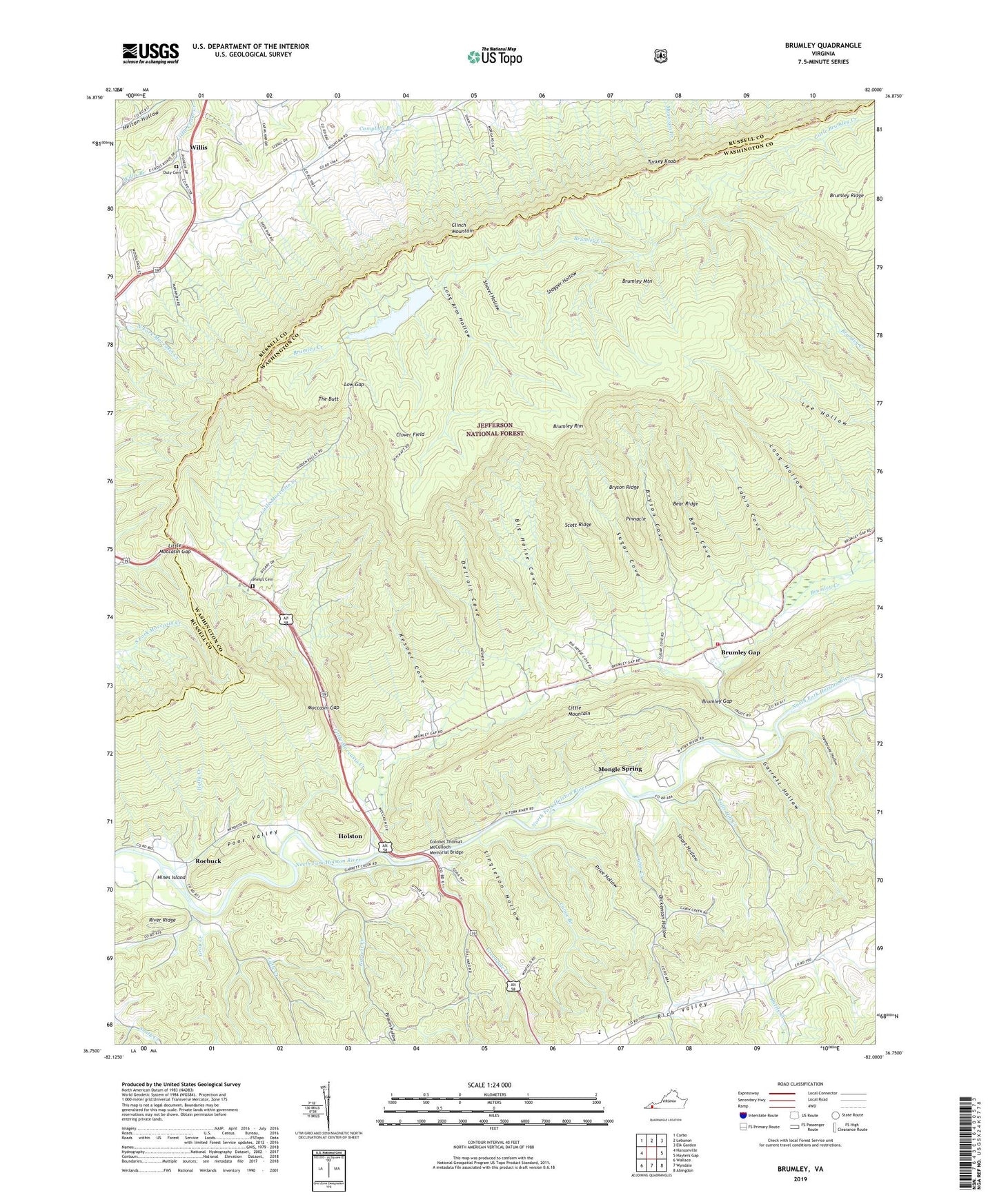
2019 topographic map quadrangle Brumley in the state of Virginia. Scale: 1:24000. Based on the newly updated USGS 7.5' US Topo map series, this map is in the following counties: Washington, Russell. The map contains contour data, water features, and other items you are used to seeing on USGS maps, but also has updated roads and other features. This is the next generation of topographic maps. Printed on high-quality waterproof paper with UV fade-resistant inks.
Quads adjacent to this one:
West: Hansonville
Northwest: Carbo
North: Lebanon
Northeast: Elk Garden
East: Hayters Gap
Southeast: Abingdon
South: Wyndale
Southwest: Wallace
Contains the following named places: Bear Cove, Bear Ridge, Big Horse Cove, Brumley Creek, Brumley Gap, Brumley Gap Volunteer Fire Department, Brumley Mountain, Brumley Rim, Bryson Cove, Bryson Ridge, Cabin Cove, Cabin Creek, Canebrake Hollow, Canoe Branch, Chestnut Grove Church, Clover Field, Colonel Thomas McCulloch Memorial Bridge, Detroit Cove, Dickenson Hollow, Duty Cemetery, Falls Hill Church, Falls Hill Creek, Garrett Creek, Garrett Hollow, Gray Creek, Green Valley Church, Greendale Creek, Greendale Elementary School, Hayes School, Hidden Valley Lake, Hidden Valley Lake Dam, Hines Island, Holly Creek, Holston, Jessie School, Kesner Cove, Little Brumley Creek, Little Creek, Little Moccasin Creek, Little Moccasin Gap, Long Arm Hollow, Long Hollow, Low Gap, Moccasin Gap, Moccasin Gap School, Mongle Spring, Phelps Cemetery, Pinnacle, Possum Hollow, Price Hollow, Rattle Creek, Riverside Church, Roebuck, Scott Ford, Scott Ridge, Short Hollow, Shovel Hollow, Singleton Hollow, Stagger Hollow, Sugar Cove, The Butt, Turkey Knob, Union Church, Willis, Willis Branch, Willis School, Willis United Methodist Church, WLFG-TV (Grundy), ZIP Codes: 24210, 24266