MyTopo
Hayters Gap Virginia US Topo Map
Couldn't load pickup availability
Also explore the Hayters Gap Forest Service Topo of this same quad for updated USFS data
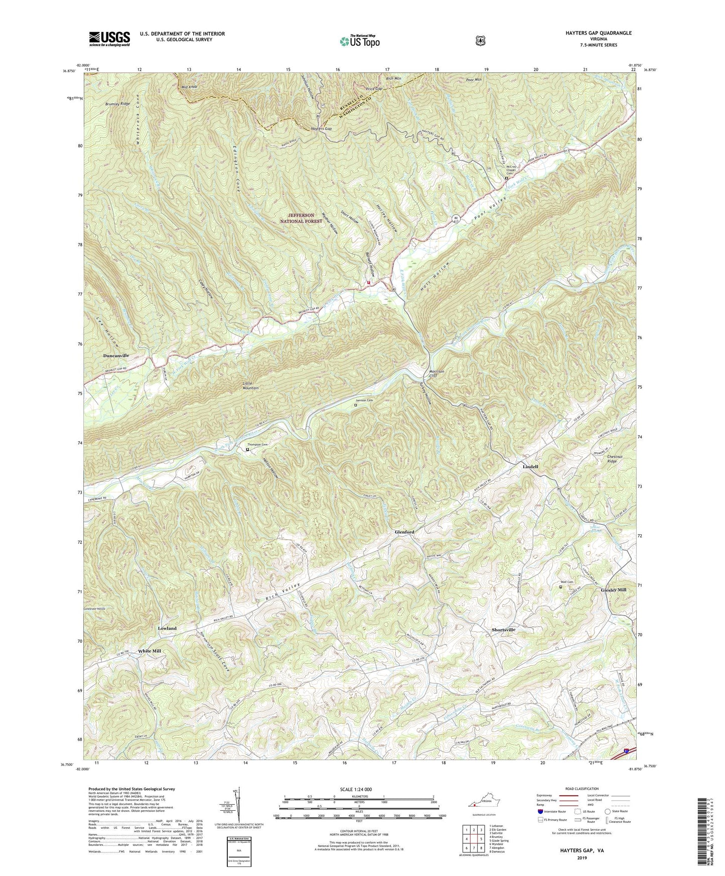
2022 topographic map quadrangle Hayters Gap in the state of Virginia. Scale: 1:24000. Based on the newly updated USGS 7.5' US Topo map series, this map is in the following counties: Washington, Russell. The map contains contour data, water features, and other items you are used to seeing on USGS maps, but also has updated roads and other features. This is the next generation of topographic maps. Printed on high-quality waterproof paper with UV fade-resistant inks.
Quads adjacent to this one:
West: Brumley
Northwest: Lebanon
North: Elk Garden
Northeast: Saltville
East: Glade Spring
Southeast: Damascus
South: Abingdon
Southwest: Wyndale
This map covers the same area as the classic USGS quad with code o36081g8.
Contains the following named places: Barnett Hollow, Beetree Branch, Bethany Church, Bethany Creek, Braudy Branch, Brumley Ridge, Casey Branch, Casey Hollow, Clinch Mountain Volunteer Fire Department, Cooley Camp Branch, Count Creek, Dry Branch, Duncan School, Duncanville, East Fork Wolf Creek, Edington Branch, Edington Cove, Finley Creek, Fullen Branch, Giesley Mill, Glenford, Glenford Church, Gobble Branch, Greenway Branch, Hayters Gap, Hayters Gap School, Helton Hollow, Henderson School, Holt Hollow, Hurley Hollow, Jamison Cemetery, Jefferson District, Lee Creek, Lee Hollow, Lindell, Little Mountain, Logan Creek, Lowland, Lowland School, Maiden Creek, Maiden Falls School, McCray Chapel, McCray Chapel Cemetery, Middle Knob, Midway, Mitchell Branch, Morrison Cliff, Mountain View Church, Mudlick Branch, Oakdale School, Poston Branch, Price Creek, Price Gap, Rich Mountain Creek, River Bend School, River Bridge, Scott Cove, Short Hollow, Shortsville, Smyth Branch, Taylor Branch, Thompson Cemetery, Toole Creek, Turkey Hollow, Valley Church, Valley Rescue Squad, Van Hook Branch, Walker Place, Wesley Chapel, Wesley Chapel School, West Fork Wolf Creek, White Mill, Whiterock Branch, Whiterock Cove, Williams Branch, Wolf Cemetery, Wolf Creek, Wydner Hollow, Yellow Spring Branch, Yellow Spring United Methodist Church, Yellow Springs