MyTopo
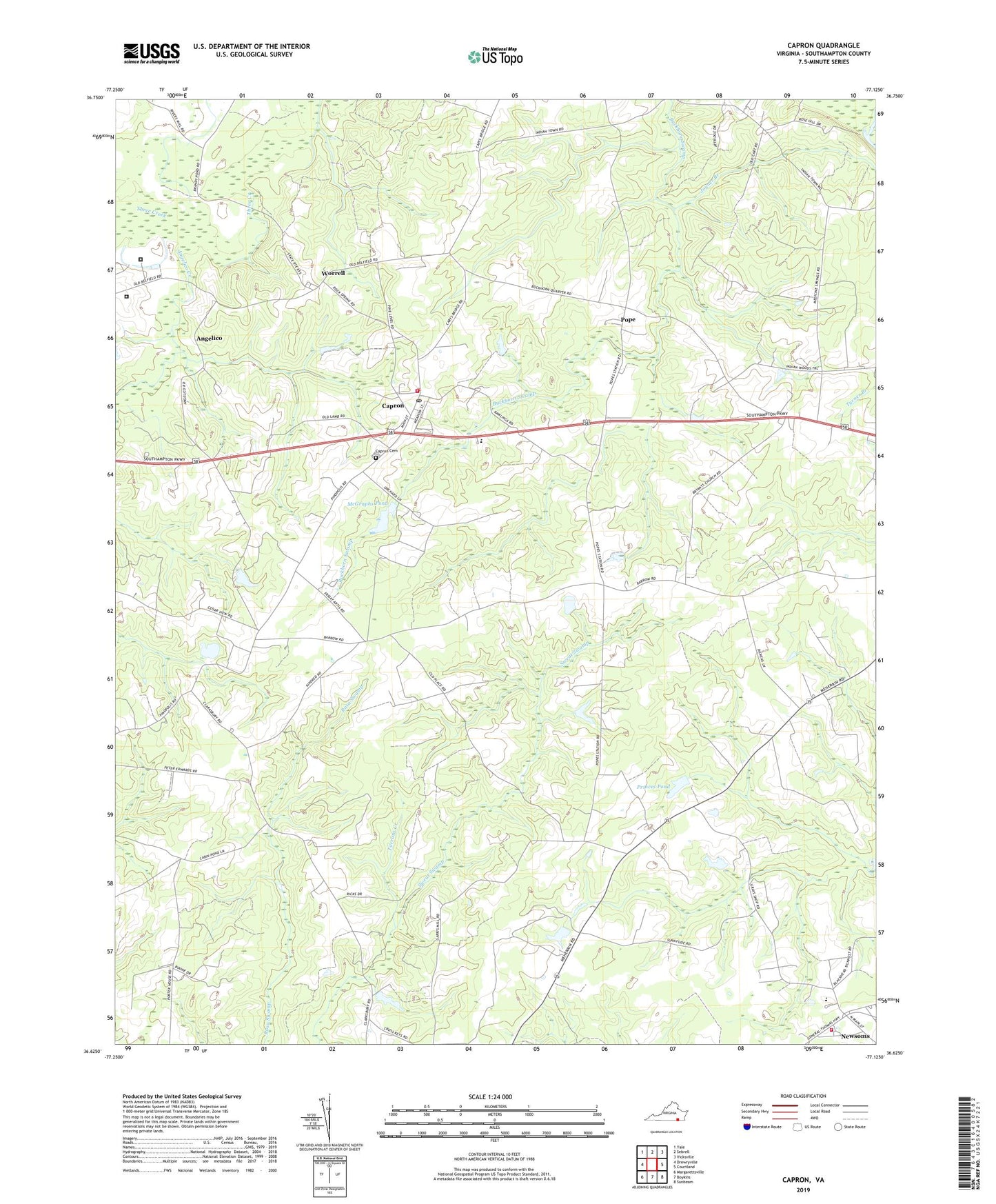
Capron Virginia US Topo Map
Couldn't load pickup availability
2019 topographic map quadrangle Capron in the state of Virginia. Scale: 1:24000. Based on the newly updated USGS 7.5' US Topo map series, this map is in the following counties: Southampton. The map contains contour data, water features, and other items you are used to seeing on USGS maps, but also has updated roads and other features. This is the next generation of topographic maps. Printed on high-quality waterproof paper with UV fade-resistant inks.
Quads adjacent to this one:
West: Drewryville
Northwest: Yale
North: Sebrell
Northeast: Vicksville
East: Courtland
Southeast: Sunbeam
South: Boykins
Southwest: Margarettsville
Contains the following named places: Angelico, Angelico Creek, Bryant Church, Capron, Capron Cemetery, Capron Elementary School, Capron Lookout Tower, Capron Post Office, Capron Volunteer Fire and First Aid Squad, Clarksbury Church, Cloyd School, Deerfield Correctional Center, Deerfield Men's Work Center, Druid, Garris Pond, Joyner Branch, Mars Hill Church, McGraphs Dam, McGraphs Pond, Meherrin Elementary School, Mount Olive School, Newsoms Volunteer Fire Department, Parker Chapel, Pope, Princes Dam, Princes Pond, Southampton Motor Speedway, Sweat Swamp, Town of Capron, Vincent Grove, Vincent Grove Church, Whitehead Church, Worrell, Zoar Church, ZIP Code: 23829