MyTopo
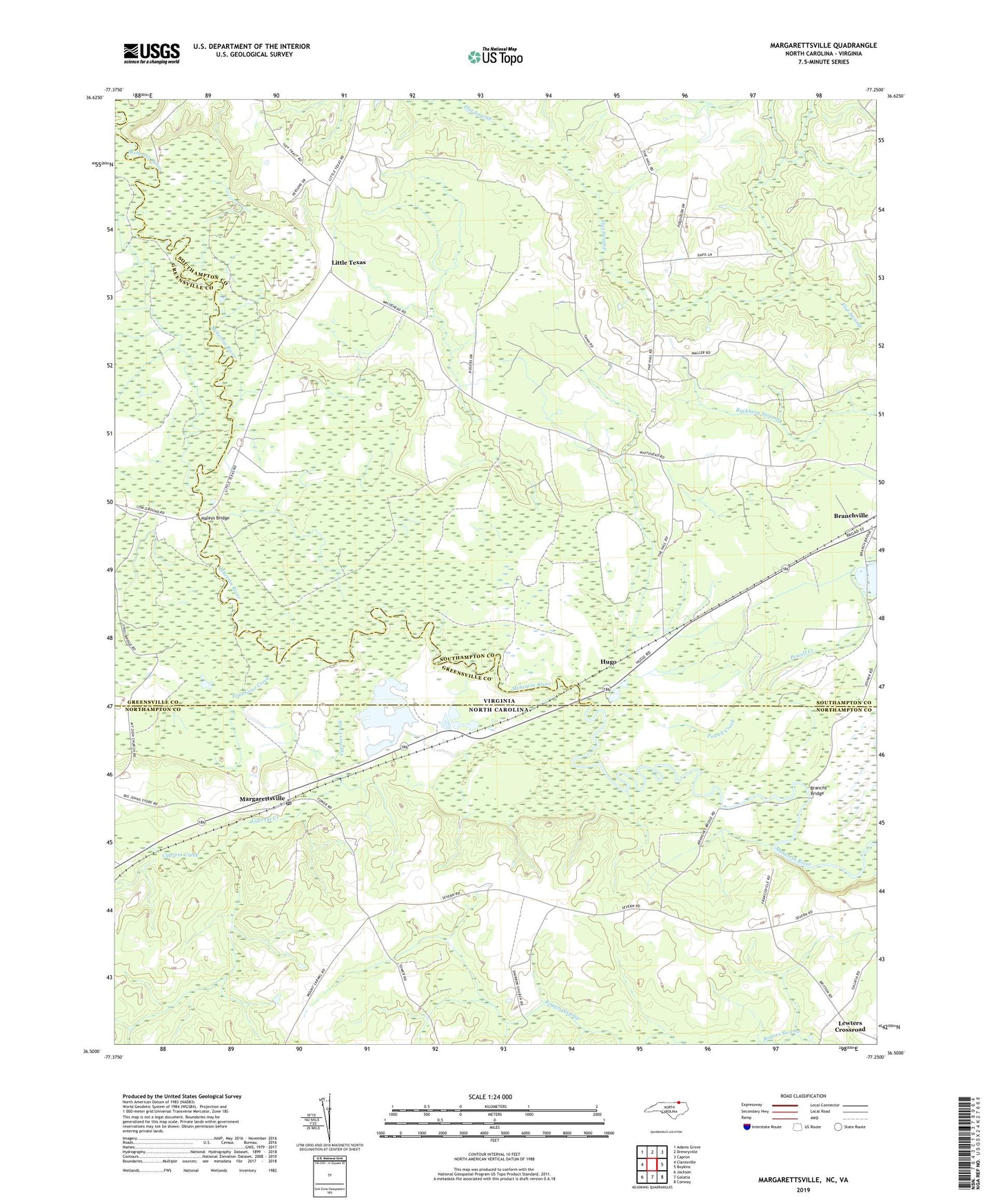
Margarettsville North Carolina US Topo Map
Couldn't load pickup availability
2022 topographic map quadrangle Margarettsville in the states of Virginia, North Carolina. Scale: 1:24000. Based on the newly updated USGS 7.5' US Topo map series, this map is in the following counties: Northampton, Southampton, Greensville. The map contains contour data, water features, and other items you are used to seeing on USGS maps, but also has updated roads and other features. This is the next generation of topographic maps. Printed on high-quality waterproof paper with UV fade-resistant inks.
Quads adjacent to this one:
West: Claresville
Northwest: Adams Grove
North: Drewryville
Northeast: Capron
East: Boykins
Southeast: Conway
South: Galatia
Southwest: Jackson
Contains the following named places: Bishop Dam, Boykins and Branchville District, Branchs Bridge, Cypress Creek, Fountains Creek, Haleys Bridge, Hugo, Lewters Crossroad, Little Texas, Margarettsville, Margarettsville Post Office, Powell Creek, Rising Star Church, Rising Star School, School Number 9, Sharon Church, Southhampton Speedway, Town of Branchville, Vicks Millpond, White Head Hall, White School, ZIP Codes: 23828, 27853