MyTopo
Vicksville Virginia US Topo Map
Couldn't load pickup availability
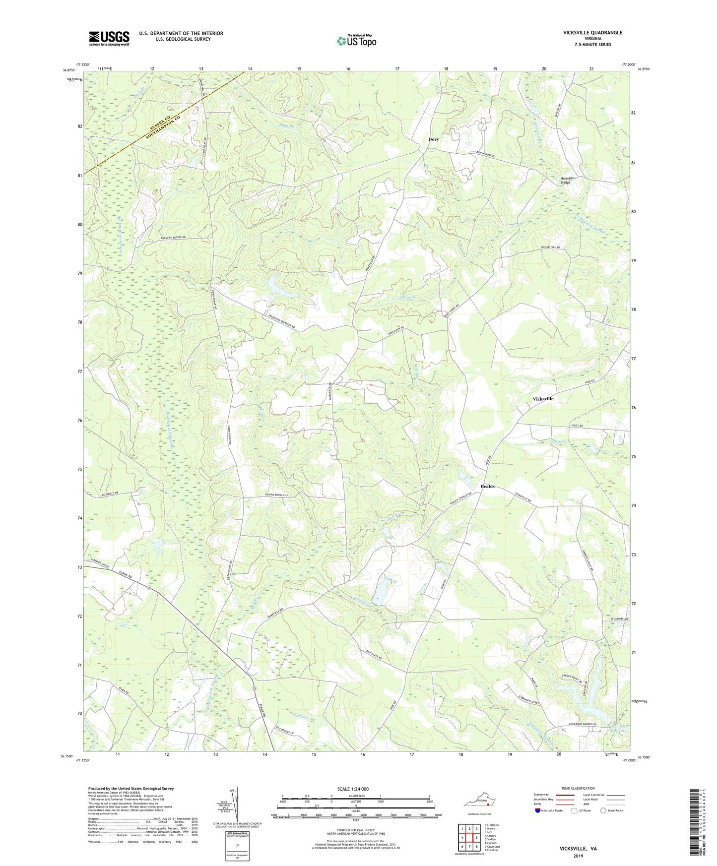
2022 topographic map quadrangle Vicksville in the state of Virginia. Scale: 1:24000. Based on the newly updated USGS 7.5' US Topo map series, this map is in the following counties: Southampton, Sussex. The map contains contour data, water features, and other items you are used to seeing on USGS maps, but also has updated roads and other features. This is the next generation of topographic maps. Printed on high-quality waterproof paper with UV fade-resistant inks.
Quads adjacent to this one:
West: Sebrell
Northwest: Littleton
North: Manry
Northeast: Ivor
East: Sedley
Southeast: Franklin
South: Courtland
Southwest: Capron
This map covers the same area as the classic USGS quad with code o36077g1.
Contains the following named places: Beales, Cabin Point School, Capron District, Colgate Darden Dam, Colgate Darden Millpond, Darden Camp, Darden Millpond, Deep Branch, Dory, Dory School, Horsepen Branch, Horsepen Bridge, Indian Branch, Indigo Branch, Mill Run, Pittman School, Saint Lukes Church, Saint Pauls Church, Vicksville, Village Run, Zion Church, ZIP Code: 23878