MyTopo
Sunbeam Virginia US Topo Map
Couldn't load pickup availability
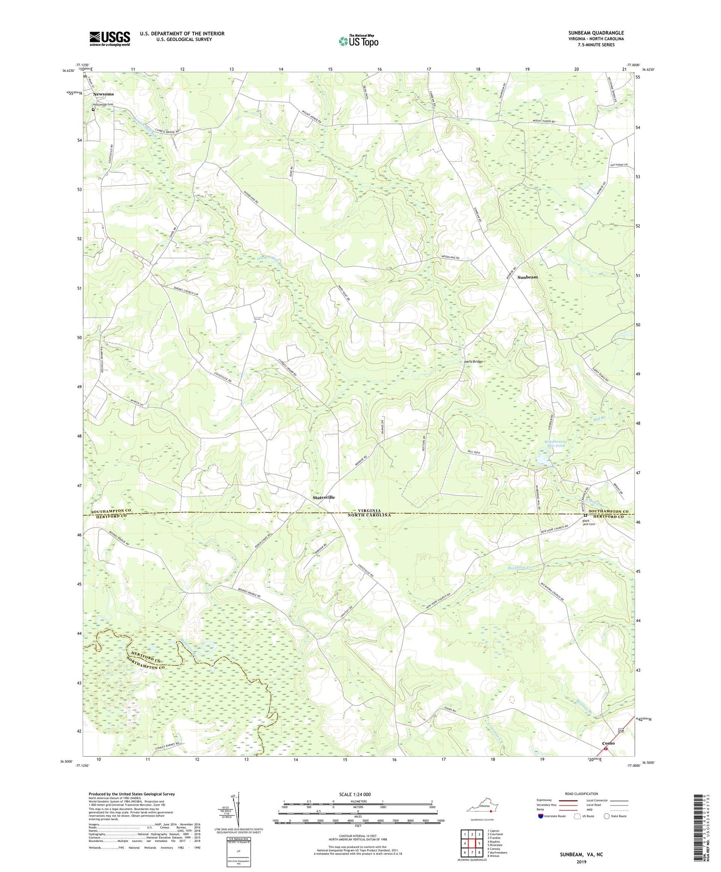
2022 topographic map quadrangle Sunbeam in the states of Virginia, North Carolina. Scale: 1:24000. Based on the newly updated USGS 7.5' US Topo map series, this map is in the following counties: Southampton, Hertford, Northampton. The map contains contour data, water features, and other items you are used to seeing on USGS maps, but also has updated roads and other features. This is the next generation of topographic maps. Printed on high-quality waterproof paper with UV fade-resistant inks.
Quads adjacent to this one:
West: Boykins
Northwest: Capron
North: Courtland
Northeast: Franklin
East: Riverdale
Southeast: Winton
South: Murfreesboro
Southwest: Conway
This map covers the same area as the classic USGS quad with code o36077e1.
Contains the following named places: Barnes Church, Black Jack Cemetery, Britts Store, Buckhorn Church, Cedar Dell School, Como, Como Post Office, Como Volunteer Fire Department and Emergency Medical Services, Darden Mill Run, Drakes Corner, Harts Bridge, Hollywood Cemetery, Hunts Church, Hunts School, Martin Airport, Monroe Chapel, Mount Gilead Church, Mount Horeb Church, Mount Sinai Church, New Hope Church, Newsoms, Newsoms District, Newsoms Post Office, Sands, Sandy Ridge Farms, Statesville, Sunbeam, Sunbeam Church, Town of Como, Township of Maneys Neck, Whitley Branch, Windbourne Dam, Windbourne Mill Pond, Windmans Mill, ZIP Code: 23874