MyTopo
Carson Virginia US Topo Map
Couldn't load pickup availability
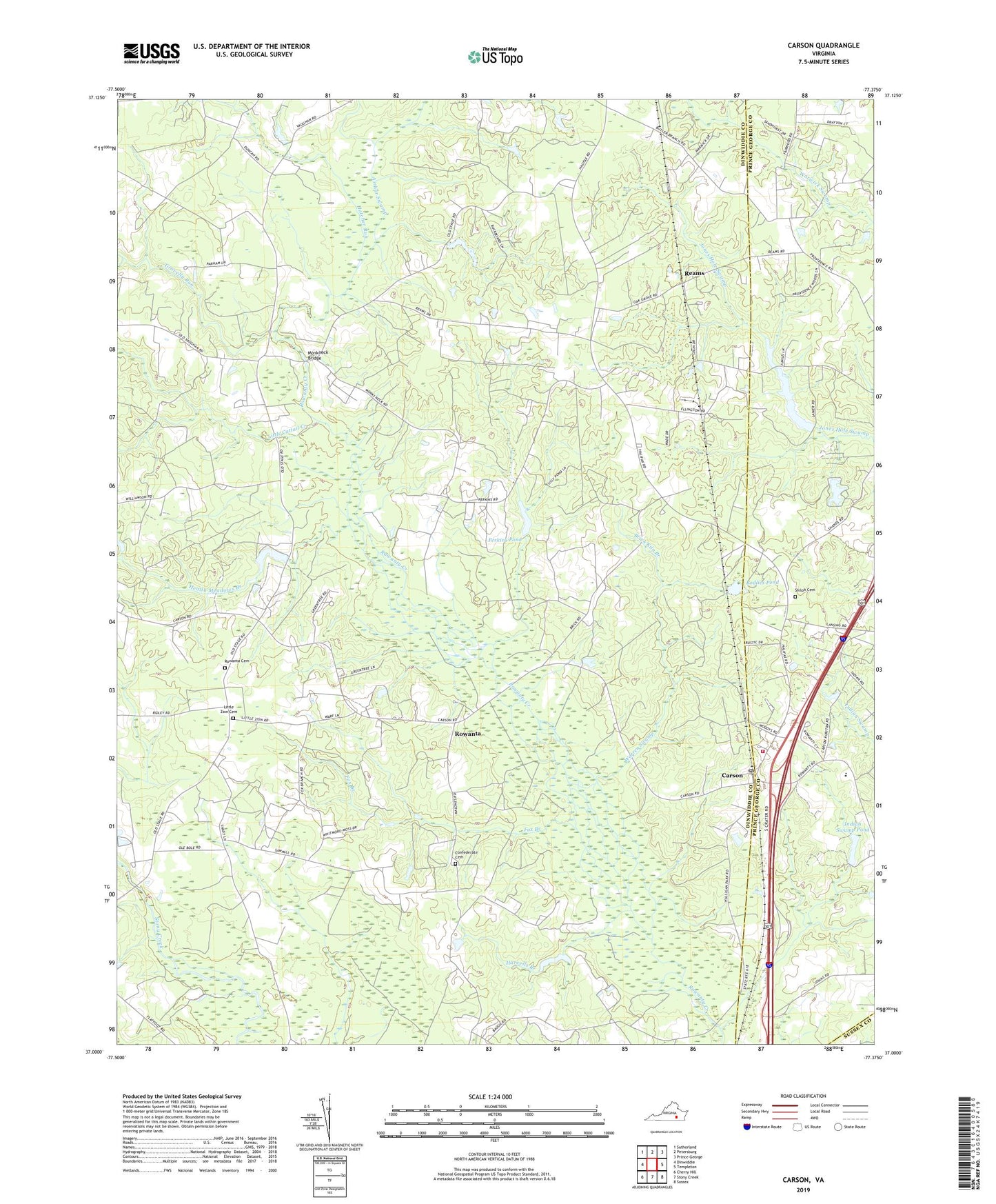
2019 topographic map quadrangle Carson in the state of Virginia. Scale: 1:24000. Based on the newly updated USGS 7.5' US Topo map series, this map is in the following counties: Dinwiddie, Prince George, Sussex. The map contains contour data, water features, and other items you are used to seeing on USGS maps, but also has updated roads and other features. This is the next generation of topographic maps. Printed on high-quality waterproof paper with UV fade-resistant inks.
Quads adjacent to this one:
West: Dinwiddie
Northwest: Sutherland
North: Petersburg
Northeast: Prince George
East: Templeton
Southeast: Sussex
South: Stony Creek
Southwest: Cherry Hill
Contains the following named places: Appomattox Regional Library System Carson Depot Library, Arthur Swamp, Bodlies Pond, Brick Kiln Branch, Brownings Store, Butterworth Dam, Butterworth Pond, Cain Dam, Cains Mill, Carson, Carson Elementary School, Carson Post Office, Carson United Methodist Church, Carson Volunteer Fire Department - Company 3, Confederate Cemetery, Crawfords Mill, District 3, Fox Branch, Gravel Run Church, Gravelly Run, Harvells Branch, Hatcher Run, Health Meadows Branch, Indian Swamp Dam, Indian Swamp Pond, Laniers Millpond, Little Cattail Creek, Little Zion Cemetery, Little Zion Church, Malone Crossing, Monkneck Bridge, Oak Grove Church, Perkins Crossing, Perkins Dam, Perkins Pond, Reams, Reams Store, Robinsons Store, Rowanta, Rowanta Cemetery, Rowanta Church, Rowanty Vocational Technical Center, Shiloh Cemetery, Shiloh Church, Shiloh Crossing, Tabernacle Church, Warren Swamp, Watt Crossing, Wedgewood Farms, Zion School, ZIP Code: 23830