MyTopo
Templeton Virginia US Topo Map
Couldn't load pickup availability
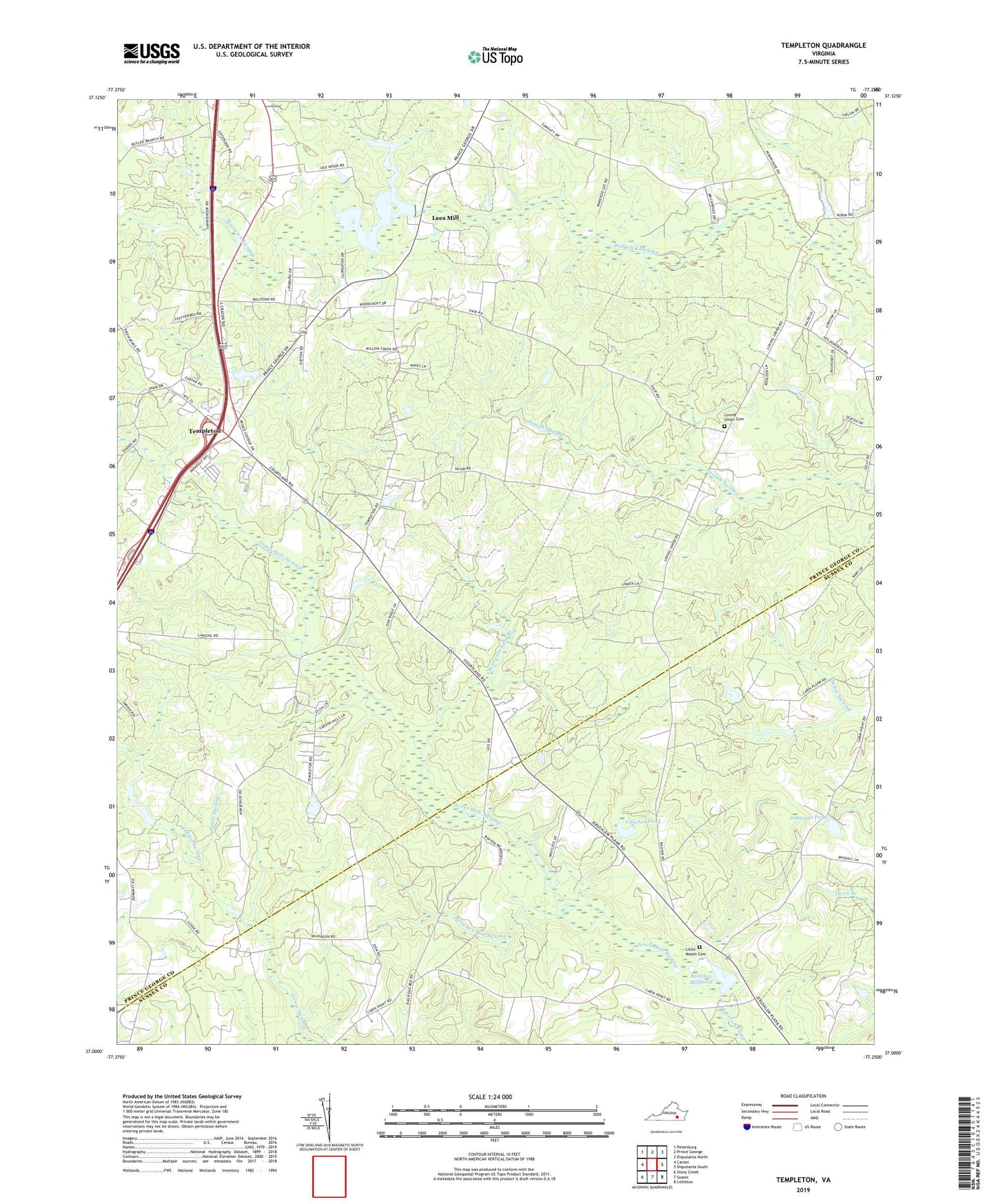
2022 topographic map quadrangle Templeton in the state of Virginia. Scale: 1:24000. Based on the newly updated USGS 7.5' US Topo map series, this map is in the following counties: Prince George, Sussex. The map contains contour data, water features, and other items you are used to seeing on USGS maps, but also has updated roads and other features. This is the next generation of topographic maps. Printed on high-quality waterproof paper with UV fade-resistant inks.
Quads adjacent to this one:
West: Carson
Northwest: Petersburg
North: Prince George
Northeast: Disputanta North
East: Disputanta South
Southeast: Littleton
South: Sussex
Southwest: Stony Creek
This map covers the same area as the classic USGS quad with code o37077a3.
Contains the following named places: Belsches Dam, Belsches Mill Swamp, Belsches Millpond, Bexley Trailer Park, Cherry Orchard Branch, Coddyshore, Couches Pond, Derby, Hakks School, Indian Swamp, Johnson Dam, Johnsons Pond, Jones Hole Swamp, Lees Dam, Lees Mill, Lees Millpond, Little Mount Cemetery, Little Mount Church, Loving Union Cemetery, Loving Union Church, Moores Mill, Mount Zion Church, Providence Church, Reeves, Salem Church, Sunny Brook Farms, Talpa, Tar Road Church, Templeton, Templeton Census Designated Place, Templeton District, Templeton School, Warwick Church